Blue-Ribbon Paddling & Fly-Fishing Flagship

Holy Waters & Cedar Bottoms: Michigan River Field Guide

14 curated river reaches across the Au Sable, Manistee, Pere Marquette, Pine, Jordan, and Two Hearted rivers. Equipped with real-time USGS CFS flow telemetry, dual put-in & take-out GIS navigation buttons, USFS watercraft permits, and livery shuttles.

Filter by River Experience:
Filter by Watershed Basin:

Interactive Reach Map: Dual Put-In & Take-Out GIS Coordinates

Put-In Launch
Take-Out Landing
══ River Reach
Reach #1 · Au Sable River Basin

Au Sable "Holy Water": Burton's Landing to Wakeley Bridge
Grayling, MI · 8.8 River Miles · 2.5–3.5 Hours Float
Running Clear · ~190 CFS Normal
River Gradient 3.2 ft/mi (Steady)
Current Velocity 2.5–3.0 mph
Rapids / Class Class I (Gentle)
Permits Required None (DNR Passport)
USGS Gauge USGS 04135700
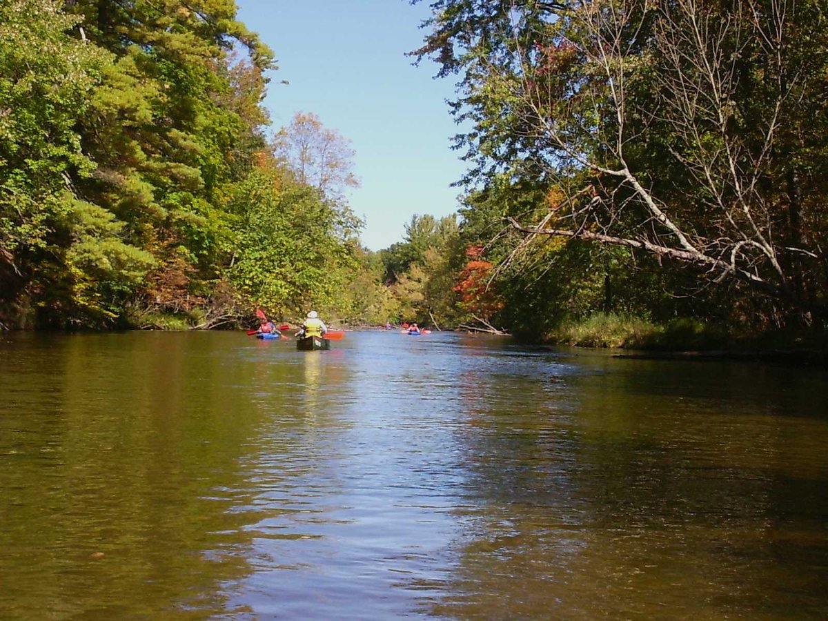
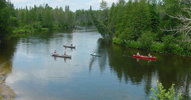
Canoes along the clear cedar banks of the Au Sable River near Grayling, Michigan
Au Sable River mainstream cedar banks. Photo: Wikimedia Commons (Public domain).

The 8.8-mile stretch from Burton's Landing downstream to Wakeley Bridge is the birth basin of Trout Unlimited (founded on these banks in 1959) and the gold standard of American spring-fed trout streams. Flowing over stable glacial outwash gravel at an almost unchanging 52° to 58°F, the Holy Water is governed by strict flies-only, catch-and-release artificial lure regulations.

For dry-fly anglers, this is hallowed ground: Hendrickson mayflies (Ephemerella subvaria) pop between 1:00 PM and 4:00 PM in May, followed by Sulphurs in June, and the legendary midnight Hexagenia limbata "Hex" hatch in late June and early July. For recreational paddlers and families, the current is smooth, forgiving, and crystal-clear with a firm gravel bottom and shallow sandbars ideal for children and sit-on-top kayaks.
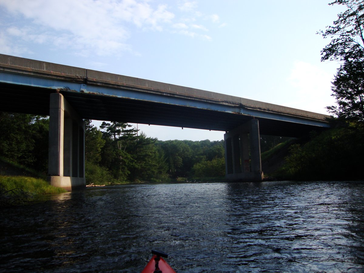
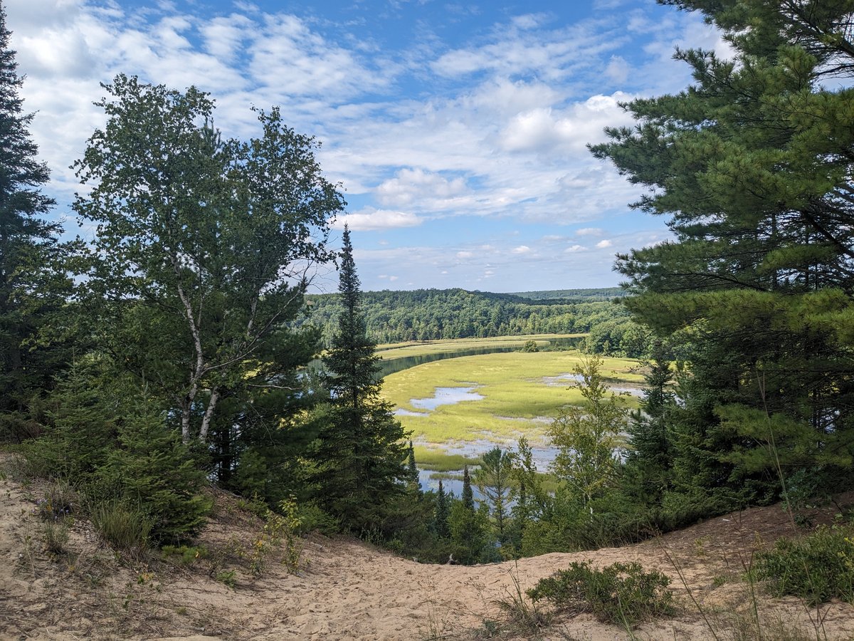
📍 Dual Launch GIS & Shuttle Logistics
🟢 Put-In Launch
Burton's Landing DNR Access
Timber canoe slide & carry-in wooden steps. Gravel lot with 12 vehicle spaces. DNR Recreation Passport required.
44.6608° N, 84.6297° W
Navigate to Put-In (Google Maps GIS) →
🔴 Take-Out Landing
Wakeley Bridge Landing
Concrete boat launch ramp & floating kayak dock. Paved parking for 25 vehicles + trailers. Vault toilet & trash service.
44.6467° N, 84.5122° W
Navigate to Take-Out (Google Maps GIS) →
🚗 Road Shuttle: 7.9 road miles · 11 min drive via North Down River Rd.
🛶 River Float: 8.8 river miles · 3.0 hrs paddle time.
Dry-Fly: 10/10 (Holy Water Flies-Only) Family/Rec: 9/10 (Gentle Flow) SUP: 9/10 (Clean Sand & Gravel) Shuttle: Paved 11 min Livery: Carlisle's & Penrod's
Reach #2 · Au Sable River Basin

South Branch Au Sable: Chase Bridge to Smith Bridge

Roscommon, MI · 9.5 River Miles · 3.5–4.5 Hours Float
Running Clear · ~210 CFS Normal
River Gradient 3.8 ft/mi (Brisk)
Current Velocity 3.0–3.5 mph
Rapids / Class Class I (Tight Cedar Bends)
Permits Required None (Wilderness Rules)
USGS Gauge USGS 04136500
South Branch Au Sable River flowing through the pristine Mason Tract wilderness
South Branch Au Sable River Mason Tract. Photo: Kurt Schwoppe (CC BY-SA 3.0).

Gifted to the state by automotive executive George Mason with the legal deed covenant that it remain an uncommercialized wilderness in perpetuity, the Mason Tract preserves 4,700 acres of pure pine barrens, towering white cedar swamps, and silent winding water. No permanent cabins, roads, or motors touch this reach.

Midway through the float sits the stone-and-timber Mason Chapel, an open river landing where paddlers pull out to sign the guest register in quiet reverence. The river here narrows through deep cut-banks and fast outside bends with sunken cedar logs ("sweepers") that require alert steering and basic ferry-gliding skills. Trophy brown trout hold tight beneath undercut cedar root-balls.

📍 Dual Launch GIS & Shuttle Logistics
🟢 Put-In Launch
Chase Bridge Access
Timber stairs & wooden canoe slide into deep pool. Shaded gravel parking for 15 vehicles. DNR Recreation Passport required.
44.5244° N, 84.4989° W
Navigate to Put-In (Google Maps GIS) →
🔴 Take-Out Landing
Smith Bridge Access (M-72)
Wooden steps & gravel landing on river right above M-72 bridge. Paved parking for 18 vehicles. Vault toilet on site.
44.6078° N, 84.4442° W
Navigate to Take-Out (Google Maps GIS) →
🚗 Road Shuttle: 8.4 road miles · 12 min drive via Chase Bridge Rd & M-72.
🛶 River Float: 9.5 river miles · 4.0 hrs float time.
Heritage Lore: 10/10 (Mason Chapel) Wilderness: 10/10 (Zero Structures) Dry-Fly: 10/10 (Flies-Only Reach) Caution: Blind Sweepers on Bends
Reach #3 · Au Sable River Basin

Lower Au Sable National Scenic River: Foote Dam to Whirlpool

Oscoda, MI · 11.0 River Miles · 3.5–5.0 Hours Float
Steady Tailwater · ~1,350 CFS Normal
River Gradient 1.8 ft/mi (Broad)
Current Velocity 2.0–2.5 mph
Rapids / Class Class I (Wide Water)
Permits Required USFS Day Pass ($5)
USGS Gauge USGS 04137500
Broad waters and sand bluffs along the Lower Au Sable River corridor near Iargo Springs
Lower Au Sable sand bluffs and river valley. Photo: Mtn-graphic (CC BY-SA 4.0).

Below Foote Dam, the Au Sable expands into a magnificent 150-foot-wide National Wild and Scenic River corridor flanked by towering 80-foot golden sand bluffs and old-growth white pines. This is big water, yet remarkably calm and free of dangerous log strainers, making it the premier family canoe, sit-on-top kayak, and SUP float on the Lake Huron side of Michigan.

In September and October, this tailwater transforms into Michigan's premier fall salmon and steelhead highway: massive Chinook salmon and chrome steelhead push upstream from Lake Huron to spawn on the gravel bars below Rea Road and Foote Site. Active bald eagle and osprey nests line the bluffs near Lumberman's Monument.

📍 Dual Launch GIS & Shuttle Logistics
🟢 Put-In Launch
Foote Dam Tailwater Launch
Paved boat ramp & shoreline carry-in launch below dam. Paved lot for 30 vehicles + trailers. Restrooms & USFS fee kiosk.
44.4439° N, 83.4561° W
Navigate to Put-In (Google Maps GIS) →
🔴 Take-Out Landing
Whirlpool DNR Access
Concrete boat ramp & boarding dock. Expansive gravel parking for 40 vehicles + trailers. Vault toilet & trash service.
44.4286° N, 83.3672° W
Navigate to Take-Out (Google Maps GIS) →
🚗 Road Shuttle: 6.8 road miles · 10 min drive via River Rd National Scenic Byway.
🛶 River Float: 11.0 river miles · 4.0 hrs paddle time.
Family/Beginner: 10/10 (Wide & Safe) Salmon/Steelhead: 10/10 (Drift Boat Runs) SUP Explorer: 10/10 (No Snags) Wildlife: Eagles & Osprey
Reach #4 · Manistee River Basin

Upper Manistee Wilderness: Deward to M-72 Bridge

Kalkaska County, MI · 12.2 River Miles · 4.0–5.5 Hours Float
Running Cold · ~180 CFS Normal
River Gradient 4.0 ft/mi (Brisk)
Current Velocity 3.0–3.5 mph
Rapids / Class Class I (Tight Cedar Turns)
Permits Required None (Wilderness)
USGS Gauge USGS 04123500
Upper Manistee River flowing through tranquil northern cedar forest
Upper Manistee forested river corridor. Photo: Eric Schmuttenmaer (CC BY-SA 2.0).

Originating in the sandy peat springs of Antrim County, the infant Manistee flows through the historic Deward ghost lumber town tract as one of Michigan's purest native brook trout streams. The water temperature rarely breaks 56°F even during July heatwaves, fed by hundreds of bubbling cedar seepages.

This is a narrow, intimate wilderness reach: the current is brisk, curling sharply around sandbars and cedar root balls. Paddlers must stay alert for low-hanging branches and submerged timber ("deadheads"). There is zero cell service from the put-in until near M-72. For dry-fly anglers, delicate presentations with 6X tippet and small parachute Adams or elk hair caddis produce eager, brightly colored wild brookies.

📍 Dual Launch GIS & Shuttle Logistics
🟢 Put-In Launch
Deward Co Rd 612 Bridge
Natural sand carry-in landing on river right. Unimproved dirt shoulder parking for 8 vehicles. Remote wilderness site.
44.8211° N, 84.8717° W
Navigate to Put-In (Google Maps GIS) →
🔴 Take-Out Landing
Manistee River M-72 Access
DNR gravel boat ramp on upstream side of bridge. Large gravel parking lot (20 vehicles). Vault toilet & info kiosk.
44.7578° N, 84.9781° W
Navigate to Take-Out (Google Maps GIS) →
🚗 Road Shuttle: 9.8 road miles · 14 min drive via Co Rd 612 and M-72.
🛶 River Float: 12.2 river miles · 4.5 hrs float time.
Brook Trout: 10/10 (Spring-Fed 54°F) Wilderness: 10/10 (Deward Tract) Alert: Zero Cell Service Shuttle: Gravel 14 min
Reach #5 · Manistee River Basin

Middle Manistee: CCC Bridge to Sharon (M-66)

Fife Lake, MI · 14.0 River Miles · 4.5–6.0 Hours Float
Steady Flow · ~820 CFS Normal
River Gradient 2.4 ft/mi (Gentle)
Current Velocity 2.5 mph
Rapids / Class Class I (Broad Gravel Flats)
Permits Required None (State Forest)
USGS Gauge USGS 04124000
Broad sandy flats and clear water of the Middle Manistee River
Middle Manistee River gravel flats. Photo: Michigan Paddling Archive (CC BY-SA 3.0).

The Middle Manistee from CCC Bridge down to Sharon is arguably the most relaxing, family-proven day float in northern Lower Michigan. Here, the river broadens to 90–120 feet with a continuous sand and fine-gravel bed, stable 2.5-mph current, and wide, gentle sweeping turns that leave ample time to navigate around any outer-bank woody structure.

CCC Bridge State Forest Campground at the put-in offers 24 rustic campsites directly overlooking the river, allowing paddlers to camp overnight and launch straight from their campsite in the morning. Shallow sandy islands midway through make ideal family picnic stops with waist-deep swimming water.

📍 Dual Launch GIS & Shuttle Logistics
🟢 Put-In Launch
CCC Bridge SFC Landing
Gravel boat ramp & wooden canoe chute. Campground & day-use lot (25 vehicles). Vault toilets & potable hand pump.
44.5119° N, 85.1275° W
Navigate to Put-In (Google Maps GIS) →
🔴 Take-Out Landing
Sharon DNR Access (M-66)
Concrete boat ramp & floating boarding dock. Paved parking lot for 20 vehicles + trailers. Vault toilet on site.
44.5881° N, 85.1831° W
Navigate to Take-Out (Google Maps GIS) →
🚗 Road Shuttle: 9.2 road miles · 13 min drive via Sunset Trail & M-66.
🛶 River Float: 14.0 river miles · 5.0 hrs paddle time.
Family/Rec: 10/10 (Wide & Forgiving) Float Camp: 10/10 (CCC Bridge SFC) SUP: 8/10 (Sandy Bottoms) Shuttle: Paved/Gravel 13 min
Reach #6 · Manistee River Basin

Lower Big Manistee: High Bridge to Bear Creek

Wellston, MI · 16.5 River Miles · 5.0–7.0 Hours (or Overnight)
Heavy Tailwater · ~1,850 CFS Normal
River Gradient 2.8 ft/mi (Heavy)
Current Velocity 3.5–4.0 mph
Rapids / Class Class I+ (Strong Eddy Lines)
Permits Required None (DNR Passport)
USGS Gauge USGS 04125550
Broad big water of the Lower Manistee River below Tippy Dam
Lower Manistee River bluffs and deep pools below Tippy Dam. Photo: Notorious4life (Public domain / CC0).

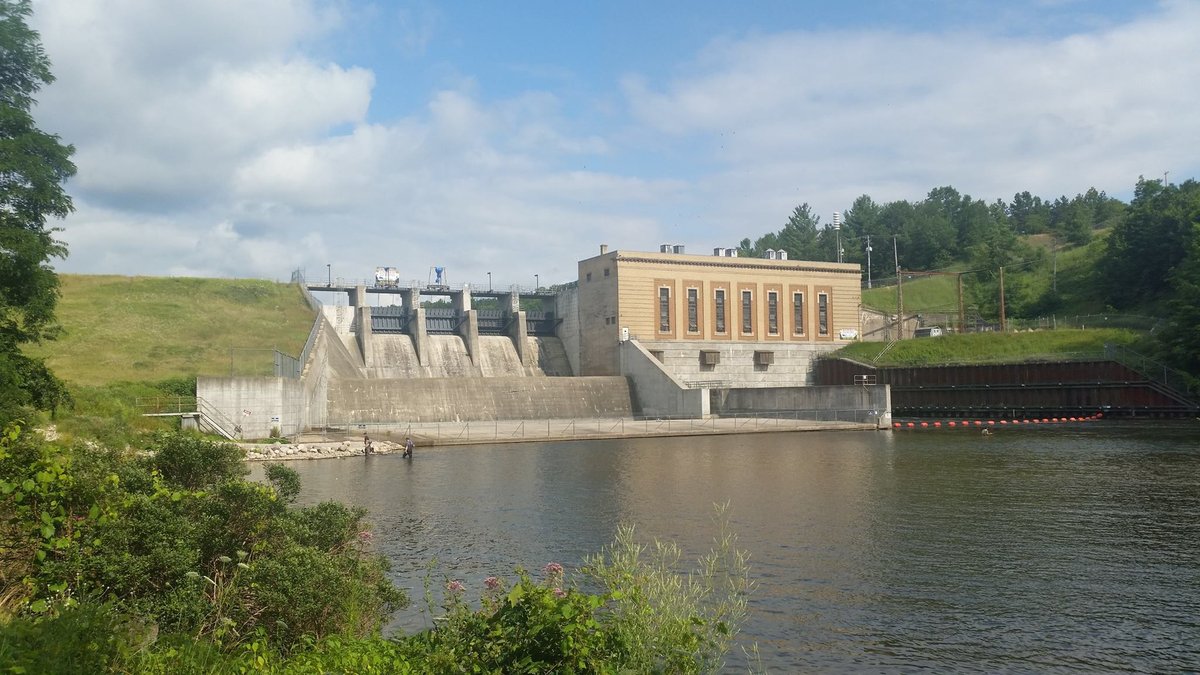
Downstream of Consumers Energy's Tippy Hydro Dam, the Big Manistee becomes a massive, surging powerhouse—over 180 feet wide with heavy flow and deep turquoise pools reaching 15 feet down. This is the holy grail for Michigan drift boat guides chasing giant king salmon in September and October, and chromer winter steelhead straight through April.

For multi-day backcountry canoeists, expansive gravel islands and national forest bluffs provide some of the finest legal dispersed float camping in the Midwest. Build your campfire on the sand, watch the stars reflect off the black water, and wake up to morning mist rolling through the cedar bottoms. Due to heavy water volume, all paddlers must wear secure PFDs.

📍 Dual Launch GIS & Shuttle Logistics
🟢 Put-In Launch
High Bridge DNR Boat Launch
Dual paved boat ramps & boarding dock. Massive paved lot for 45 vehicles + trailers. Vault toilets & trash service.
44.2750° N, 85.9622° W
Navigate to Put-In (Google Maps GIS) →
🔴 Take-Out Landing
Bear Creek DNR Access
Gravel drift boat ramp & kayak beach at Bear Creek confluence. Parking for 25 vehicles + trailers. Vault toilet.
44.3314° N, 86.0597° W
Navigate to Take-Out (Google Maps GIS) →
🚗 Road Shuttle: 9.5 road miles · 15 min drive via High Bridge Rd & Coates Hwy.
🛶 River Float: 16.5 river miles · 6.0 hrs float time (or 2-day camp).
Float Camping: 10/10 (Gravel Island Camps) Salmon/Steelhead: 10/10 (Tippy Dam Runs) Drift Boat: Dual Concrete Ramps PFD Mandatory: Heavy 1850 CFS
Reach #7 · Pine River Basin

Pine National Scenic River: Elm Flats to Low Bridge

Wellston, MI · 8.5 River Miles · 2.5–3.5 Hours Float
Fast Whitewater · ~275 CFS Normal
River Gradient 12.0 ft/mi (Steepest in LP)
Current Velocity 4.0–6.0 mph
Rapids / Class Class I–II (Standing Waves)
Permits Required USFS Watercraft Permit
USGS Gauge USGS 04125000
Fast clear currents and boulder riffles of the Pine National Scenic River
Pine National Scenic River rapids corridor. Photo: US Forest Service (Public domain).

Tumbling down an astonishing 12-foot-per-mile gradient, the Pine River is the wildest, fastest, and most technical whitewater run in Michigan's Lower Peninsula. The water is ice-cold, carving through clay bedrock chutes, boulder fields, and tight s-turns with standing wave trains that will test your bracing, ruddering, and eddy-turn techniques.

Mandatory Federal Regulation: To protect this fragile National Wild and Scenic River canyon from erosion, the U.S. Forest Service enforces strict watercraft permits from the Friday before Memorial Day through Labor Day between 9:00 AM and 6:00 PM. Reserve your permit through Recreation.gov months in advance. Securely strap all dry bags and wear a high-flotation PFD.

📍 Dual Launch GIS & Shuttle Logistics
🟢 Put-In Launch
Elm Flats USFS Access
Timber stairs & wooden canoe slide. Paved USFS lot (20 vehicles). Watercraft permit validation kiosk & vault toilet.
44.2189° N, 85.7761° W
Navigate to Put-In (Google Maps GIS) →
🔴 Take-Out Landing
Low Bridge USFS Access
Concrete boat ramp & timber kayak steps. Paved USFS lot for 35 vehicles + trailers. Vault toilets & fee station.
44.2250° N, 85.8942° W
Navigate to Take-Out (Google Maps GIS) →
🚗 Road Shuttle: 8.7 road miles · 14 min drive via S 9 Rd & M-55.
🛶 River Float: 8.5 river miles · 3.0 hrs whitewater float.
Whitewater: 10/10 (Class I–II Chutes) USFS Permits: Required (May–Sep) Expert Paddler: Standing Waves PFD Mandatory: Fast Current
Reach #8 · Pere Marquette Basin

Pere Marquette National Scenic: Green Cottage to Upper Branch

Baldwin, MI · 10.5 River Miles · 3.5–4.5 Hours Float
Running Clear · ~620 CFS Normal
River Gradient 3.6 ft/mi (Active)
Current Velocity 3.0 mph
Rapids / Class Class I (Undammed Freestone)
Permits Required USFS Watercraft Permit
USGS Gauge USGS 04122500
Pere Marquette National Scenic River flowing over pristine gravel bars in Manistee National Forest
Pere Marquette National Scenic River. Photo: en:User:Yetiwriter (CC BY-SA 3.0).

The Pere Marquette is Michigan's crown jewel undammed freestone river—where German brown trout were first successfully stocked in the United States in 1884. Free of hydro dams from its headwaters all the way to Lake Michigan, the PM retains an untamed seasonal pulse: clear cold water, gravel spawning bars, and deeply undercut banks draped with ancient hemlock and white pine.

From M-37 down to Gleason's Landing, the river is designated Quality Trout Water with strict flies-only and artificial lure catch-and-release rules. Paddlers must obtain a mandatory USFS watercraft permit between Memorial Day weekend and Labor Day. The section between Green Cottage and Upper Branch Bridge provides a quintessential blue-ribbon float: lively riffles, dark holding pools, and zero development.

📍 Dual Launch GIS & Shuttle Logistics
🟢 Put-In Launch
Green Cottage USFS Access
Wooden stairs & timber canoe slide down hillside. Shaded gravel parking for 15 vehicles. USFS permit kiosk & vault toilet.
43.8647° N, 85.9189° W
Navigate to Put-In (Google Maps GIS) →
🔴 Take-Out Landing
Upper Branch Bridge USFS Access
Gravel drift boat ramp & wooden steps. Paved parking lot for 20 vehicles + trailers. Vault toilet & info board.
43.8964° N, 86.0353° W
Navigate to Take-Out (Google Maps GIS) →
🚗 Road Shuttle: 8.2 road miles · 12 min drive via US-10 & S Branch Rd.
🛶 River Float: 10.5 river miles · 4.0 hrs float time.
Brown Trout: 10/10 (First U.S. Stocking 1884) USFS Permits: Required (May–Sep) Flies-Only: Quality Trout Water Undammed: True Freestone Pulse
Reach #9 · Pere Marquette Basin

Lower Pere Marquette: Gleason's Landing to Walhalla

Branch, MI · 12.0 River Miles · 4.0–5.5 Hours Float
Running Clear · ~620 CFS Normal
River Gradient 2.8 ft/mi (Mellowing)
Current Velocity 2.5 mph
Rapids / Class Class I (Deep Clay Pools)
Permits Required USFS Watercraft Permit
USGS Gauge USGS 04122500
Paddlers canoeing down the cedar-lined Pere Marquette River corridor near Gleason's Landing
Pere Marquette River wilderness float. Photo: Michigan Paddling Archive (CC BY-SA 3.0).

Downstream of Gleason's Landing, the Pere Marquette transitions from strict flies-only water into open gear regulations. The river cuts deeply through dark blue-gray clay banks, forming massive submerged log complexes where migratory king salmon stage by the thousands in late summer, followed by autumn coho and sea-run steelhead.

Gleason's Landing USFS Campground offers riverside rustic sites, making this the ideal multi-day staging base. For paddlers and canoe trippers, the river features deep outside sweeping bends with wide sandy inside point-bars perfect for pulling up canoes and swimming in clean, refreshing current.

📍 Dual Launch GIS & Shuttle Logistics
🟢 Put-In Launch
Gleason's Landing USFS Campground
Paved canoe slide & gravel drift boat launch. Campground day-use lot (25 vehicles). Vault toilets & hand pump.
43.8906° N, 86.0028° W
Navigate to Put-In (Google Maps GIS) →
🔴 Take-Out Landing
Walhalla Road Bridge DNR Access
Concrete boat ramp & gravel shoreline. Large gravel parking lot (30 vehicles + trailers). Vault toilet & trash service.
43.9161° N, 86.1189° W
Navigate to Take-Out (Google Maps GIS) →
🚗 Road Shuttle: 8.5 road miles · 13 min drive via US-10 & Walhalla Rd.
🛶 River Float: 12.0 river miles · 4.5 hrs float time.
Salmon Staging: 10/10 (Clay Holes) Float Camp: 10/10 (Gleason's SFC) Family Friendly: Broad Gentle Runs USFS Permits: Required (May–Sep)
Reach #10 · Jordan River Basin

Jordan River Natural River: Graves Crossing to Rogers Road

East Jordan, MI · 9.0 River Miles · 3.0–4.0 Hours Float
Cold Spring-Fed · ~200 CFS Normal
River Gradient 4.5 ft/mi (Swift)
Current Velocity 3.0–3.5 mph
Rapids / Class Class I (Tight Cedar Chutes)
Permits Required None (Natural River Rules)
USGS Gauge USGS 04127800
Lush green cedar banks and crystal-clear water along the Jordan Natural River
Jordan River Natural River valley. Photo: Wikimedia Commons (CC BY-SA 3.0).

Designated in 1972 as Michigan's very first Natural River under the Natural River Act, the Jordan River flows through a glacial outwash valley of astonishing ecological purity. Fed by hundreds of subterranean cold-water artesian springs, the water temperature rarely exceeds 52°F, ensuring year-round nursery habitat for wild brook trout and sculpin.

Launching from Graves Crossing State Forest Campground, the river cuts through a cathedral of mossy northern white cedars. The current is brisk and clean with a firm sand-and-gravel bottom. Tight bends require basic steering control to avoid overhanging cedar boughs. For families, children, and fly anglers, it is one of northern Michigan's most visually breathtaking 4-hour river journeys.

📍 Dual Launch GIS & Shuttle Logistics
🟢 Put-In Launch
Graves Crossing DNR Access / SFC
Wooden steps & timber launch chute. State Forest Campground parking for 15 vehicles. Vault toilet & hand pump.
45.1092° N, 85.0883° W
Navigate to Put-In (Google Maps GIS) →
🔴 Take-Out Landing
Rogers Road Bridge Access
Natural sand river landing on river right. Gravel roadside turnaround clearing for 10 vehicles. Rustic carry-out.
45.1611° N, 85.1186° W
Navigate to Take-Out (Google Maps GIS) →
🚗 Road Shuttle: 5.6 road miles · 9 min drive via Graves Crossing Rd & Rogers Rd.
🛶 River Float: 9.0 river miles · 3.5 hrs paddle time.
1st Natural River: 10/10 (Protected Corridor) Cold Springs: 50°F Artesian Headwaters Family Friendly: Fast but Shallow Sand Shuttle: Quick 9 min
Reach #11 · Pigeon River Basin

Pigeon River Wild Waters: Sturgeon Divide to Webb Road

Vanderbilt, MI · 7.2 River Miles · 2.5–3.5 Hours Float
Running Clear · ~85 CFS Normal
River Gradient 4.8 ft/mi (Freestone)
Current Velocity 3.0 mph
Rapids / Class Class I (Boulders & Snags)
Permits Required None (P.R.C. Rules)
USGS Gauge USGS 04128900
Dense northern forest and cold tea-colored stream in Pigeon River Country
Pigeon River Country State Forest. Photo: Chris Izworski Trout Streams (Public domain / Wikimedia).

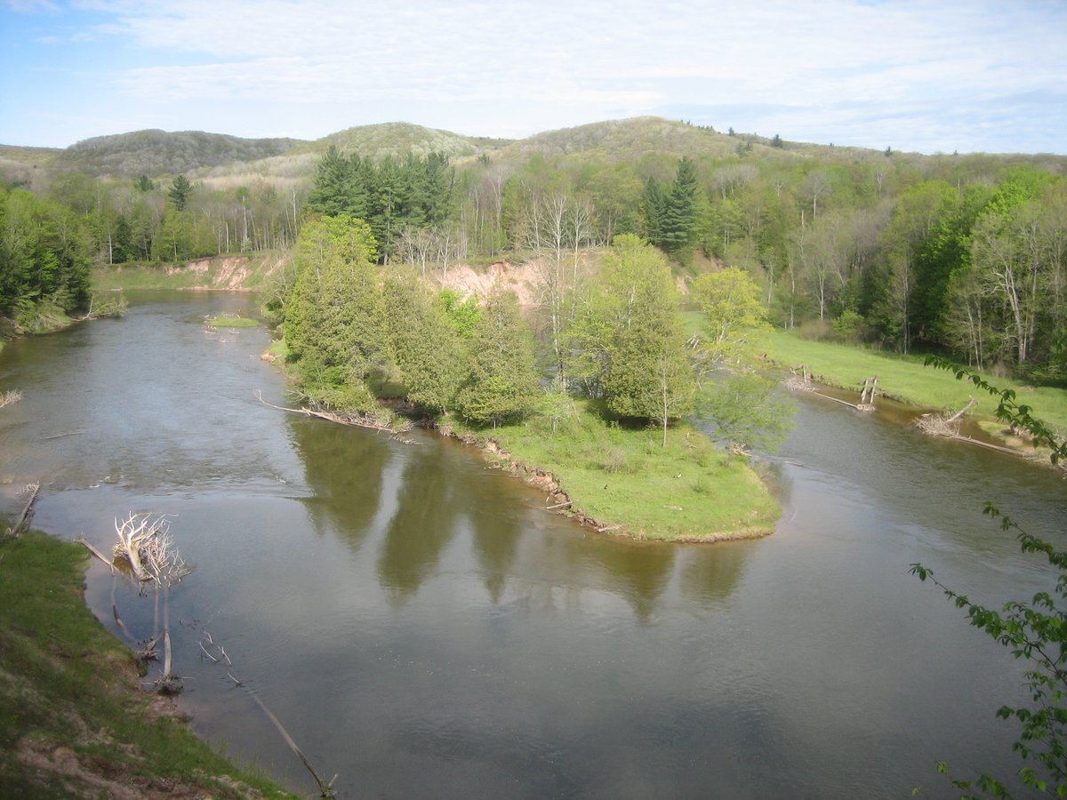
Flowing straight through the 106,000-acre heart of the "Big Wild"—Pigeon River Country State Forest—this boulder-strewn freestone stream is Michigan's premier big-wilderness freestone trout water. The surrounding forest is home to the largest free-roaming wild elk herd east of the Mississippi (over 1,000 elk), plus black bears, bobcats, and bald eagles.

The Pigeon is wilder, rockier, and more unkempt than the gentle sand-bottomed Au Sable. Submerged granite boulders and natural log blowdowns create pocket-water feeding lanes where wild brookies and feisty brown trout aggressively strike dry flies and streamers. There is no cell service across this entire forest basin; bring a map, compass, and water filter.

📍 Dual Launch GIS & Shuttle Logistics
🟢 Put-In Launch
Sturgeon Divide / Red Bridge
Rustic gravel carry-in launch under bridge. Dirt shoulder clearing for 8 vehicles. Wilderness carry-in with no facilities.
45.1950° N, 84.4817° W
Navigate to Put-In (Google Maps GIS) →
🔴 Take-Out Landing
Webb Road Bridge Access
Sand bank carry-in landing on river right. Gravel parking clearing for 10 vehicles. Pigeon River Country information kiosk.
45.1389° N, 84.4756° W
Navigate to Take-Out (Google Maps GIS) →
🚗 Road Shuttle: 5.2 road miles · 9 min drive via Osmun Rd & Webb Rd.
🛶 River Float: 7.2 river miles · 3.0 hrs wilderness paddle.
Wild Elk Herd: 10/10 (Heart of Big Wild) Freestone Pocket Water: Wild Trout Wilderness Alert: Zero Cell Service Shuttle: Forest Sand Roads
Reach #12 · Upper Peninsula Basin

Two Hearted Wilderness: High Bridge to Lake Superior Mouth

Newberry, MI · 14.0 River Miles · 5.0–6.5 Hours Float
Wilderness Amber · ~130 CFS Normal
River Gradient 3.0 ft/mi (Wilderness)
Current Velocity 2.5–3.0 mph
Rapids / Class Class I (Spruce Snags)
Permits Required None (State Forest)
USGS Gauge USGS 04044700
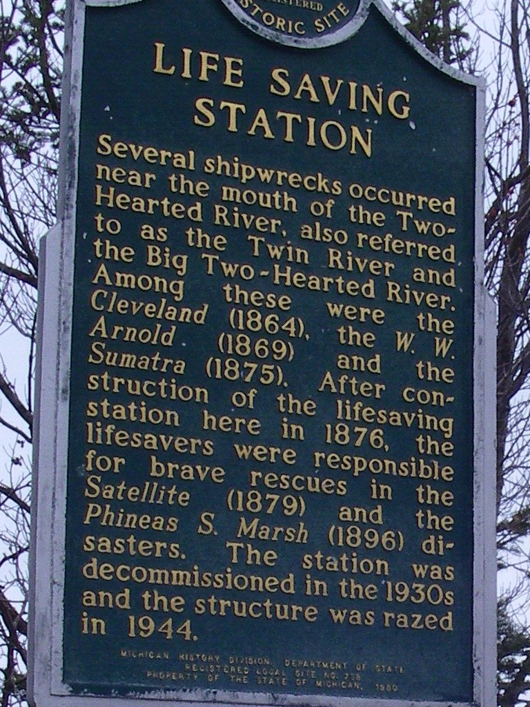
Two Hearted River historical marker and river corridor leading to Lake Superior
Two Hearted River Lake Superior corridor. Photo: Wikimedia Commons (CC BY-SA 3.0).

Immortalized in title by Ernest Hemingway (though he actually fished the Fox River in Seney for the story), the real Two Hearted River is one of the wildest, most solitary black-spruce water highways in the entire Upper Peninsula. Deep in Luce County, this amber-tinted stream flows over clean sandbars flanked by ancient tamarack bogs and blueberry plains.

The float culminates in one of the great geographic spectacles of the Northwoods: the river rounds a massive golden sand spit and empties directly into the roaring blue surf of Lake Superior. At the mouth, Two Hearted River State Forest Campground provides 39 rustic campsites right where the river meets the big lake. Target native coaster brook trout and migratory fall steelhead near the mouth.

📍 Dual Launch GIS & Shuttle Logistics
🟢 Put-In Launch
High Bridge State Forest Access
Timber slide & gravel carry-in launch off Co Rd 407. Forest parking clearing (12 vehicles). Remote wilderness access.
46.6433° N, 85.4419° W
Navigate to Put-In (Google Maps GIS) →
🔴 Take-Out Landing
Two Hearted River Mouth SFC
Sandy beach river mouth landing on Lake Superior spit. State Forest Campground lot (30 vehicles). Vault toilets & water.
46.6989° N, 85.4228° W
Navigate to Take-Out (Google Maps GIS) →
🚗 Road Shuttle: 8.8 road miles · 18 min drive via seasonal sand roads (4WD/AWD recommended).
🛶 River Float: 14.0 river miles · 5.5 hrs backcountry float.
Lake Superior Mouth: 10/10 (Surf Confluence) Wilderness Solitude: 10/10 (Black Spruce Bog) Float Camping: Mouth SFC 4WD Vehicle Recommended
Reach #13 · Upper Peninsula Basin

Hemingway's Fox River: Seney to Fox River SFC

Seney, MI · 10.5 River Miles · 3.5–5.0 Hours Float
Cold Peat Springs · ~160 CFS Normal
River Gradient 2.8 ft/mi (Meandering)
Current Velocity 2.5 mph
Rapids / Class Class I (Cedar Sweepers)
Permits Required None (DNR Passport)
USGS Gauge USGS 04059000
Quiet amber waters of the Fox River flowing through the Upper Peninsula wilderness
Fox River near Seney, Upper Peninsula. Photo: Chris Izworski Trout Streams (Public domain / Wikimedia).

In the late summer of 1919, a wounded 20-year-old Ernest Hemingway stepped off the train in the burned-over lumber hamlet of Seney, hiked north along the railroad tracks, and set up camp along the Fox River to heal from the traumas of World War I. That trip provided the emotional and sensory architecture for his masterpiece, "Big Two-Hearted River"—which he set on the Two-Hearted in name only because of its poetic cadence.

The real Fox River remains astonishingly wild and unchanged: tea-colored, spring-cold water curling past dense cedar hummocks, tag alders, and white birch. The river borders the 95,000-acre Seney National Wildlife Refuge, offering frequent sightings of sandhill cranes, trumpeter swans, and river otters. Wild brook trout rise eagerly to grasshoppers and caddis along the grassy undercut banks.

📍 Dual Launch GIS & Shuttle Logistics
🟢 Put-In Launch
Fox River M-28 Bridge Launch
Natural sand canoe landing under highway bridge in Seney. Paved highway shoulder turnout for 10 vehicles. Highway roadside landing.
46.3497° N, 85.9461° W
Navigate to Put-In (Google Maps GIS) →
🔴 Take-Out Landing
Fox River State Forest Campground
Wooden canoe steps & sandy landing on river right. Campground parking for 15 vehicles. Rustic campsites, hand pump & vault toilet.
46.4022° N, 85.9614° W
Navigate to Take-Out (Google Maps GIS) →
🚗 Road Shuttle: 6.2 road miles · 11 min drive via Co Rd 450 (Fox River Rd).
🛶 River Float: 10.5 river miles · 4.0 hrs float time.
Hemingway 1919: 10/10 (True Nick Adams River) Wild Brookies: Dry Fly Hopper Water Wildlife: Seney Refuge Cranes & Moose Shuttle: Paved/Gravel 11 min
Reach #14 · Sleeping Bear Basin

Lower Platte River: Salmon Weir to Lake Michigan Mouth

Honor, MI · 4.5 River Miles · 1.5–2.5 Hours Float
Gentle Crystal Clear · ~125 CFS Normal
River Gradient 1.5 ft/mi (Shallow & Calm)
Current Velocity 1.5–2.0 mph
Rapids / Class Class I (Zero Rapids)
Permits Required NPS Park Pass ($25)
USGS Gauge USGS 04127200
Platte River flowing gently into Lake Michigan at Sleeping Bear Dunes National Lakeshore
Platte River Point at Sleeping Bear Dunes. Photo: National Park Service (Public domain / NPS).

Flowing straight through the southern boundary of Sleeping Bear Dunes National Lakeshore, the Lower Platte is without question the most relaxed, child-safe, and crystal-clear river float in the State of Michigan. Averaging only 2 to 3 feet in depth over a pure white sugar-sand bottom, this 4.5-mile float carries paddlers past Loon Lake, nesting loons, and dune bluffs without a single rapid, boulder, or dangerous log strainer.

This is the uncontested #1 Stand-Up Paddleboarding (SUP) river float in Michigan: the water is glass-calm, protected from Lake Michigan winds by dense pine dunes, and deep enough for long tracking fins while remaining shallow enough to step off onto soft sand at any point. The float ends on the pristine sandy beach at Platte River Point, where the warm river lazily mingles with the emerald swells of Lake Michigan.

📍 Dual Launch GIS & Shuttle Logistics
🟢 Put-In Launch
Platte River Salmon Weir / M-22
Wooden launch platform & canoe slide. Paved parking lot for 25 vehicles. National Park pass required. Vault toilet on site.
44.6983° N, 86.1039° W
Navigate to Put-In (Google Maps GIS) →
🔴 Take-Out Landing
Platte River Point / Lake Michigan
Sandy river spit beach landing. Expansive paved NPS lot (60 vehicles). Restrooms, outdoor rinse showers & picnic tables.
44.7333° N, 86.1517° W
Navigate to Take-Out (Google Maps GIS) →
🚗 Road Shuttle: 4.8 road miles · 8 min drive via Lake Michigan Rd.
🛶 River Float: 4.5 river miles · 2.0 hrs gentle float.
#1 Family Float: 10/10 (Pure Sand & 2-3 ft Depth) #1 SUP in Michigan: 10/10 (Glass Clear) Lake Michigan Beach Take-Out Livery: Riverside Canoe Trips

U.S. Forest Service & Michigan DNR River Permit Regulations

To prevent overcrowding, ecological bank degradation, and litter on federally protected National Wild and Scenic Rivers, the U.S. Forest Service (Huron-Manistee National Forests) enforces mandatory watercraft quotas on specific reaches. Review the official rules below before staging your float:

River Reach Permit Season Window Permit Window Hours Daily Craft Quotas Reservation Portal
Pine River USFS Permits (Elm Flats to Low Bridge) Fri before Memorial Day – Labor Day 9:00 AM – 6:00 PM Capped daily per launch point Recreation.gov (Pine River Watercraft)
Pere Marquette Scenic Permits (M-37 to Gleason's) Fri before Memorial Day – Labor Day 9:00 AM – 6:00 PM Capped daily per section Recreation.gov (Pere Marquette Watercraft)
Au Sable River (Foote Dam to Whirlpool) Year-Round Daylight Hours No craft cap (Parking fee pass applies) USFS Day Pass ($5 / vehicle)
Sleeping Bear Dunes (Lower Platte River) Year-Round Daylight Hours No craft cap (NPS entrance pass applies) NPS Sleeping Bear Dunes Pass ($25)

Northern Michigan Blue-Ribbon Mayfly & Caddis Hatch Calendar

Stable spring-fed water temperatures across the Au Sable, Manistee, Pere Marquette, and Jordan rivers fuel legendary aquatic insect emergences. Match your river float dates with the primary hatch windows:

Aquatic Insect Hatch Peak Emergence Window Water Temp Threshold Time of Day Key River Reaches
Hendrickson (Ephemerella subvaria) Late April – Late May 50°F – 54°F 1:00 PM – 4:30 PM (Afternoon) Au Sable Holy Water, Manistee Upper Deward, Pere Marquette
Sulphur / Pale Evening Dun Late May – Late June 58°F – 62°F 7:00 PM – Dark (Evening rise) South Branch Mason Tract, Boardman, Pere Marquette
Brown Drake (Ephemera simulans) Early June – Mid-June 60°F – 64°F Dusk to Full Dark (Intense) Au Sable Mainstream, Manistee CCC Bridge, Jordan River
Hexagenia limbata ("The Hex") Late June – Early July 64°F – 68°F 9:30 PM – Midnight (Night fishing) Au Sable Mason Tract, Middle Manistee, Lower Au Sable
Trico Mayfly (Tricorythodes) July – September 56°F – 60°F 7:00 AM – 10:00 AM (Morning spinner fall) Au Sable Holy Water, Upper Manistee, Pigeon River

Cedar Sweeper & Strainer Survival Guide: Cold-Water River Safety

Michigan trout rivers flow through dense cedar and hemlock swamps where fallen trees ("sweepers") and partially submerged branches ("strainers") pose the single greatest objective hazard to recreational paddlers. Water rushes through the branches like a sieve while pinning boats and paddlers against the wood with tons of hydraulic force.

Frequently Asked Questions: Michigan River Paddling & Angling

Do I need a federal permit to paddle the Pine or Pere Marquette rivers?
Yes. The U.S. Forest Service requires mandatory watercraft permits on both the Pine River and the Pere Marquette National Scenic River from the Friday before Memorial Day through Labor Day. Daily craft caps apply between 9:00 AM and 6:00 PM to protect fragile riverbanks from overcrowding. Permits are reserved through Recreation.gov.
What are the gear rules on Michigan "Holy Water" flies-only sections?
On Michigan Quality Trout Waters (Type 4 or Gear-Restricted streams like the Au Sable Mainstream from Burton's to Wakeley, the South Branch Mason Tract, and Pere Marquette from Baldwin to Gleason's), anglers may only use artificial flies or single-pointed unweighted artificial lures. Harvest is restricted (catch-and-release only on designated sections), and scented synthetic baits are prohibited.
Can you camp for free along northern Michigan riverbanks?
Dispersed camping is permitted on state forest lands and Huron-Manistee National Forests, provided campsites are located at least 100 to 200 feet from the water's edge, away from boat landings, and outside designated no-camping zones (like the Mason Tract). State Forest Campgrounds along the rivers offer established fire rings and vault toilets for a nominal nightly fee.
What is the safest flow (CFS) for canoeing or kayaking Michigan rivers?
Stable groundwater feeds give rivers like the Au Sable (180–220 CFS at Grayling) and Manistee steady, predictable summer flows. However, fast-gradient streams like the Pine River become turbulent Class II whitewater during spring runoff above 350 CFS. Always check live USGS real-time gauges before launching.
How does two-vehicle self-shuttling work on Michigan rivers?
Drive both vehicles to the take-out landing first. Leave vehicle B parked in the designated day-use or trailer lot with your vehicle transfer gear. Drive together in vehicle A with your boats to the put-in launch. After completing your float, load boats onto vehicle B, drive back to the put-in to retrieve vehicle A. Always verify DNR Recreation Passport or USFS vehicle parking passes at both sites.
When does the famous Hexagenia limbata (Hex) mayfly hatch happen?
The massive Hexagenia limbata (giant yellow mayfly) emerges from silt beds during the last two weeks of June and the first week of July, typically between 9:30 PM and midnight on warm, muggy nights when water temperatures reach 64°–68°F. It brings the river's largest, wariest trophy brown trout to the surface.

Connected Live Michigan River Tools

This field guide connects directly with Chris Izworski's live river hydrology and trout angling telemetry engines:

Au Sable River Field Map → Manistee River Map → Michigan Paddling Explorer → Michigan Trout Stream Map →