Skip to National Park Phenomenon Atlas content
Chris Izworski

Independent national park field guide · By Chris Izworski

The National Park Phenomenon Atlas: 12 Narrow-Window U.S. Natural Events & How to Time Them

America's most breathtaking natural wonders don't operate on a relaxed summer vacation schedule. They are tightly choreographed physical collisions of solar declination, geothermal hydrology, photoperiod biology, and slot-canyon hydraulics—events with windows as fleeting as 15 minutes before sunset (Yosemite's glowing Firefall) or 10 nights of synchronized bioluminescence (Great Smoky Mountains fireflies). This independent guide explores 12 natural park phenomena, with seasonal calendars and official links. Access rules change by season; 2026 examples are not confirmed rules for 2027.

By Chris Izworski · 12 natural phenomena with links to official access evidence. Historical 2026 booking dates must not be treated as future requirements.

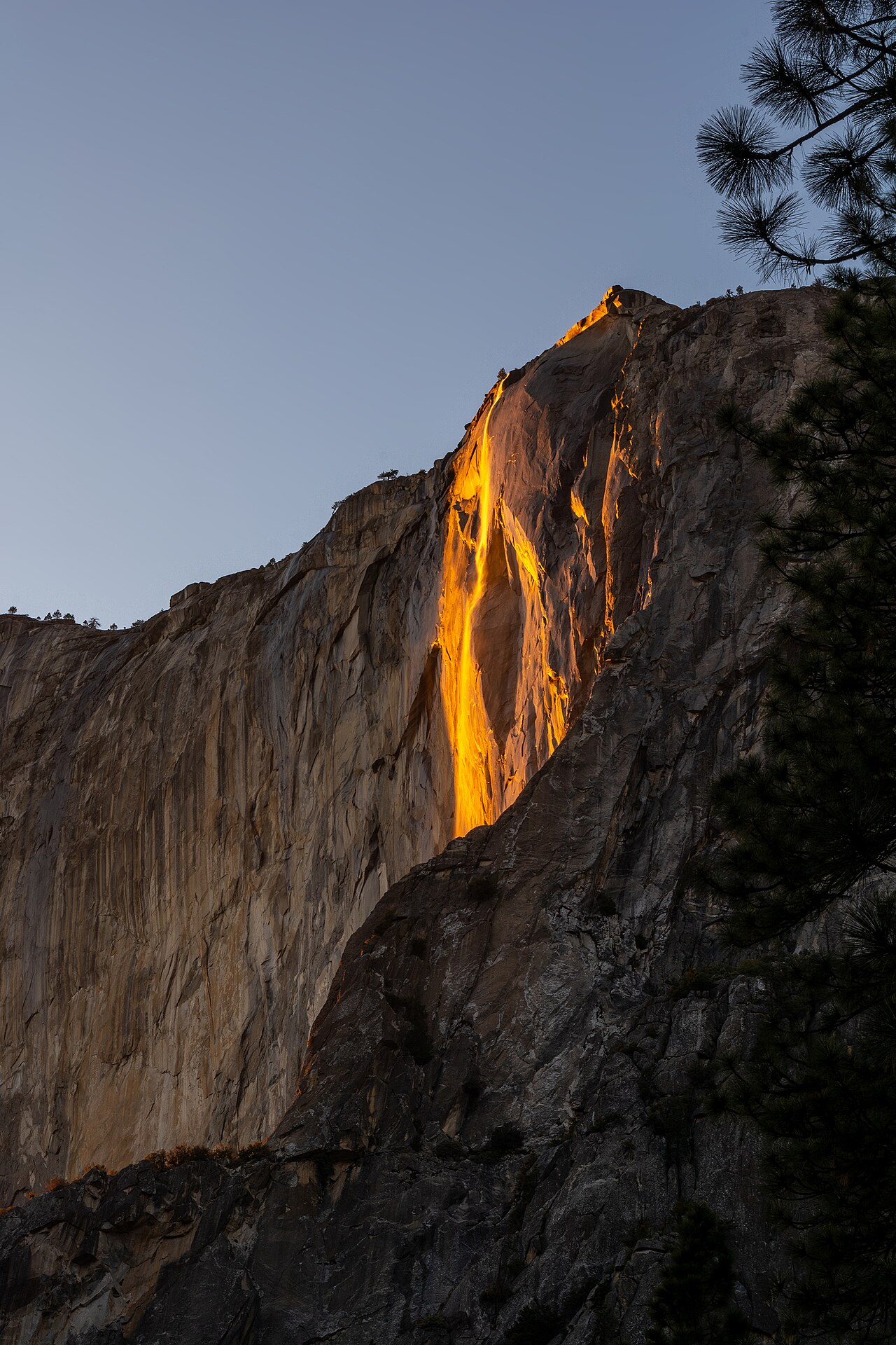
Horsetail Fall glowing fiery orange against the granite wall of El Capitan at sunset in Yosemite National Park
Yosemite Horsetail Fall · Photo: Matthew Dillon · CC BY 2.0 · Yosemite National Park, CA
Dozens of Florida manatees resting together in the transparent turquoise spring water at Blue Spring State Park
Blue Spring Manatee Aggregation · Photo: KimonBerlin · CC BY-SA 2.0 · Blue Spring, FL
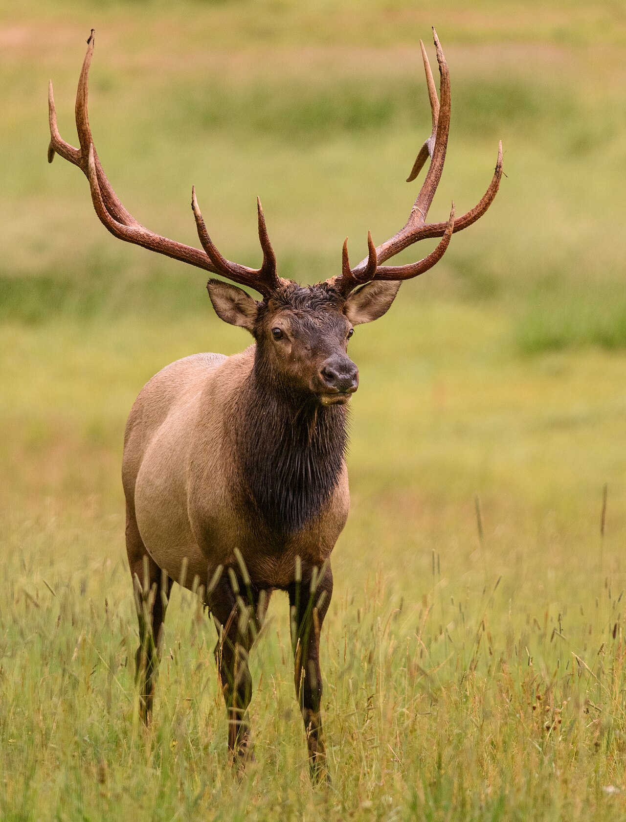
A majestic bull elk with large antlers bugling in an alpine meadow with Rocky Mountain peaks in the background
Rocky Mountain Elk Rut · Photo: Andrew Russell · CC BY 2.0 · Rocky Mountain NP, CO

Interactive Ranger Timeline Engine · Calendar Scrubber

12-Month Phenomenon Calendar: What Peak Windows Are Open Right Now?

Select a month to explore natural-event timing. Permit examples describe 2026 only; 2027 requirements remain unconfirmed until official announcements.

Quick Filter:
Full 12-Month Phenomenon Almanac Annual Cycle Overview

Explore 12 audited narrow-window national park phenomena across the United States. Use the timeline buttons above to scrub through each calendar month and discover which natural spectacles are unfolding right now, alongside urgent booking deadlines.

Select a month to explore natural windows. 2026 rules are historical, not future booking instructions.

Cartographic Ranger Dispatch · Continental & Island Coordinates

Interactive National Park Phenomenon Map

Click any numbered ranger badge on the map to inspect vehicle access rules, peak seasonal windows, and jump directly to that park's chief interpretive ranger dossier.

Chief Interpretive Ranger Briefings · Physics, Law & Wilderness Safety

The Science of Narrow Windows: How to Plan for the Fleeting

Physics & Optics · Ephemeral Events

Solar Declination & Geothermal Plumbing

Natural spectacles like Yosemite's Firefall or Acadia's first sunrise are governed by celestial mechanics. The tilt of the Earth's axis aligns the setting or rising sun with a precise granite notch for only 10 to 15 days each calendar year. Similarly, hydrothermal plumbing in Yellowstone relies on delicate subsurface silica deposits that regulate subterranean steam flashpoints. Missing the window by even one week turns a world-class wonder into a standard rock face or dormant geyser pool.

Federal Logistics · Recreation.gov

The Advance Reservation Matrix

Different trips require separate checks for park entry, activity permits, parking, shuttles, and temporary restrictions. For 2026, Glacier required no vehicle reservation, although Logan Pass had ticketed shuttles and timed parking; Yosemite Firefall required no February entrance or viewing reservation but had traffic controls. For 2027 and later, verify newly announced NPS policies rather than assuming 2026 rules repeat.

Ecology & Ethics · Leave No Trace

Red-Light Protocols & Bear Perimeters

Experiencing these phenomena requires strict compliance with park regulations. In Great Smoky Mountains, white light shatters the fireflies' bioluminescent mating signals; only red-filtered headlamps are permitted. In Rocky Mountain and Katmai, NPS recommends staying at least 75 feet from elk at Rocky Mountain National Park. At Katmai Brooks Camp maintain at least 50 yards from bears; closer bear viewing is permitted only where rangers allow it on designated platforms. Follow local NPS instructions, pack out food scraps, and carry bear spray where allowed.

Hydrology & Weather · Safety Boundaries

Monsoon Flashes & Thermal Inversions

Weather is the ultimate arbiter. In Zion's Narrows, a thunderstorm 15 miles upriver can funnel a deadly wall of water through the canyon within minutes; rangers close the gorge whenever USGS flow exceeds 150 CFS. At Haleakalā (10,023 ft) and Cadillac Mountain, high-elevation summit winds plunge temperatures into the 20s and 30s while valley floors bask in mild sunshine. Always layer for winter conditions even in peak summer.

12 Audited U.S. Natural Events · Field Dossiers

The 12 Narrow-Window National Park Phenomena

Explore all 12 events ranked by seasonal progression, featuring physical triggers, precise timing windows, permit lead times, and connected live condition decision tools.

Horsetail Fall glowing fiery orange against the granite wall of El Capitan at sunset in Yosemite National Park
No 2026 Entry Reservation Peak: Feb 10–28
Yosemite National Park · California

1. Yosemite Horsetail Fall "Firefall"

Peak WindowFeb 10–28 (Peak Feb 15–26)
Daily Timing10–15 Min Before Sunset
2026 Entry RuleNo Reservation · 2027 Unconfirmed
Physical TriggerSolar Angle + Snowmelt Flow

For roughly two weeks in mid-to-late February, the setting sun strikes Horsetail Fall on the eastern shoulder of El Capitan at an exact 90-degree optical angle. If the waterfall has water from high-elevation snowpack melt and the western horizon toward the Central Valley remains completely clear of clouds, the cascading spray illuminates with an intense, fiery orange-red glow resembling pouring lava.

The Physical Trigger:

Requires three non-negotiable variables: sufficient snowpack with daytime temperatures above freezing to generate meltwater; absolute cloud clearance on the western horizon at sunset; and exact February solar declination.

Permit & Access Logistics:

For February 2026, NPS required no reservation to enter Yosemite or visit Horsetail Fall. Visitors used Yosemite Falls parking and a 1.5-mile walk each way, or more distant parking with the free valley shuttle. Northside Drive included a temporary pedestrian lane, while parking, stopping and unloading were restricted. 2027 rules are not confirmed by the 2026 source. Check official NPS viewing restrictions.

Chief Ranger Field Advice:

Set up at the El Capitan Picnic Area viewing zone along Northside Drive by 2:00 PM. Bring warm insulated boots, microspikes for icy road shoulders, camp chairs, and headlamps for the 1.5-mile return walk in darkness.
Connected Tool: Yosemite Firefall Live Sunset Cloud Tracker → View Yosemite Horsetail Fall on Google Maps · area only, not verified parking ↗
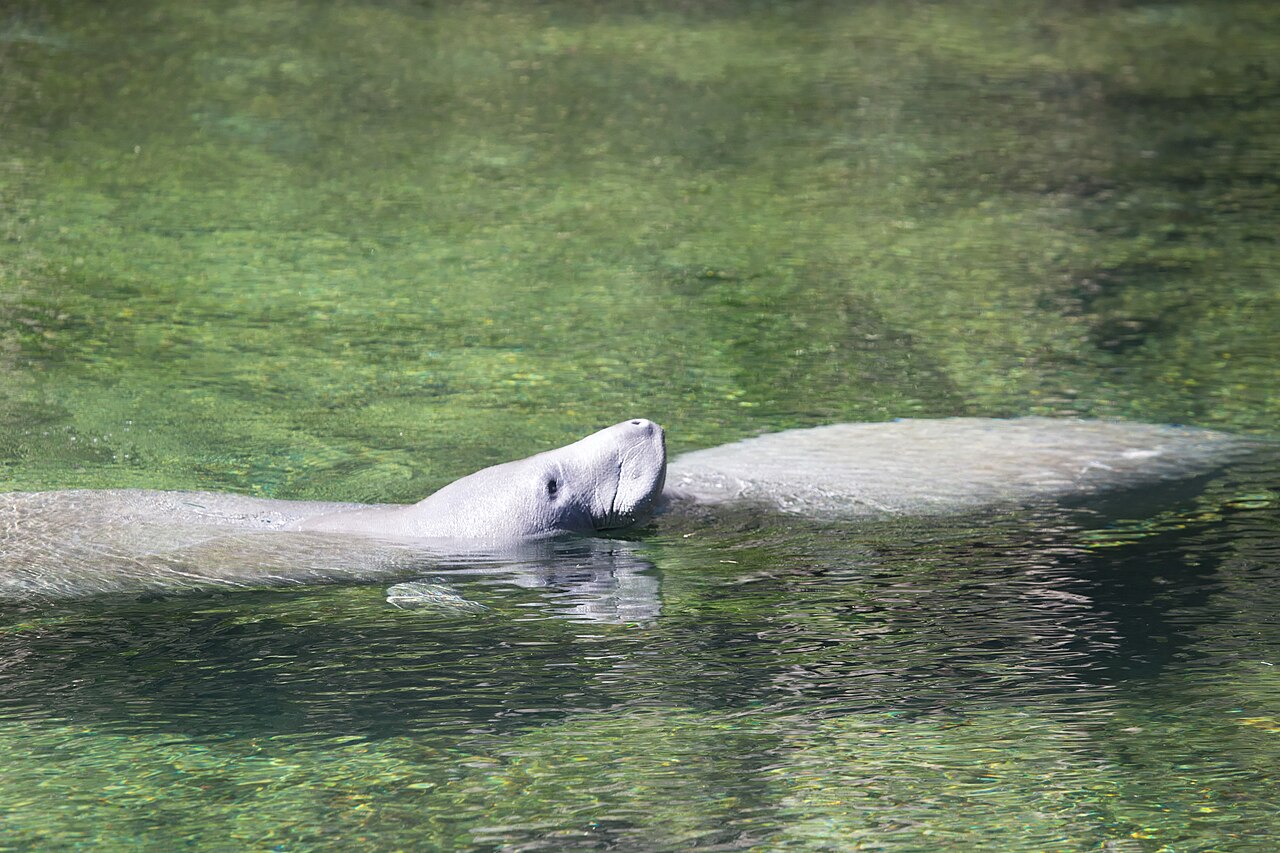
Dozens of Florida manatees resting together in the transparent turquoise spring water at Blue Spring State Park
Open Park Access Peak: Dec–Feb Cold Fronts
Blue Spring State Park / St. Johns River · Orange City, Florida

2. Blue Spring West Indian Manatee Gathering

Peak WindowNov 15–Mar 15 (Peak Dec–Feb)
Daily TimingEarly Morning After Cold Front
Permit Lead TimeNo Lottery · Gate Arrival by 7:30 AM
Physical TriggerConstant 72°F Aquifer Boil

When Arctic cold fronts drop water temperatures in the St. Johns River below 68°F (20°C), hundreds of West Indian manatees face fatal cold stress syndrome and swim into the crystal-clear 0.4-mile Blue Spring run. Fed by an underground Floridan Aquifer boil discharging 102 million gallons daily at a steady 72°F, the spring becomes a thermal sanctuary with record counts exceeding 700+ individuals gathered in transparent waters.

The Physical Trigger:

Manatees possess low metabolic rates and thin blubber layers. Prolonged exposure to river water below 68°F induces hypothermia. The spring's thermal stability acts as a biological life-support refuge.

Permit & Access Logistics:

No Recreation.gov lottery required. However, state park vehicle capacity is strictly enforced. On cold January and February mornings, the vehicle gate frequently reaches capacity and closes by 7:30 AM to 8:00 AM.

Chief Ranger Field Advice:

All in-water activities (swimming, snorkeling, scuba, and paddling) are legally closed throughout the winter refuge season to protect the herd. Walk the 0.3-mile elevated wooden boardwalk to Overlook 1 and Overlook 2 for unobstructed overhead viewing.

Connected Tool: Blue Spring Live Manatee Counter & River Temp Engine → View Blue Spring State Park on Google Maps · area only, not verified parking ↗
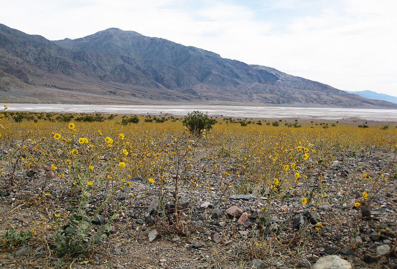
A sweeping field of yellow Desert Gold flowers blooming across the desert floor with the salt flats and mountains of Death Valley beyond
Open Park Access Peak: Late Feb–Mid Apr
Death Valley National Park · California / Nevada

3. Death Valley Superbloom & Badwater Salt Crusts

Peak WindowLate Feb–Apr (Elevation Dependent)
Daily TimingGolden Hour / Morning Light
Permit Lead TimeNo Reservation · Book Hotel 6 Mo Ahead
Physical TriggerCyclonic Autumn Rains (>3 Inches)

Occurring only once every 10 to 15 years, a true Death Valley superbloom is an astronomical botanical anomaly. Millions of dormant annual desert seeds—Desert Gold (Geraea canescens), Notch-leaf Phacelia, and Gravel Ghost—remain suspended in arid soils until rare autumn rainstorms deliver over 3 inches of soaking moisture. Combined with winter ephemeral lake flooding across Badwater Basin (-282 ft) that evaporates into fresh geometric salt polygon crusts, the driest place in North America briefly transforms into an ocean of gold.

The Physical Trigger:

Seed coats contain protective chemical germination inhibitors that require heavy soaking rains to wash away, followed by mild spring warming without desiccant desert windstorms.

Permit & Access Logistics:

Standard National Park entrance pass. No vehicle reservations. Lodging at Furnace Creek Oasis and Stovepipe Wells books 4 to 6 months in advance during spring bloom rumors.

Chief Ranger Field Advice:

Never walk off established trails in bloom corridors; desert annuals are fragile and crushing them destroys the seed bank for future decades. Pair lower-elevation viewing along Badwater Road in February with canyon hikes (Titus Canyon, Golden Canyon) in April.

Connected Tool: Death Valley Live Weather & Park Access Engine → View Badwater Basin on Google Maps · area only, not verified parking ↗
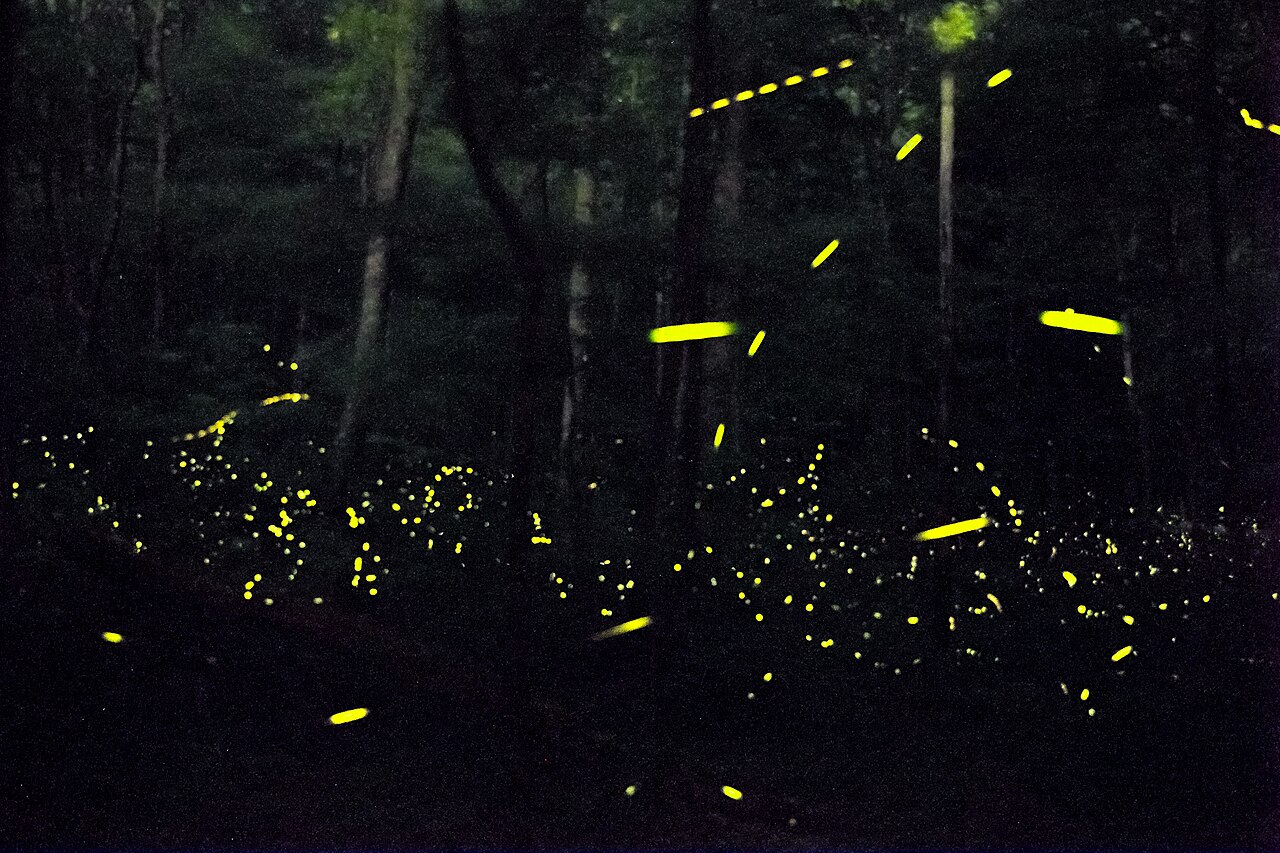
A dense hardwood forest in the Great Smoky Mountains illuminated by the bioluminescent flashes of synchronous fireflies
Recreation.gov Lottery Peak: Late May–Early Jun
Great Smoky Mountains National Park · Tennessee / North Carolina

4. Elkmont Synchronous Fireflies (Photinus carolinus)

2026 NPS EventMay 20–27 · 2027 Unconfirmed
Daily Timing9:30 PM–11:00 PM Full Darkness
2026 Vehicle LotteryApr 24, 10 AM–Apr 27, 11:59 PM EDT
Physical TriggerDegree-Days & Soil Warming

In the mature hardwood forests of Elkmont, thousands of male Photinus carolinus beetles engage in a breathtaking, synchronized bioluminescent mating display found in only a few places on Earth. Flying through the humid mountain air, the fireflies flash in near-perfect unison: 5 to 8 rapid flashes across entire mountain slopes, followed by 6 to 8 seconds of absolute, pitch-black silence, before repeating the rhythm in hypnotic waves.

The Physical Trigger:

Soil temperatures and cumulative spring degree-days determine the exact emergence window. The flashing synchrony evolved so females on the forest floor can distinguish their species' pattern amid ambient forest clutter.

Permit & Access Logistics:

The 2026 NPS Elkmont viewing event ran May 20–27. The vehicle reservation lottery opened April 24 at 10 AM EDT and closed April 27 at 11:59 PM EDT. During restricted viewing hours, vehicle access was limited to reservation holders and registered campers; registered Elkmont campers could reach the event on foot. This was event-area vehicle access, not a park-wide entrance requirement. The 2027 event and lottery dates are unconfirmed. NPS 2026 firefly announcement.

Chief Ranger Field Advice:

White light destroys the mating display. Only red-filtered flashlights are permitted on trails. Point red beams directly down at your feet while walking, and extinguish all lights once seated along the Little River and Jakes Creek trails.

Connected Tool: Great Smoky Mountains Live Conditions & Weather Engine → View Elkmont Historic District on Google Maps · area only, not verified parking ↗
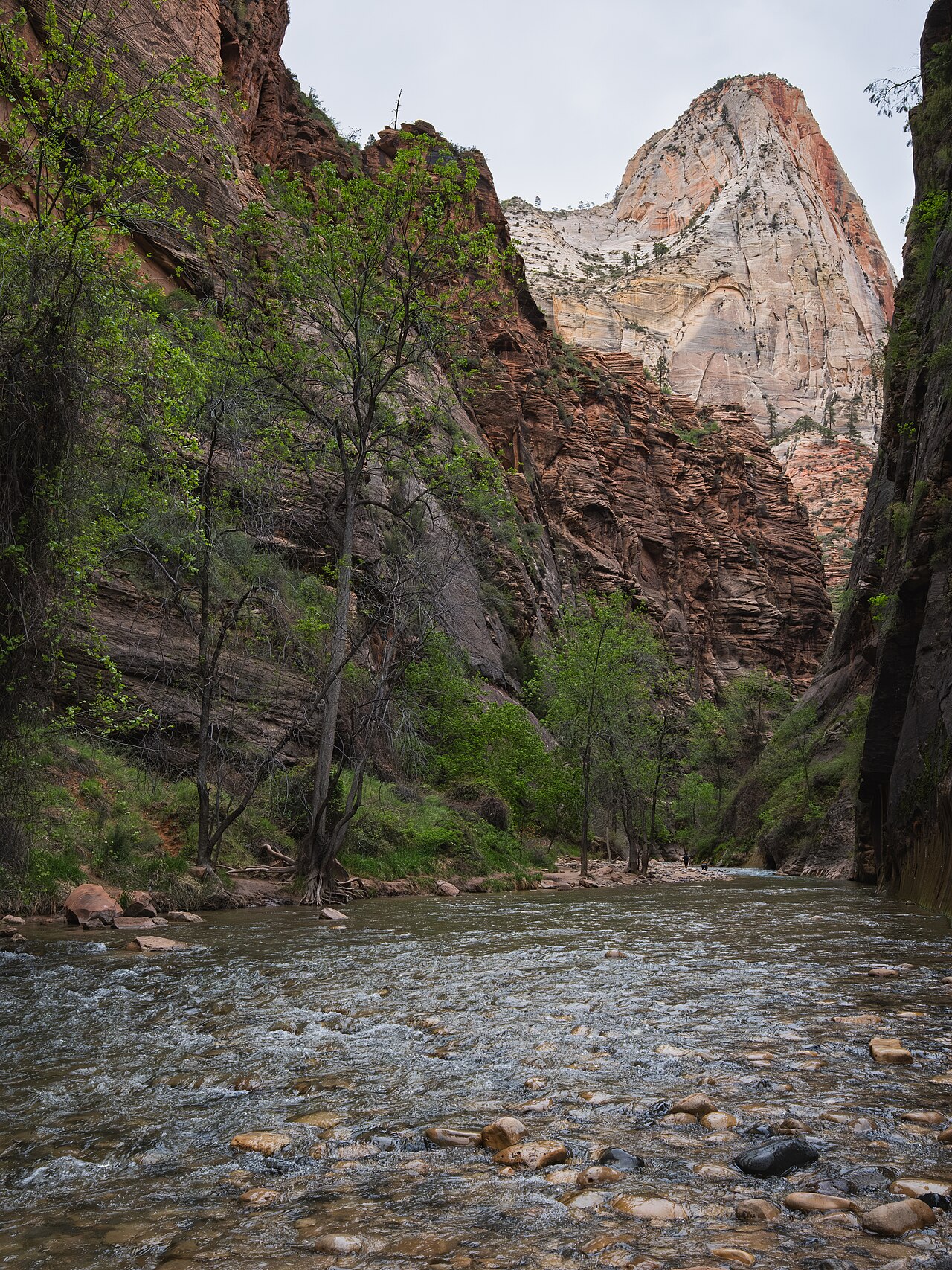
Hikers wading through the shallow Virgin River between towering sheer Navajo sandstone cliffs in The Narrows, Zion National Park
Bottom-Up: No Permit Peak: Late May–Oct
Zion National Park · Springdale, Utah

5. Zion Narrows Summer/Fall Slot Canyon Window

Peak WindowLate May–Oct (Goldilocks: Sep–Oct)
Daily TimingEarly Morning Shuttle Departure
Wilderness PermitRequired only for 16-Mile Top-Down
Physical TriggerUSGS Flow Rate <150 CFS

Wading up the Virgin River between 1,000-foot sheer Navajo sandstone cliffs in The Narrows is one of the world's premier canyon experiences—yet it is strictly governed by upstream river hydraulics. During snowmelt and storms, river flow can exceed 150 cubic feet per second (CFS), when NPS closes the route. Lower flow is not an all-clear: the park also closes the Narrows during NWS Flash Flood Warnings and for at least two hours afterward. Summer and early fall may offer lower flows, but actual access changes daily.

The Physical Trigger:

The canyon is an inescapable slot. When a convective storm hits the 500-square-mile upper watershed, water gathers into a catastrophic surge within hours. Zion NPS closes The Narrows immediately if flow exceeds 150 CFS or if a Flash Flood Warning is issued.

Permit & Access Logistics:

Bottom-up hiking from Temple of Sinawava as far as Big Spring requires no Wilderness permit. The 16-mile top-down through-hike from Chamberlain’s Ranch does require a Wilderness permit, with different procedures for a single-day or overnight trip. The 2027 release schedule is unconfirmed. NPS Narrows permits by route.

Chief Ranger Field Advice:

Wear closed-toe footwear with traction and bring a sturdy hiking stick, as NPS recommends. Check river flow, NWS warnings, cyanobacteria advisories and current NPS closure notices before entering; leave immediately if the river rises or turns muddy.

Connected Tool: Zion Narrows Live USGS Flow & Flash-Flood Alert Engine → View Temple of Sinawava on Google Maps · area only, not verified parking ↗
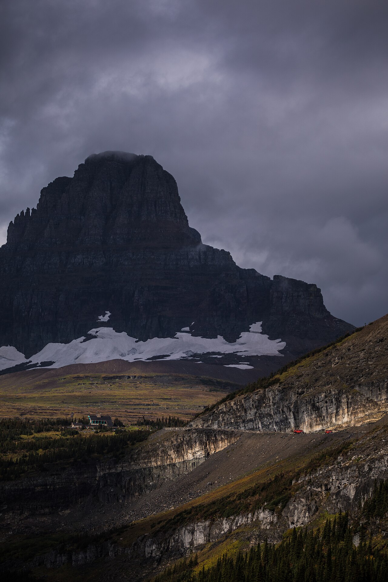
The dramatic alpine curves of Going-to-the-Sun Road winding below Clements Mountain at Logan Pass in Glacier National Park
No 2026 Vehicle Reservation Peak: Late Jun/Jul–Mid Oct
Glacier National Park · West Glacier, Montana

6. Going-to-the-Sun Road Alpine Opening & Logan Pass

Peak WindowLate Jun/Jul–Mid Oct (Wildflowers Jul/Aug)
2026 Logan Pass3-Hour Parking · Ticketed Shuttle
2026 Entry RuleNo Reservation · 2027 Unconfirmed
Physical TriggerBig Drift Avalanche Clearing (60+ Ft)

Few road openings on the planet rival the engineering and alpine drama of Glacier's Going-to-the-Sun Road. Crossing the Continental Divide at Logan Pass (6,646 ft), the 50-mile route takes NPS heavy equipment crews over 10 weeks of hazardous plowing through 40-to-80-foot avalanche snowdrifts along the sheer rock faces of the Garden Wall. When the full road finally unlocks in late June or early July, it unveils a transient alpine paradise of yellow glacier lilies, waterfalls pouring onto pavement, and bighorn sheep nursing lambs.

The Physical Trigger:

Deep Pacific maritime and Arctic continental snowpacks converge on the Livingston and Lewis mountain ranges, burying the highway under massive avalanches that freeze into dense glacial ice.

Permit & Access Logistics:

NPS did not require a vehicle reservation anywhere in Glacier in 2026. Logan Pass had separate requirements July 1–September 7: three-hour private-car parking with a free kiosk permit displayed on the dashboard, and a ticketed shuttle for shuttle riders. 2027 rules are unconfirmed. Read NPS Logan Pass 2026 guidance.

Chief Ranger Field Advice:

In summer 2026, drivers parked first, then obtained a free timestamped kiosk permit. Highline Trail day hikers generally needed a separately ticketed shuttle; the 2026 shuttle was not free or first-come/first-served. Check this season's NPS operations and road status before travel.

Connected Tool: Glacier Sun Road Live Plowing & Logan Pass Engine → View Logan Pass Visitor Center on Google Maps · area only, not verified parking ↗
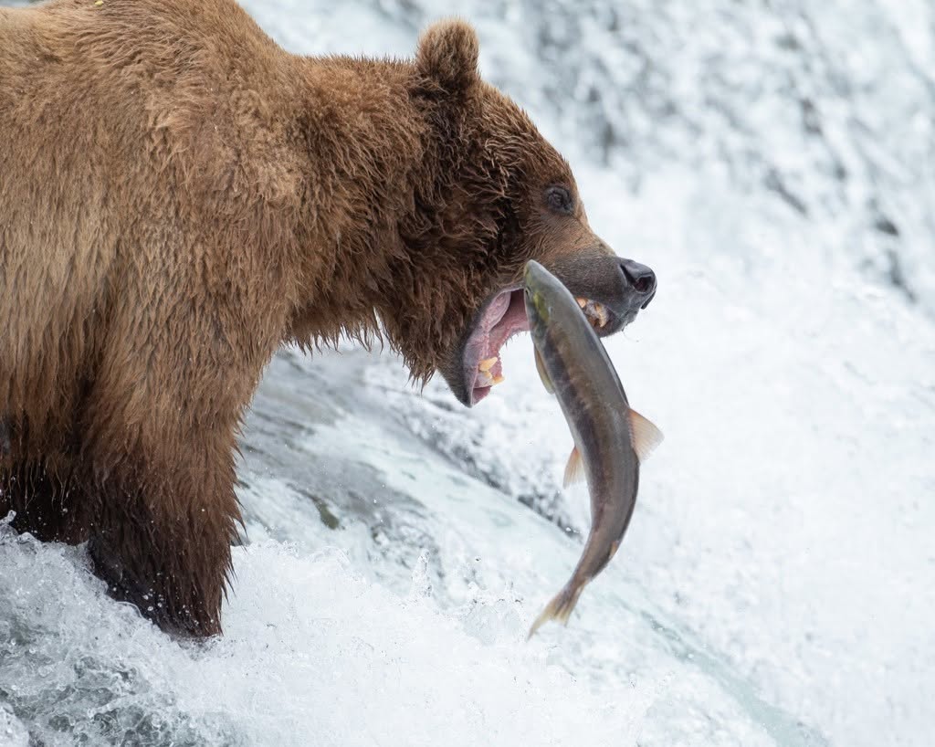
A large coastal brown bear standing atop Brooks Falls with jaws open capturing a migrating red sockeye salmon leaping upstream
Bear Viewing: No Reservation Peak: July 1–31
Katmai National Park & Preserve · King Salmon, Alaska

7. Katmai Brooks Falls Brown Bear Sockeye Feeding

Peak WindowJuly 1–31 (Peak Migration July 5–25)
Viewing AccessPlatform Capacity Managed · Check Hours
2026 July/Aug CampgroundReservations Released Feb 7 · 8 AM AKST
Physical TriggerBristol Bay Sockeye Salmon Run

In the Alaskan wilderness accessible only by floatplane, July triggers the ultimate wildlife spectacle on the continent. Millions of sockeye (red) salmon enter Bristol Bay and fight their way up the Brooks River toward spawning gravels in Naknek Lake. At the 6-foot Brooks Falls, hundreds of thousands of salmon must launch themselves into the air to surmount the waterfall lip. Up to 40+ massive coastal brown bears assemble at the falls to catch fighting 6-pound fish mid-air, establishing a strict dominance hierarchy on the rocks.

The Physical Trigger:

The Bristol Bay sockeye run is the largest wild salmon migration on Earth. The waterfall creates an energetic bottleneck that forces salmon to repeatedly leap, giving apex predators unprecedented feeding efficiency.

Permit & Access Logistics:

Brooks Falls viewing does not require an advance reservation. Rangers manage the platform’s capacity, and mandatory bear-safety orientation applies to arriving visitors. Campground overnight stays are separate: 2026 campground reservations released January 7 for May–June nights, February 7 for July–August, and March 7 for September–October, at 8 AM AKST. Boat or floatplane transportation must be arranged separately. Brooks River Corridor activity permits may be required outside designated trails, boardwalks and viewing platforms. 2027 campground release dates are unconfirmed. NPS viewing rules · NPS campground reservations.

Chief Ranger Field Advice:

All arrivals attend the NPS bear-safety orientation at Brooks Camp. Follow marked trails, platforms and ranger instructions; bear movement can delay passage across bridges. In the June 15–August 15 window, Falls and Riffles viewing platforms have overnight closures. Check the posted hours rather than assuming access at dawn or late night.

Connected Tool: National Park Decision Tools Hub → View Brooks Falls Platform on Google Maps · area only, not verified parking ↗
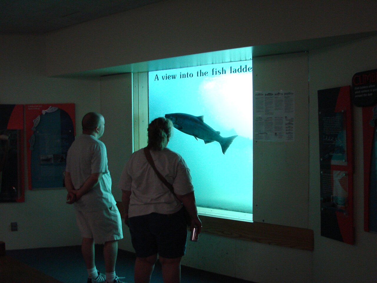
A large adult salmon leaping over concrete fish ladder baffles at Bonneville Dam along the Columbia River
Open Public Access Peak: Jun–Oct Runs
Columbia River Gorge / Bonneville Dam · Oregon / Washington

8. Columbia River Sockeye & Chinook Salmon Run

Peak WindowJun–Oct (Sockeye Jun/Jul · Chinook Sep)
Daily Timing9:00 AM–5:00 PM Viewing Windows
Permit Lead TimeNo Reservation Required · Free Entry
Physical TriggerAnadromous Upstream Spawning Run

Carving a deep basalt canyon through the Cascade Mountain Range, the Columbia River Gorge is the ancient highway for Pacific anadromous fish. From June through October, hundreds of thousands of sockeye salmon, massive fall Chinook, coho, and steelhead battle 140 miles upstream from the Pacific Ocean. At Bonneville Lock and Dam, public underwater viewing galleries and cascading fish ladder channels allow visitors to watch 30-pound salmon leaping concrete baffles and passing counting windows just inches behind the glass.

The Physical Trigger:

Salmon born in high alpine tributaries spend 2 to 5 years in the Pacific Ocean before returning to their natal streams. They navigate by olfactory homing, swimming tirelessly against heavy river discharge without feeding.

Permit & Access Logistics:

Free admission. The U.S. Army Corps of Engineers Bonneville Lock and Dam Visitor Center on Bradford Island is open daily. No tickets or lotteries needed.

Chief Ranger Field Advice:

September is the overall grand finale: daily fish counts at Bonneville regularly exceed 15,000 to 25,000 migrating salmon per day. Pair dam viewing with a hike along the Gorge waterfalls (Multnomah, Wahkeena, Horsetail).

Connected Tool: Columbia River Daily Salmon Ladder Counts & Ladder Engine → View Bonneville Lock & Dam on Google Maps · area only, not verified parking ↗
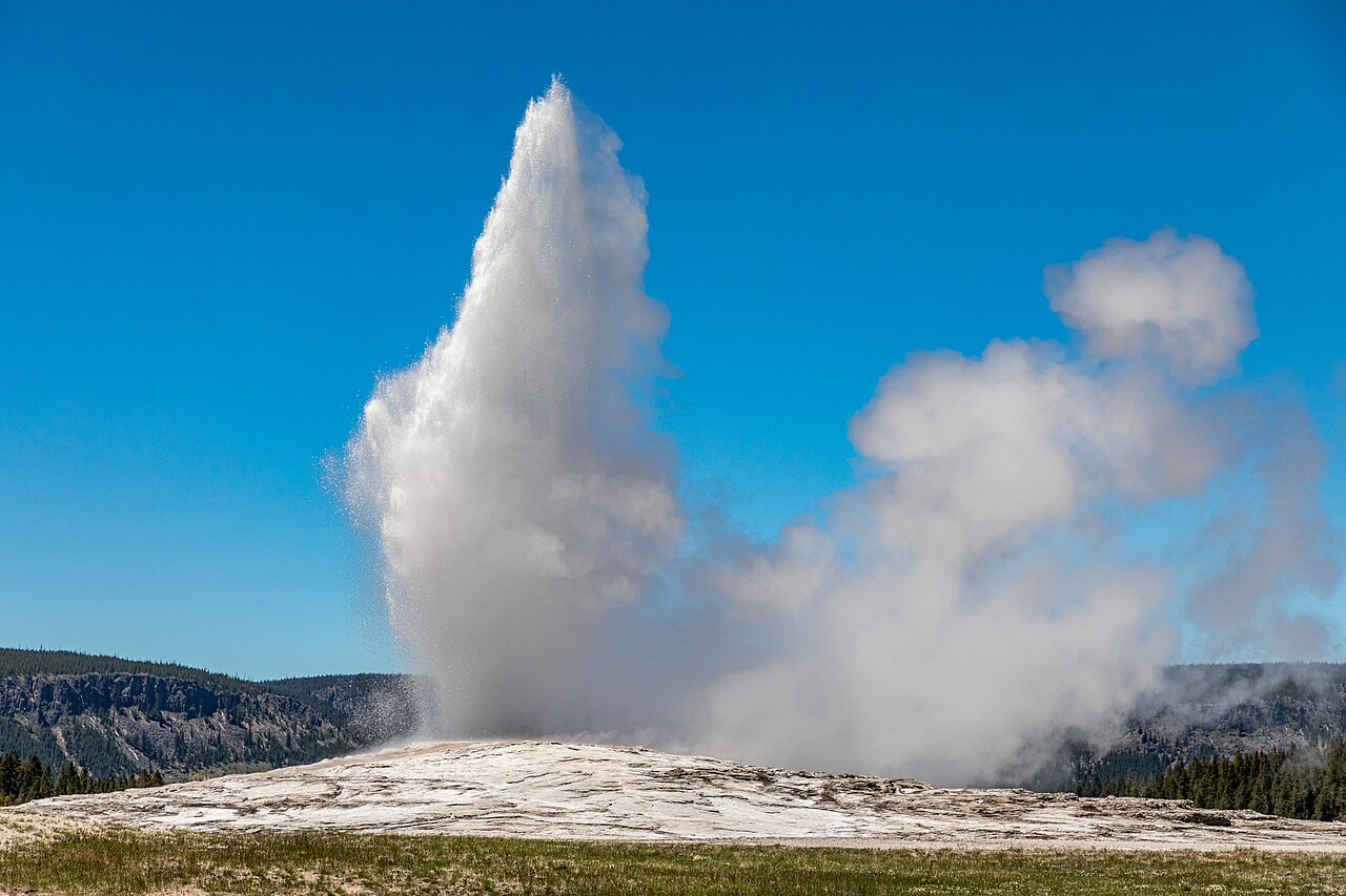
Old Faithful geyser erupting a towering column of steam and boiling water into a blue sky in Yellowstone National Park
Open Park Access Peak: May–Oct Daylight
Yellowstone National Park · Wyoming / Montana / Idaho

9. Yellowstone Upper Geyser Basin & Steamboat Cycles

Peak WindowMay–Oct (Boardwalks Clear & Daylight Long)
Daily TimingInterval-Based (Check Prediction Clock)
Permit Lead TimeNo Permit · Book In-Park Lodging 1 Yr Ahead
Physical TriggerSuperheated Rhyolitic Hydrothermal Plumbing

Sitting atop a massive volcanic caldera, Yellowstone harbors over 500 active geysers—more than half the geysers on Earth. In the Upper Geyser Basin, Old Faithful erupts with dependable rhythm every 60 to 110 minutes, launching boiling water 130 feet into the mountain air. Meanwhile, nearby in the Norris Geyser Basin, Steamboat Geyser—the tallest active geyser in the world—unleashes unpredictable superheated eruptions exceeding 300 feet, shaking the forest and spewing abrasive silica mist across the pines.

The Physical Trigger:

Deep magma chambers heat groundwater to over 400°F (204°C) under high pressure. When rising water begins boiling near the surface, steam expands rapidly, ejecting the water column and causing an explosive flash of pressure release.

Permit & Access Logistics:

Standard National Park entrance pass. No reservations required for geyser viewing. Historic park hotels (Old Faithful Inn, Lake Hotel) open for reservations 365 days in advance on May 1.

Chief Ranger Field Advice:

Never leave established wooden boardwalks. Thermal crusts over boiling acidic groundwater can be as thin as an inch; stepping through causes fatal thermal burns. Consult NPS prediction boards at Old Faithful Visitor Education Center to time Grand Geyser, Castle, and Riverside.

Connected Tool: Yellowstone Geysers Live Prediction & Eruption Windows → View Upper Geyser Basin on Google Maps · area only, not verified parking ↗
A massive bull elk with multi-tined antlers bugling in an open autumn meadow in Moraine Park, Rocky Mountain National Park
2026 Timed Entry Window Peak: Sep 15–Oct 25
Rocky Mountain National Park · Estes Park, Colorado

10. Rocky Mountain Moraine Park Bull Elk Bugling Rut

Peak WindowSep 15–Oct 25 (Peak Sep 20–Oct 10)
2026 Meadow ClosureSep 1–Oct 31 · No Foot Travel 5 PM–10 AM
2026 Timed EntryGeneral Through Oct 12 · Bear Lake Through Oct 18
Physical TriggerDiminishing Autumn Photoperiod

As golden aspen leaves peak across the Colorado Rockies in late September, Moraine Park, Horseshoe Park, and Upper Beaver Meadows become the amphitheater for one of North America's most intense wildlife spectacles. Diminishing daylight triggers a massive surge of testosterone in bull elk (Cervus canadensis). Weighing up to 800 pounds with six-foot antler spreads, mature bulls gather harems of 30+ cow elk, challenging rival bulls with piercing, high-pitched bugles that echo off towering granite cirques before clashing antlers in violent shoving battles.

The Physical Trigger:

Melatonin receptors register shortening daylength, stimulating hormonal surges that drive rutting aggression, scent marking, wallowing in mud, and vocal bugling to assert dominance over territory.

Permit & Access Logistics:

In 2026, general-park timed entry was required May 22–October 12 between 9 AM and 2 PM; Bear Lake Road (including Moraine Park) required the separate Timed Entry+ permit May 22–October 18 between 5 AM and 6 PM. September permits released August 1, October permits September 1, each at 8 AM MDT. Additional next-day permits released at 7 PM MDT, not 5 PM. Outside these seasonal windows timed-entry reservations were not required. 2027 rules unconfirmed. NPS timed-entry dates and corridors.

Chief Ranger Field Advice:

From September 1 through October 31, NPS restricts foot travel in named elk meadows, including Moraine Park, Horseshoe Park, Upper Beaver Meadows, Harbison Meadow and Holzwarth Meadow, from 5 PM to 10 AM daily. These area-specific restrictions are not a park-wide road closure. Watch from open roadside viewing locations or signed safe areas; stay at least 75 feet from elk. NPS elk viewing and meadow closures.

Connected Tool: Rocky Mountain Elk Rut Live Meadow & Bugling Intel → View Moraine Park on Google Maps · area only, not verified parking ↗
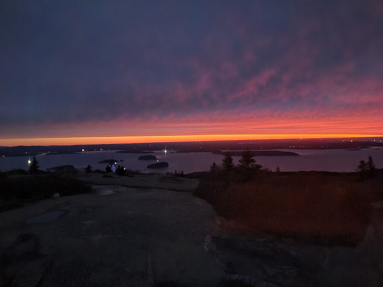
The sun rising over the Atlantic Ocean and coastal islands, casting golden light across the granite summit of Cadillac Mountain in Acadia
Sunrise Vehicle Pass Peak: Oct 7–Mar 6
Acadia National Park · Bar Harbor, Maine

11. Acadia Cadillac Mountain First U.S. Sunrise

Peak WindowOct 7–Mar 6 (Astronomical First Sunrise)
Daily TimingDawn (30 Min Before Sunrise)
2026 Summit Vehicle RuleMay 20–Oct 25 · 90-Day / 2-Day Releases
Physical TriggerEarth's Axial Tilt & Southern Declination

Rising 1,530 feet straight out of Frenchman Bay, Cadillac Mountain is the highest point along the eastern seaboard of North America. Due to Earth's 23.5-degree axial tilt and southern solar declination during the autumn and winter months, Cadillac Mountain summit greets the very first beam of sunlight in the United States every morning from October 7 through March 6. Standing atop the pink Mount Desert Island granite, observers watch dawn ignite across the Atlantic Ocean, illuminating outer spruce-covered islands in brilliant rose-gold light.

The Physical Trigger:

During autumn and winter, the solar terminator line angles northeast to southwest. Cadillac Mountain's altitude and southern coastal protrusion allow its summit to intersect the rising sun rays minutes before Mars Hill or Lubec.

Permit & Access Logistics:

In 2026, Cadillac Summit Road required a vehicle reservation May 20–October 25 for both sunrise and daytime visits. NPS released 30% of reservations 90 days ahead and 70% two days ahead, at 10 AM ET. Other areas of Acadia did not require vehicle reservations. Outside the seasonal booking period, summit driving access depends on actual NPS road operations; do not treat absence of a reservation requirement as an open road. 2027 policy unconfirmed. NPS Cadillac Summit Road policies.

Chief Ranger Field Advice:

Summit winds at dawn frequently drop wind chill temperatures below 20°F even during October. Dress in full sub-freezing winter wind layers and bring a thermos of hot coffee. Stay strictly on durable pink granite; fragile subalpine vegetation takes decades to recover from footsteps.

Connected Tool: Cadillac Mountain Solar Alignment & First Sunrise Tracker → View Cadillac Mountain Summit on Google Maps · area only, not verified parking ↗
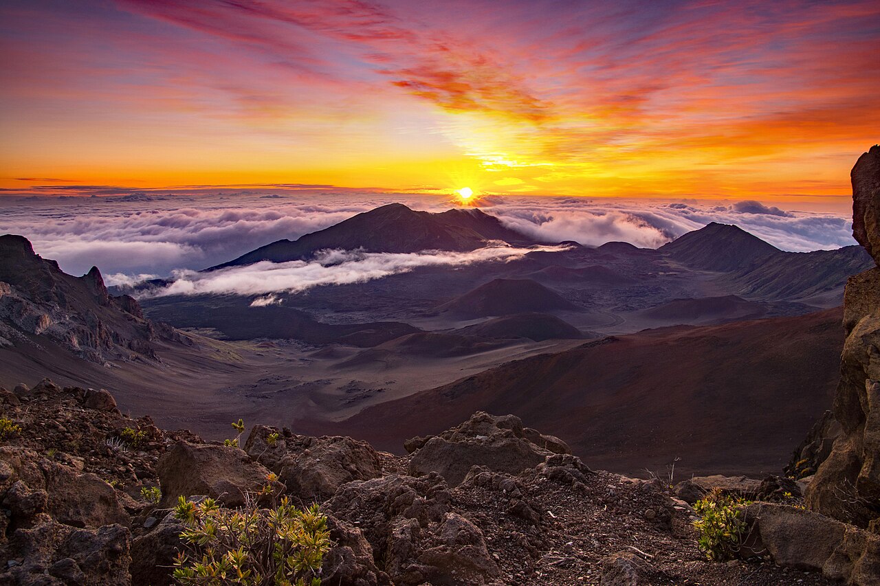
A brilliant orange sunrise bursting over a sea of white trade-wind inversion clouds viewed from the 10,023-foot volcanic rim of Haleakala
Sunrise Ticket Mandatory Peak: Apr–Oct Inversions
Haleakalā National Park · Kula, Maui, Hawaii

12. Haleakalā Summit Cloud Inversion Sunrise

Peak WindowYear-Round (Best Trade Winds Apr–Oct)
Daily Timing3:00 AM–7:00 AM Summit Entry
Permit Lead TimeBook 60 Days Ahead at 7:00 AM HST
Physical TriggerTrade-Wind Atmospheric Inversion

Rising 10,023 feet above the Pacific Ocean, the summit crater of Haleakalā ('House of the Sun') offers an otherworldly atmospheric vantage point. Pacific trade winds generate a strong temperature inversion layer typically between 5,000 and 7,000 feet, trapping moist marine air and thick stratocumulus clouds below the volcano's rim. Visitors standing at the summit gaze across an undulating ocean of white clouds stretching to the horizon, watching the sun erupt through the cloud deck in vivid scarlet, indigo, and gold hues.

The Physical Trigger:

Subsiding dry air from the Hadley cell circulation caps rising moist maritime air, creating a sharp boundary layer (the trade-wind inversion). The volcano summit pierces above this layer into dry, crystalline alpine atmosphere.

Permit & Access Logistics:

Haleakalā Sunrise vehicle reservations are strictly required for any vehicle entering between 3:00 AM and 7:00 AM via Recreation.gov. Tickets release 60 days in advance at 7:00 AM HST (1:00 PM EDT), with a secondary batch releasing 2 days in advance at 7:00 AM HST.

Chief Ranger Field Advice:

Despite being in Hawaii, summit temperatures hover between 30°F and 45°F (-1°C to 7°C) before dawn with ferocious wind chills. Bring heavy winter coats, beanies, and gloves. Arrive at the summit by 5:15 AM to observe the astronomical twilight glow.

Connected Tool: Haleakalā Summit Inversion & Trade-Wind Live Tracker → View Haleakalā Summit on Google Maps · area only, not verified parking ↗

Interpretive Ranger Desk · Visitor Questions & Practical Advice

Frequently Asked Questions: Timing National Park Natural Phenomena

How do I plan a trip around a natural phenomenon that only lasts two weeks?

Plan for the natural event, then verify NPS requirements for your actual visit year. Park entrance, event access, campground permits, shuttle tickets, and parking controls are separate. In 2026, Glacier had no vehicle reservation and February Yosemite Firefall had no entrance or viewing reservation. Logan Pass ticketed shuttles and three-hour parking still applied, and Yosemite imposed parking and pedestrian restrictions. Requirements for 2027 are not confirmed by 2026 guidance.

Why does the Yosemite Horsetail Fall Firefall fail to light up on some February nights?

The Firefall requires three independent physical variables to intersect simultaneously. First, Horsetail Fall must have flowing water, which depends on high-elevation snowpack receiving daytime solar melting. Second, the western sky toward California's Central Valley must remain completely free of cloud decks at sunset; even a low bank of clouds 100 miles away can block the sun's rays before they hit El Capitan. Third, the solar declination must align precisely between February 10 and February 28. If clouds roll in or temperatures stay sub-freezing all day, the effect does not occur.

What are the wildlife safety distances for watching the elk rut and brown bears?

Federal regulations strictly require visitors to remain at least 75 feet (25 yards or two bus lengths) away from bull elk, deer, and bighorn sheep, and at least 300 feet (100 yards) away from bears and wolves. During the autumn rut, bull elk are aggressively territorial, weigh over 700 pounds, and will charge vehicles and pedestrians without warning. In Katmai National Park, visitors must complete mandatory NPS bear school upon landing and remain on elevated boardwalks and viewing platforms along Brooks Falls.

When is the safest window to hike the Zion Narrows without flash flood danger?

September and early October offer the prime 'goldilocks' window for hiking The Narrows. By September, the high-volume spring snowmelt runoff that closes the river in April and May has receded, water temperatures hover around 60°F to 62°F, and the volatile North American Monsoon storm season (July and August) has diminished. However, slot canyon flash floods can trigger from storms miles away. Zion NPS closes the river immediately whenever flow exceeds 150 cubic feet per second (CFS) or when NWS Salt Lake City issues a Flash Flood Warning.

Why is Cadillac Mountain in Acadia the first place in the U.S. to see sunrise only in fall and winter?

Because of Earth's 23.5-degree axial tilt, the solar terminator line (the boundary between day and night) angles from northeast to southwest during the Northern Hemisphere's autumn and winter (October 7 through March 6). This southern solar declination gives Maine's 1,530-foot granite peak the geographic advantage over northern locations like Mars Hill or West Quoddy Head. From May to September, the sunrise angle shifts north, and Mars Hill, Maine greets the sun first.

What etiquette is required for viewing the Elkmont synchronous fireflies in Great Smoky Mountains?

The synchronous firefly mating display depends entirely on female beetles on the forest floor spotting the rhythmic bioluminescent flashes of flying males. White flashlight beams, camera flashes, and phone screens instantly disrupt this mating communication. Park rangers strictly enforce red-light headlamp protocols (red cellophane or red LED settings only), keeping flashlights pointed down at your feet while walking, and shutting all lights off once seated.