Pictured Rocks - Munising Snowshoe Trail
Dedicated marked winter snowshoe loop. Read the field notes and confirm current NPS access.
Michigan Winter Trails / Field Decision Desk
Snowshoes beneath hemlocks, a tracked ski loop, a packed winter walk, or a fat-bike outing. Choose the experience first, then compare documented routes and the winter approach you still need to verify.
Two documented snowshoe options to start your research.
Dedicated marked winter snowshoe loop. Read the field notes and confirm current NPS access.
Two documented snowshoe loops. Read the field notes and confirm current DNR access.
Before you go: verify regional snow, trail-specific grooming and today's road and parking access independently.
Michigan Winter Trails · A Skier, Snowshoer & Fat-Biker's Field Guide by Chris Izworski
A summer trail map can get you stuck up to your axles on an unplowed seasonal road in January, or put your snowshoes straight through a freshly groomed classic ski track. Here are 15 of my favorite Michigan winter trail systems and 50 named state and national park loops—complete with which loops are snowshoe-only, where fat-tire bikes are welcome, and which bridges or seasonal roads are closed for the winter.
Explore the 15 winter trail systemsBy Chris Izworski · 15 trail systems & 50 named DNR/NPS loops · Track etiquette, fat-bike windows & winter road heads-ups
15 Trail Systems · 50 Named Loops
Filter by how you want to travel, which peninsula you're visiting, how much effort you want to spend, and how the winter trailhead is maintained.
Showing all 15 Michigan winter trail systems and 50 named loops.
Munising · Pictured Rocks National Lakeshore · Easy · 2.65 Miles
Signed NPS snowshoe loop · No ski-track conflicts
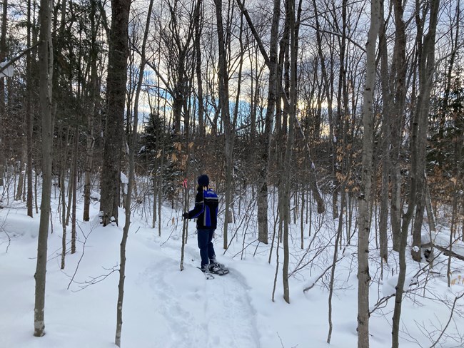
When Lake Superior's northwest snow machine buries Alger County in waist-deep powder, the 2.65-mile Munising Snowshoe Trail is pure winter magic. It threads through quiet hemlock hollows and northern hardwoods right above town, giving snowshoers their own blazed singletrack completely separate from the groomed cross-country ski trails.
Loops & distances: Munising Snowshoe Trail (2.65 mi dedicated snowshoe loop)
Because it's built specifically for snowshoes, you get the fun of breaking trail through fresh Lake Superior powder without ever worrying about stepping on a classic ski groove.
How I do itStart from the signed Munising Snowshoe Trail access near Sand Point Road, wear full-flotation snowshoes after any lake-effect squall, and pair the loop with a walk out to the Sand Point inland ice curtains.
Heads-up on the trail: Remember that the nearby Munising Falls canyon trail remains closed until further notice after its 2025 washout; repairs are estimated for completion in late 2027, and if you cross any of the groomed Munising ski loops, step cleanly across without walking down the set tracks.

Paradise · Tahquamenon Lower Falls · Moderate · 1.6 & 2.4 Miles
Official DNR winter map · Dedicated snowshoe loops
Most winter visitors only stop at the Upper Falls, which leaves the Lower Falls wonderfully peaceful from December through March. The DNR lays out two dedicated winter snowshoe loops here—the 1.6-mile Green Loop and the 2.4-mile Blue Loop—winding through deep cedar and spruce woods before bringing you out to the ice-rimmed island cascades.
Loops & distances: Green Snowshoe Loop (1.6 mi) · Blue Snowshoe Loop (2.4 mi) · Lower Falls Boardwalk Overlook (0.6 mi)
With the main summer concession parking loop gated for winter, snowshoeing in from the winter lot makes the Lower Falls feel like your own private northwoods park.
How I do itPark at the plowed winter lot near the Hemlock Campground entrance off M-123 and follow the Green or Blue snowshoe blazes toward the river overlooks.
Heads-up on the trail: Do not try to hike the 4-to-5-mile River Trail between the Lower and Upper Falls in winter unless you're rigged for a strenuous backcountry breaking-trail expedition—the DNR leaves it completely ungroomed and deep drifts hide steep sidehills above the river.

Paradise · Tahquamenon Upper Falls · Easy · 0.75 & 1.0 Mile
Plowed M-123 day-use lot · Separate snowshoe & ski loops
Hearing the roar of Upper Tahquamenon Falls through a silent, snow-muffled hemlock forest is one of the defining experiences of a Michigan winter. From the plowed Upper Falls day-use lot, you can walk the packed 0.75-mile path straight to the 200-foot-wide brink, or strap on snowshoes for the 1.0-mile Marked Snowshoe Loop through the woods.
Loops & distances: Upper Falls Brink Walk (0.75 mi packed path) · Marked Snowshoe Trail (1.0 mi loop) · Lantern Loop (1.0 mi · Cross-country ski only)
The park staff keeps the main day-use parking lot cleared all winter and posts daily trail notes right at the trailhead.
How I do itPull microspikes over your winter boots if you're just walking the packed path out to the brink overlooks, or bring snowshoes for the 1.0-mile woods loop after fresh snow.
Heads-up on the trail: Watch the trailhead signs carefully—the 1.0-mile Lantern Loop is groomed strictly for cross-country skiers (no snowshoes or boots allowed), and the lower gorge staircases are often gated when encased in river-mist ice.

Paradise · Whitefish Bay Snowbelt · Moderate · 1.6 to 3.4 Miles
Directly off paved M-123 · Ungroomed backcountry snow
Just west of Paradise on M-123, the Paradise Pathway is the kind of classic old-school Upper Peninsula state forest trail where you can glide through red pines for two hours and never hear another voice. Its three stacked loops cross ancient sandy beach ridges left behind by post-glacial Lake Superior.
Loops & distances: South M-123 Loop (1.6 mi) · North M-123 Loop (3.2 mi) · North Ridge Loop (3.4 mi)
Because the trailhead sits right on paved M-123 between Tahquamenon Falls and the town of Paradise, you don't have to gamble on miles of unplowed logging roads to reach deep Whitefish Bay snow.
How I ski or snowshoe itBring wider touring skis (60mm+ waist) or full snowshoes—the pathway isn't machine-groomed, so you'll be gliding in a skier-broken two-track or breaking fresh powder yourself.
Heads-up on the trail: When local skiers have worked hard to pack a clean two-track glide line through two feet of powder, snowshoe alongside their track rather than stepping down the center of the ski groove.

Sault Ste. Marie / Kinross · Chippewa County · Demanding Hills · 2.0 & 5.7 Miles
Rural county approach · Steep wooded descents on outer loop
South of Sault Ste. Marie near the Pine River, the Pine Bowl Pathway takes its name from a natural glacial amphitheater carved into the Eastern U.P. forest. The 2.0-mile inner loop is a pleasant woodland outing, while the 5.7-mile outer loop climbs and plunges across punchy ridges that test your downhill ski control.
Loops & distances: Pine Bowl Short Loop (2.0 mi) · Pine Bowl Long Outer Loop (5.7 mi)
It offers genuine elevation change in an otherwise flat stretch of eastern Chippewa County.
How I approach itStick to the 2.0-mile Short Loop if you're on snowshoes or out for a relaxed tour; save the 5.7-mile outer ridge loop for days when you want a serious workout and feel confident descending wooded hills on skis.
Heads-up on the trail: Never snowshoe down the middle of the steep ski descents on the outer loop—skiers coming down those wooded pitches need a smooth surface to snowplow and control their speed.

Ontonagon / Silver City · Western U.P. · Demanding · 200"+ Snowbelt
Enter via East M-64 / Ski Hill · M-107 closed to cars in winter
In the Porcupine Mountains, winter doesn't dabble—Lake Superior buries these old-growth hemlock ridges under more than 200 inches of snow a season. While the famous summer road out to the Lake of the Clouds escarpment (M-107) closes to wheeled vehicles and becomes a snowmobile corridor, the eastern park hub around the Porkies Winter Sports Complex transforms into a deep-snow Nordic ski and snowshoe paradise.
Loops & corridors: Porkies Nordic Ski & Snowshoe Network (centered at the East M-64 / Ski Hill hub near Silver City)
Volunteers and park staff groom roughly 25 miles of classic cross-country loops through the old-growth forest around the ski hill, alongside dedicated snowshoe trails and chairlift-served telemark/snowshoe tours.
How I route thereNavigate strictly to the eastern park entrance on M-64 near Silver City and park at the Porcupine Mountains Winter Sports Complex—never let your car's GPS try to route you onto South Boundary Road or west on M-107 in winter.
Heads-up on the trail: You're in real Western U.P. wilderness here with patchy cell service and fast-moving Lake Superior squalls; carry a paper map from the ski chalet, extra layers, and a headlamp.

Traverse City · Vasa Pathway · Easy · 0.25, 0.6 & 1.5 Miles
Plowed Bartlett Road Trailhead · Dedicated snowshoe blazes
Just east of Traverse City in the Pere Marquette State Forest, the Bartlett Road Vasa Trailhead is one of the best-organized winter hubs in the Midwest. Because the main Vasa ski loops host high-speed skate and classic skiers training for the North American Vasa race, TART Trails and the DNR carved out three separate, color-coded snowshoe loops through the pines.
Loops & distances: Orange Snowshoe Loop (1.5 mi) · Green/Yellow Snowshoe Loop (0.6 mi) · Red Snowshoe Loop (0.25 mi)
Separating snowshoers onto their own winding singletrack keeps the championship 3K, 5K, 10K, and 25K ski courses immaculate while giving walkers a quiet forest canopy.
How I use itPark at the plowed Bartlett Road trailhead off Bunker Hill Road, check the big trailhead map board by the warming shelter, and follow the Orange, Green/Yellow, or Red snowshoe markers.
Heads-up on the trail: Never walk or snowshoe onto the wide groomed 3K, 5K, 10K, or 25K ski decks—skiers fly down those rollers at 20+ mph and boot ruts ruin the corduroy.

Traverse City · Vasa Corridor · Moderate · Groomed Fat-Bike Singletrack
Groomed snow singletrack · Requires 3.8"+ tires & low PSI
Starting from the same Vasa corridor outside Traverse City, the Winter Sports Singletrack (WSS) is a masterclass in volunteer winter fat-bike grooming. When sub-freezing temperatures lock up the packed ribbon through the oaks and pines, riding a fat bike here feels like banking through a smooth, silent bobsled run.
Corridor: Vasa Winter Sports Singletrack (groomed fat-tire bike loop · separate from the Nordic ski deck)
Northern Michigan Trail Alliance and TART volunteers groom this singletrack specifically for wide fat-bike tires so riders and skiers each have their own dedicated playground.
How I ride itBring a low-pressure tire gauge and drop your 3.8-inch (or wider) fat-bike tires down to 3–5 PSI at the trailhead so your tire footprint floats across the groomed crust instead of cutting a trench.
Heads-up on the trail: If an afternoon thaw softens the snow and your tires start leaving a rut deeper than an inch—or if you have to dismount and push up climbs—call it a day so the ribbon doesn't freeze into concrete ruts overnight.
Empire & Glen Arbor · Sleeping Bear Dunes · Moderate · 1.5 to 5.0 Miles
Groomed Heritage Trail + 10 NPS ski & snowshoe loops
No national park site in the Great Lakes offers a richer variety of winter trails than Sleeping Bear Dunes. Volunteer groomers set classic tracks and a skate lane along the winding Sleeping Bear Heritage Trail between Empire, Glen Haven, and Port Oneida, while 10 mainland backcountry loops climb through maple-beech hills, historic farmsteads, and Lake Michigan bluff overlooks.
Named NPS loops: Sleeping Bear Heritage Trail (groomed classic & skate) · Empire Bluff (1.5 mi) · Cottonwood (1.5 mi) · Windy Moraine (1.5 mi) · Pyramid Point (2.7 mi) · Treat Farm (2.8 mi) · Platte Plains (3.3 mi) · Good Harbor Bay (3.5 mi) · Duneside (3.7 mi) · Bay View (4.6 mi) · Shauger Hill (5.0 mi)
Because the trailheads sit right along plowed M-22 and M-109, you can easily match a flat coastal glide or a hilly moraine tour to the day's wind and snow.
How I pick a loopStart on the groomed Heritage Trail from the Dune Climb or Glen Haven lots when you want effortless glide, or head to Windy Moraine, Bay View, or Treat Farm on touring skis after a fresh Lake Michigan snow squall.
Heads-up on the trail: When snowshoeing on the Heritage Trail, stay strictly on the outer edge off the groomed ski deck, and remember that pets are prohibited on the Heritage Trail from December 1 through March 31.
Glen Arbor · Sleeping Bear Dunes · Moderate · 2.5 & 3.1 Miles
Plowed Glen Arbor & M-22 trailheads · High bluff views
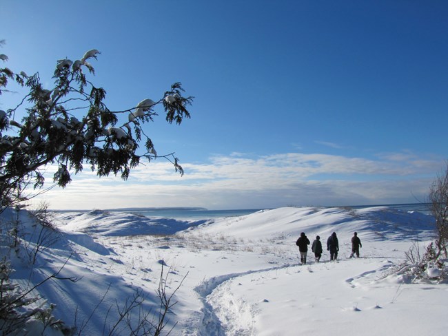
If you're bringing snowshoes to Leelanau County, Alligator Hill is the crown jewel. Climbing the forested glacial ridge between Big Glen Lake and Sleeping Bear Bay, the 3.1-mile Easy/Intermediate loop opens up to sweeping winter views of North and South Manitou Islands floating in steel-blue Lake Michigan.
Loops & distances: Alligator Hill Easy/Intermediate Loop (3.1 mi) · Old Indian Trail Loop (2.5 mi)
The high moraine catches deep Lake Michigan snow squalls even when lower towns along US-31 are thin, and park rangers also lead popular Saturday snowshoe hikes from the Philip A. Hart Visitor Center in Empire during January and February.
How I do itPark at the Alligator Hill trailhead at Stocking Drive and Forest Haven Road in Glen Arbor, climb to the Manitou Passage overlook, and warm up afterward in Glen Arbor or Empire.
Heads-up on the trail: Never step over the brink of Sleeping Bear's steep coastal sand bluffs in winter—snow conceals overhanging cornices and 400-foot ice chutes dropping straight to Lake Michigan.

Grayling · Hartwick Pines State Park · Easy · 1.25 & 2.0 Miles
Plowed visitor center lot off M-93 · Easy I-75 access
Anytime I'm driving north up I-75 past Grayling in winter, Hartwick Pines is my favorite hour-long leg stretcher. Walking beneath 160-foot old-growth eastern white pines when their boughs are loaded with fresh snow and the forest floor is completely hushed feels like stepping back into 1840s Michigan.
Loops & distances: Old Growth Forest Foot Trail (1.25 mi loop) · Mertz Grade Pathway (2.0 mi loop) · Au Sable River Foot Trail (3.0 mi · Out-and-back only due to closed bridge)
The main visitor center parking lot sits just off paved M-93 a couple of minutes from I-75 Exit 259, making it one of the easiest winter trailheads to reach in the northern Lower Peninsula.
How I walk itBecause the 1.25-mile Old Growth loop sees steady foot traffic all winter, it packs down into a firm snow trough—slip microspikes over your winter boots for the Old Growth loop, or strap on snowshoes/skis for the 2.0-mile Mertz Grade loop.
Heads-up on the trail: Don't count on completing the 3.0-mile Au Sable River Foot Trail as a full circle right now—the DNR has the river footbridge closed indefinitely, so you'll need to turn around at the water and retrace your steps.

Black River / Alpena · Negwegon State Park · Demanding · 3.1 to 3.7 Miles
3.5-mile unpaved Sand Hill Rd approach · High-clearance only in snow
If you want raw, undeveloped Lake Huron wilderness in winter—and you have the vehicle and self-reliance to reach it—Negwegon State Park between Harrisville and Alpena is unforgettable. Over 10 miles of trails wind through coastal jack pine, cedar bogs, and ancient sandy beach ridges overlooking an empty Lake Huron bay.
Loops & distances: Potawatomi Trail (3.6 mi loop) · Algonquin Trail (3.7 mi loop) · Chippewa Trail (3.1 mi loop)
Because there are no campgrounds, paved roads, or modern buildings inside Negwegon, you will almost certainly have the entire Lake Huron shoreline to yourself in January.
How experienced visitors approach itReaching the trailhead requires driving roughly 3.5 miles down unpaved Sand Hill Road off US-23 and Black River Road. Only attempt the drive in winter with true AWD/4WD clearance, recovery gear, and downloaded offline maps.
Heads-up on the trail: Never take a low-clearance passenger sedan down Sand Hill Road after a winter storm—if the two-track is drifted in, pivot fifteen minutes south on paved US-23 to Harrisville State Park's Cedar Run loops instead.

Mears · Silver Lake State Park · Moderate · Dec 15–Mar 15 Fat-Bike Season
Open to fat bikes Dec 15–Mar 15 · 3.5"+ tire width required
All summer long, Silver Lake's 450-acre open dune sea roars with four-wheel-drive trucks and dune buggies. But from December 15 through March 15, the engines are gone and the Michigan DNR opens the entire wind-sculpted expanse between Silver Lake and Lake Michigan to fat-tire bicycles.
Winter dune window: Silver Lake Open Dune Fat-Bike Zone (Dec 15–Mar 15 · minimum 3.5-inch tire width required)
When sub-freezing temperatures freeze the damp sand and snow into a firm, rippling crust, you can ride boundless lines up and down the dunes with Lake Michigan surf crashing below you.
How I ride itStage out of the Silver Lake ORV parking lot with a Michigan Recreation Passport on your windshield, run tires at least 3.5 inches wide (4.0–4.8 inches is even better), and drop your tire pressure so you float across wind-blown snow drifts.
Heads-up on the dunes: The fat-bike season runs strictly from December 15 through March 15—stay inside the posted dune boundaries and never ride out onto the ice shelves along the Lake Michigan waterline.

North Muskegon · Muskegon State Park · Moderate · 8 Named Loops (0.3–3.1 Miles)
Plowed Scenic Drive trailheads + Lighted Winter Sports Complex
If you live in West Michigan, Muskegon State Park is the closest thing to a complete winter mountain town. On one side of the park, you have the Muskegon Luge Adventure Sports Park with lighted, groomed cross-country ski and snowshoe loops; across Scenic Drive, eight natural state park loops climb through forested coastal dunes to the historic timber Blockhouse and quiet Lost Lake bog.
All 8 state park loops: South Loop (0.3 mi) · Scenic Loops (1.2 mi) · Dune Ridge (1.4 mi) · Nordic Loop (1.7 mi) · Devils Kitchen (2.2 mi) · Lost Lake (2.5 mi) · Hearty Hiker (2.5 mi) · Water Tower (3.1 mi)
Even in mild West Michigan winters, the wooded dune hollows hold snow well—and if natural snow is thin, the Luge complex next door has synthetic/iced tracks and lighted trails.
How I do itPark at the Blockhouse or Snug Harbor lot for a free state park winter hike or snowshoe through Lost Lake and Devils Kitchen, or buy a trail pass at the Luge Lodge for an evening ski under the lights.
Heads-up on the trail: Keep hiking boots off the groomed ski corduroy inside the Winter Sports Complex, and pack microspikes for the wooden stairs and dune pitches around the Blockhouse.

Bay City · Saginaw Bay · Easy & Flat · 0.9, 1.3 & 5.1 Miles
Plowed year-round off M-247 · Microspikes or touring skis
This is my home trail here in Bay City, and in winter it has a quiet beauty all its own. Winding around Tobico Marsh—one of the largest coastal wetlands on the Great Lakes—the dead-flat loops pass through oak-pine beach ridges and frozen cattail channels where bald eagles perch in the cottonwoods and snowy owls occasionally hunt the Saginaw Bay shoreline.
Loops & distances: Tobico Marsh Trail (5.1 mi full loop) · Lagoon Trail (1.3 mi loop) · Frank N. Andersen Nature Trail (0.9 mi loop)
Because the park sits just minutes north of Bay City on paved M-247 and has zero steep hills, it's an effortless winter walk, snowshoe, or classic touring ski.
How I walk it in winterBecause Saginaw Bay gets winter thaws followed by hard freezes, the paved and packed sections of the 5.1-mile marsh loop often glaze over—I always throw a pair of microspikes in my coat pockets alongside my binoculars.
Heads-up on the trail: Climb the two marsh observation towers for sweeping winter views, but stay strictly on the land trails and boardwalks—never step out onto the marsh lagoon ice or the pressure cracks along Saginaw Bay.
How Michigan Winter Trails Work
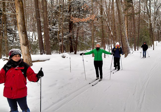
Whether you're strapping on snowshoes, clipping into classic skis, airing down a fat bike, or pulling microspikes over your winter boots, a little local trail craft makes everyone's day better.
FIELD LESSON 01 · DEDICATED SNOWSHOE SINGLETRACK
When you want to wander through deep hemlock and pine woods without worrying about ski etiquette, pick a dedicated snowshoe trail—like the 2.65-mile Munising Snowshoe Trail at Pictured Rocks, the Green (1.6 mi) and Blue (2.4 mi) loops at Lower Tahquamenon Falls, or the color-coded snowshoe loops at Traverse City's Vasa Trailhead.
Field tip: Even at parks with dedicated snowshoe trails, watch the signs at junctions—at Upper Tahquamenon Falls, the 1.0-mile Marked Snowshoe Trail welcomes snowshoes, while the neighboring 1.0-mile Lantern Loop is strictly reserved for cross-country skis.
More Loops for Your Notebook · Completing All 50 Named Routes
Alongside the 15 main trail hubs above, these five state parks and forest pathways round out all 50 named loops in my winter notebook—followed by seven specific trails where unplowed roads, closed bridges, or ski-only rules regularly catch winter visitors off guard.
Loop 1 (1.5 mi) and the Cutoff Loop (0.5 mi) wind through quiet northern hardwoods and conifers off M-75 and Chandler Hill Road near Boyne Mountain—a peaceful backcountry snowshoe or classic ski away from the resort lifts.
DNR Spring Brook Pathway ↗Right off plowed US-23 south of Harrisville, featuring the 2.0-mile Heritage Trail plus four sheltered Cedar Run Loops (0.5, 0.8, 1.3, and 1.6 mi) through fragrant white cedar and pine woods.
DNR Harrisville State Park ↗Gold (0.9 mi), Yellow/Brown (2.0 mi), and Red (4.1 mi) loops along Saginaw Bay's wooded dunes. Local tip: the main campground entrance and the day-use trailhead sit roughly two miles apart along M-25.
DNR Port Crescent State Park ↗Features the 0.5-mile Paved Accessible Loop and 1.6-mile Sand Trails behind the Lake Michigan dunes. Winter note: Grand Mere is open to hunting in season (wear blaze orange), and stay off icy coastal dune faces.
DNR Grand Mere State Park ↗The Blazing Star Prairie (1.5 mi) and Oak Savanna (1.5 mi) loops offer flat winter walking right across M-29 from the St. Clair River freighter channel—pack waterproof boots or ice cleats for mid-winter freeze-thaw cycles.
DNR Algonac State Park ↗Every winter, apps that scrape summer hiking databases send people to trailheads that are unplowed, closed, or groomed strictly for skiers. Keep these seven in mind before you drive:
Good Neighbor Rules on Winter Snow
Michigan's winter trails work because skiers, snowshoers, fat-bikers, and winter hikers look out for one another. Whenever you're on snowshoes or boots, step wide of parallel classic ski tracks so they don't freeze into ankle-twisting ruts; air your fat-bike tires down below 5 PSI so you float on the groomed ribbon; and never trust a seasonal dirt road in January just because your phone's GPS draws a line down it.
Michigan DNR Winter Recreation Guide ↗ · Sleeping Bear Dunes Winter Rules ↗ · Michigan DNR Park & Trail Closures ↗