Michigan’s Upper Peninsula / waterfall field guide
The Upper Peninsula, one waterfall at a time.
Follow the sound of rushing water into the Upper Peninsula's forests, sandstone canyons and rocky river valleys. Some falls are a short stroll from the road; others reward a long walk beneath the hemlocks. Use this guide to find the one that fits your day, and enjoy the journey in.
Before you head out: A few familiar stops need extra planning. Munising Falls remains closed, Agate Falls has a trestle restriction, and the road to Bond Falls is seasonal. Access notices were checked November 2, 2026; each waterfall guide links to the park or land manager for the latest conditions.
Explore the waterfall map
Explore 80 waterfall destinations and scenic stops across the U.P. Choose a pin, picture the place, then open its guide for the walk, parking, and what to expect along the way.
FIND YOUR WATERFALL / PLAN YOUR DAY
What kind of waterfall day sounds good?
A waterfall outing might mean ten minutes on a boardwalk, an hour exploring a gorge, or a quiet afternoon on a woodland trail. Pick a region and how much time you'd like at each stop. We'll show you places worth considering, along with the trail and road details that can shape your visit.
Your date helps highlight seasonal road and trail conditions.
A few places to start exploring
Looking for waterfall stops that fit your day…
Allow extra time for driving, weather, and the unexpected stop along the way.
While your choices load, explore the full map and waterfall guides below.
Choose a waterfall to see where it lies on the map, then open its guide for the trail approach.
Good things to know before you go
The time estimates describe the visit on foot, rather than the drive between stops. A pin marks the waterfall itself, while each guide explains the documented visitor approach. Check current park notices for road closures, trail changes and river conditions.
Western U.P. · Porcupine Mountains · Little Carp River
Seasonal road access · check DNR20–50 min
A short, quiet cascade a few hundred feet from the Little Carp River footbridge, an ideal introductory stop before the longer Greenstone Falls hike.
Plan your arrival: Pick Overlooked for the short stop from the Little Carp River parking area, then decide if you want to continue to Greenstone on the longer two-mile round-trip route.
Park: Signed Little Carp River Trailhead parking at the end of Little Carp River Road, entered from South Boundary Road. Use this lot, not the mapped waterfall coordinates.
Walk: From the signed Little Carp River Road trailhead, follow the Little Carp River Trail a few hundred feet to the first footbridge. Overlooked Falls is just downstream; check the bridge-side views without scrambling along the bank.
Access: Public Michigan DNR state-park walking route from the Little Carp River Road lot. No water-flow or current road-opening data is supplied here.
Western U.P. · Porcupine Mountains · Upper Carp River
Seasonal road access · check DNR120–300 min
A remote Upper Carp River cascade reached on a sustained Government Peak Trail walk through rugged Porcupine Mountains forest.
Plan your arrival: Choose Trap Falls for a half-day hiking destination rather than a quick scenic stop. Compare with Overlooked if your party needs a much shorter walk.
Park: Use the designated Government Peak Trailhead parking on M-107 inside Porcupine Mountains Wilderness State Park. Do not navigate to the waterfall coordinate or improvise riverbank parking.
Walk: Take the Government Peak Trail from its signed M-107 trailhead. Michigan DNR's visitor publication describes a 3.2-mile round-trip hike to Trap Falls; other guides publish longer approaches. Confirm the current route and mileage on the DNR trail map before leaving the trailhead.
Access: Public nonmotorized Government Peak Trail within Porcupine Mountains Wilderness State Park. This is a committed woodland hike, not a pullout or accessible waterfall platform.
Park: Use the signed Cascade Falls Trail parking area on Forest Road 468, reached from Forest Road 400 near Bergland. The waterfall map pin is not the vehicle destination.
Walk: Follow the established Cascade Falls main trail about 0.75 mile one way; the separate Bluff Trail is about one mile one way with rocky scrambling. The NCT spur to Cascade is NOT complete.
Access: Public Ottawa National Forest hiking trail. Current opening and road conditions are unverified; no live access determination.
Western U.P. · Burned Dam Campground · Ottawa National Forest
Short USFS campground trail20–45 min
A short river cascade with a genuine Forest Service quarter-mile round-trip footpath from a rustic campground.
Plan your arrival: Campground road maintenance is primarily May–September; late fall and winter drivable access are not guaranteed. Current opening and road conditions are unverified.
Park: From Watersmeet take US-45 north about one mile, Old US-2 east about seven miles, then FR 4500 north about one mile to Burned Dam Campground. Use designated campground visitor parking, not the waterfall coordinate or general Forest Service site GIS point.
Walk: Forest Service describes a short established trail from Burned Dam Campground to the Middle Branch Ontonagon River and Mex-i-min-e Falls, around a quarter mile ROUND TRIP, easy to intermediate.
Access: Forest Service visitor route, but no real-time road/seasonal clearance and NO driving to natural waterfall GIS coordinate.
A short wooded trail through cedars to two small Misery River ledges, best after spring melt.
Plan your arrival: Use the Poyhonen Road visitor-bureau parking approach, not a shortcut from golf grounds. Current opening and road conditions are unverified.
Park: From M-26 roughly 1.5 miles southwest of Twin Lakes State Park turn west onto Poyhonen Road; visitor map shows a parking area about 0.8 mile along it. Avoid golf course maintenance areas; raw state GIS point is not the lot.
Walk: Visitor bureau documents about 250 yards along an unimproved trail to small Misery River falls. The path is rustic with mossy roots and no verified accessible viewing deck.
Access: Published visitor route only; no real-time safe pull-off or road/gorge passability. The natural waterfall GPS point is NOT parking.
Secluded canyon falls near Chatham. The unpaved FR2276/2293 approach, separate NCTA spur and winter vehicle restriction matter more than the waterfall map pin.
Plan your arrival: Check open National Forest roads and find designated/permitted parking; do not assume a precise waterfall GPS is a drivable turnout.
Park: From Chatham drive north on Rock River Rd/H-01; turn onto FR2276 (Cole Creek/Sandstrom Road), then FR2293 (Falls Road) to permitted visitor parking described by U.P. tourism. NCTA's western NCT trailhead reference is NOT automatically the Rock River Falls car park. Roads may be impassable in winter; do not navigate to GIS falls point.
Walk: Follow the existing natural Rock River Falls trail on foot. NCTA documents a separate 1.2-mile side spur from its main trail, while direct trail estimates depend on the parking. No surveyed park-lot GPS, footpath polyline or universal hike length is asserted.
Access: Public Hiawatha National Forest wilderness route; current opening and road conditions are unverified. No pedestrian river crossing, maintained viewing deck or invented lot coordinate.
Slate-ledged cascades in a short riverside corridor connecting L’Anse's lower and middle falls.. Lower and Middle are separate drops, not separate driving destinations.
Plan your arrival: Use the official Main Street riverside lot, stay on public trail and keep off railway and power-plant grounds.
Park: Downstream Falls River Trail: from L’Anse Main Street, use the public small-park parking on the right beside Falls River as specified by Baraga County Trails. Walk on the marked east-bank trail upstream, beside the power plant. The upstream alternate is the right-side signed lot on US-41 just before its Falls River bridge. Neither parking entrance is the natural waterfall coordinate.
Walk: Follow the signed Falls River Trail beside the river. On the downstream approach the first named natural cascade is Lower Falls, followed upstream by Middle Falls visible from the high bank. Baraga County Trails describes 1.4 miles out-and-back for the complete trail, NOT the distance between individual waterfall views. Do not cross the railroad, utility structures, US-41 or the river for shortcuts.
Access: Official published riverside trail; current opening and road conditions are unverified.
Steep wilderness trail; winter road unplowed120–180 min
Powerful Sturgeon River drop through a narrow volcanic-rock chute in a remote forested gorge.
Plan your arrival: Use the NCTA-mapped wilderness trailhead. The state GIS #45 point is 6.74 km away and not an acceptable parking or hiking destination.
Park: Use the signed Sturgeon River Gorge Wilderness trailhead on the mapped Forest Road 2270 access corridor. The NCTA's 2025 trail map distinguishes this wilderness trailhead parking from the FR2200 North Country Trail lot. An older NCTA GPS list uses the road name FR2276 for the wilderness falls parking; follow current Forest Service road signs and maps, not either historic numbering alone. No certified live drivable route or vehicle navigation to the waterfall point.
Walk: From the established wilderness parking, follow the Sturgeon Falls footpath downhill through steep switchbacks into the gorge. Visit Keweenaw estimates approximately one mile each way to the river waterfall; allow 2–3 hours for the trip. The NCTA 2025 map's white-blazed half-mile spur connects the parking with the North Country Trail, and must NOT be mistaken for the falls walk.
Access: Wilderness visitor route; current opening and road conditions are unverified. Research GIS pin is not the public waterfall.
Park: DO NOT VISIT the Twin Waterfalls Memorial Plant Preserve. The Michigan Nature Association currently prohibits all visitors, and its homepage announces closure through 2028. Former Nestor, Cleveland or Washington Street directions and older trail maps are superseded by the landowner's closure. No parking or path to either fall is recommended.
Walk: There is no permitted visitor trail to Memorial Falls or Tannery / Rudy M. Olson Falls while the preserve is closed. Do not bypass barricades, enter from neighboring property, walk along the creek, or treat GIS natural coordinates as a public route. Consider Wagner Falls or Mosquito Falls subject to their own current access restrictions.
Access: Landowner-confirmed total closure; do not route to a GIS feature.
Western U.P. · Hammell Creek · Calumet Township · M-26
Phase 1 only; no final overlook30–75 min
A towering Hammell Creek waterfall framed by volcanic rock; the public site is still being constructed.
Plan your arrival: If you visit, choose the completed parking-to-bridge portion and assess whether continuing onto the undeveloped path is permitted and safe. This is not yet a completed ADA waterfall overlook.
Park: DNR Phase 1 built a dedicated parking area and access drive off M-26, 1.5 miles north of Lake Linden. Use the entrance signed for Houghton-Douglass Falls; the DNR site reference point 47.206425,-88.431575 is an area direction, not a surveyed parking space. Do not use the waterfall's natural GIS marker or historical lower private-land access.
Walk: From the DNR's completed M-26 site entrance, use the Phase 1 accessible path to the pedestrian bridge over Hammell Creek. BEYOND THE BRIDGE the trail remains rugged and undeveloped, with no completed accessible fall overlook, safety barriers or observation platform. Do not treat a local visitor bureau's approximate 0.5-mile round trip as an ADA-certified trail.
Access: DNR says the property is still under development and will officially open/dedicate once all phases are complete; Visit Keweenaw currently describes visitation after Phase 1. DNR cautions that beyond the bridge the trail is rugged with no barriers. Phase 2 overlooks and completed accessible route are scheduled for construction in 2027. Verify posted site-specific restrictions before attempting the undeveloped path. Current opening and road conditions are unverified.
Western U.P. · Falls River · L’Anse · Baraga County
Small public park; conditions unverified15–45 min
A short, broad Falls River cascade beside a historic concrete powerhouse, with a small riverside park and upstream trail.
Plan your arrival: Choose this for a short, less strenuous Falls River stop separate from the downtown Middle and Lower Falls Trail. Stay on the park side and do not use the abandoned industrial building.
Park: Travel from US-41 south of L'Anse onto Power Dam Road. The Baraga County tourism listing and independent field guide describe the signed Power House Falls spur off Power Dam Road leading to a small park with parking and pavilion. This is NOT the downtown Falls River Trail parking and not the GIS natural falls waypoint. Present maintenance, road clearance and park opening have not been verified live.
Walk: From the small park at Power House Falls, view the cascade from established riverside ground. The Village of L'Anse describes a roughly half-mile upstream riverside trail; this is the general path length, not a signed promise of access to every other drop. Do not enter the old powerhouse, climb its walls, use industrial structures, or scramble down the falls.
Access: The Village of L'Anse describes a small park beside Power House Falls, and Baraga County visitor bureau separately lists it as a waterfall destination. Independent field directions identify the signed Power Dam Road park spur. No verified current closure notice was found; do not assert open now or winter plowing. Current opening and road conditions are unverified.
Low, wide steps of amber Sturgeon River water sliding across layered slate, framed by cedar and white pine; the falls unfold in a long series of rapids rather than one towering plunge.
Plan your walk: A quiet northwoods hiking stop when the Baraga Plains Road NCT parking is available and foot trails are passable. Take the signed route, not the vehicle two-track; do not expect a roadside viewing platform or one giant drop.
Parking: From M-28 near Watton take Baraga Plains Road north, cross the Sturgeon River on the road bridge, and continue to the named Tibbets Falls / North Country Trail parking area on the west side of Plains Road. The Peter Wolfe Chapter's current segment 46 guide confirms this parking area and warns not to block the westbound sandy two-track. The parking is a trailhead, NOT the waterfall GIS coordinate. Use NCTA's current Avenza map #27 and road signs; no live winter clearing, exact driving turnoff coordinates or vehicle access down the sandy two-track is guaranteed.
Walking: Follow the marked foot connector from the Tibbets Falls trailhead to the blue-blazed North Country Trail, then use the official Peter Wolfe Chapter/Avenza #27 map to follow the Sturgeon River section where Tibbets Falls appears along Segment 44. The waterfall is a series of slate-ledged rapids visible from the trail as it climbs the bluff. Several NCT segments and a separate white-blazed fishermen's spur meet near Plains Road; confirm the correct trail on the current chapter map. Do not drive the unmaintained sandy two-track, attempt an unsignposted river crossing, or walk out onto slick slate slabs for a closer photograph.
Current conditions: Winter plowing and road opening are not verified. Do not follow the sand two-track or cross the river.
A short riverside cascade beneath a massive hydropower penstock, with a public Noquemanon walking approach. Not the rugged, access-unresolved Dead River Falls farther upstream.
Plan your arrival: Park in a designated Wright Street dirt lot and use the marked river path; the waterfall map pin is not parking.
A creek gorge reached by the NTN South trailhead, designated highway crossing and motor-vehicle-restricted Mount Marquette Road. Never park on the opposite M-553 shoulder.
Plan your arrival: Use NTN South Trails parking then walk to the designated crossing, not an improvised shoulder shortcut.
Park: Use the Noquemanon Trail Network South Trailhead on M-553 before Rippling River Resort; DO NOT park on the opposite high-speed highway dirt shoulder. Follow the official marked trail to the designated pedestrian crossing and then Mount Marquette Road, which is closed to motor vehicles.
Walk: From NTN South parking follow the marked connection south to designated M-553 crossing, then Mount Marquette Road on foot about 1.2 miles and a short side trail toward Morgan Creek Falls. Allow roughly 2.8 miles round trip including the connected trailhead approach; do not drive the closed road.
Access: Public NTN South trail network; current opening and road conditions are unverified. GIS natural falls coordinates are not parking or a crossing.
Central U.P. · Carp River · NTN South Trails · Marquette
Documented NTN overlook · not live verifiedManaged segment: 0.64 mi · full hike longer
See the gorge from a managed trail viewpoint built into NTN's 2024 Carp River Falls Trail connection. A safer visitor decision than chasing the old, slippery waterfall-base scramble.
Plan the correct visit: Public NTN South parking serves this area. Open the mapped 0.64-mile trail segment in our river atlas, but do not mistake it for the complete parking-to-falls route or drive to the GIS marker.
Park: NTN South Trailhead on CR 553. Walk to designated M-553 crossing; do not park on highway shoulder or drive Mount Marquette Road.
Walk: The NTN maps its trail network in Trailforks, which confirms the specific 0.64-mile Carp River Falls Trail segment. NTN's 2024 account describes the waterfall viewpoint. Travel Marquette also documents an older walking approach via Morgan Falls. The entire parking-to-viewpoint GPS line is not verified here. Follow posted signs.
Safety: The former gorge-bottom climb is steep and dangerous; no live snow, trail or water status is asserted.
Western U.P. · Copper Harbor · Manganese Creek gorge
Deep gorge · stay on upper path20–45 min
A narrow waterfall drops into deep mossy gorge near Copper Harbor. Short walk does not mean low risk.
Plan your arrival: Follow Manganese Road and posted upper viewpoint signs; avoid riverbank scrambles. Current opening and road conditions are unverified.
Park: From Copper Harbor visitor area follow Manganese Road south approximately 0.7 mile and use a safe legal roadside stopping place near the signed upper trail. No exact certified parking coordinates; do not navigate to state GIS #145.
Walk: Short tourism-published upper gorge path to a viewing area, around 100 feet from roadway to falls vicinity. Very steep walls; no endorsed lower gorge or creek descent.
Access: Published visitor route only; no real-time safe pull-off or road/gorge passability. The natural waterfall GPS point is NOT parking.
Park: Follow M-26 about three miles northeast of Eagle River. Stop only in an actual legal safe pull-off with room outside the highway; the nearby Jampot business is not public waterfall parking. Do not drive to the natural waterfall GIS point.
Walk: Lower falls viewed from highway vicinity. No public maintained upstream gorge trail is established. Avoid scrambling creek bed or crossing road unsafely.
Access: Published visitor route only; no real-time safe pull-off or road/gorge passability. The natural waterfall GPS point is NOT parking.
Western U.P. · Jumbo River · Ottawa National Forest
Backcountry unmarked routeAllow extra time
Three small Jumbo River cascades reached by an unmarked angler path; requires careful backcountry decisions.
Plan your arrival: Forest Service states FR 3610 from Kenton; side-road labels conflict in regional guides. Never drive to falls GIS point. Current opening and road conditions are unverified.
Park: Follow Forest Service Highway 16 south from Kenton, turn onto FR 3610 and look for the unmarked footpath about 1/4 mile down the road. No verified developed parking lot or precise vehicle waypoint; use only legal turnouts. Other regional FR 3645/USFS 168 labels conflict and must not be assumed equivalent.
Walk: Follow the Forest Service-described informal path west to Jumbo River, then carefully upstream to falls. The angler-worn route is not signed, surveyed or maintained as a visitor loop; exact distance and bridge status unknown.
Access: Forest Service visitor route, but no real-time road/seasonal clearance and NO driving to natural waterfall GIS coordinate.
Western U.P. · Carp Lake Township Greenwoods Park · Big Iron River
Seasonal township park · check entrance20–45 min
A short upper-falls park visit with broad stepped river cascades. The GIS point for the natural falls lies outside the township's mapped park parcel and is NOT a driving destination.
Plan your arrival: Follow the township's own park listing, signed M-64 entrance and designated lot, then the established upper-falls path. Do not walk downstream onto unverified riverfront land.
Park: Use the signed Greenwoods/Bonanza Falls township park entrance off M-64 south of Silver City and its designated gravel lot. The township map destination is an area reference, not an exact parking coordinate. Do not drive to the GIS waterfall point.
Walk: From the signed township parking area, take the short established footpath straight to the upper river view, then return by the same path. Do not extend into unsurveyed downstream riverfront land.
Access: Township-listed Greenwoods visitor park and signed upper-falls approach only; current opening and road conditions are unverified.
Eastern U.P. · Quiver Falls Unit · Wisconsin shore
Designated overlook · check access20–45 min
Broad Menominee River cascades and logging-era dam remnants, seen from an officially designated overlook.
Plan your arrival: Use Pemene Dam Road and the signed Quiver Falls parking area, never the falls GIS pin. Wisconsin DNR says access roads are unplowed in winter.
Park: From US-141 north of Pembine follow County Road R east roughly 7.2 miles, turn onto Pemene Dam Road and follow county directions and signs for Quiver Falls lot. GIS waterfall coordinate is NOT a vehicle destination.
Walk: Dedicated footpath from Quiver Falls parking area to a designated viewing area. Wisconsin DNR describes accessible parking and viewing, but does not supply exact trail distance or full-route grade.
Access: Public Wisconsin DNR designated trail or overlook; current opening and road conditions are unverified. The waterfall GIS coordinate is not parking.
Misicot is the Third Pier drop in Piers Gorge, seen from Michigan's public overlook trail above powerful rapids.
Plan your arrival: Park at the signed Michigan Piers Gorge trail area reached via Highway 8 and Piers Gorge Road. The Wisconsin Sand Portage lot is separate. The river GIS falls point is not a parking or walking waypoint. Current opening and road conditions are unverified.
Park: Park at the signed Michigan Piers Gorge trail area reached via Highway 8 and Piers Gorge Road. The Wisconsin Sand Portage lot is separate. The river GIS falls point is not a parking or walking waypoint.
Walk: Follow the Michigan Piers Gorge Scenic Hiking Trail, officially described as 1.5 miles overall, to the established overlooks for Piers 1–3. Misicot is Third Pier; no verified distance from parking to this exact view is claimed.
Access: Public Michigan DNR-designated Piers 1–3 trail and overlooks only; paddlers' whitewater scouting routes are not visitor paths. The GIS waterfall location is NOT the parking lot.
Eastern U.P. · Pemene Falls Unit · Wisconsin shore
Primitive overlook · check road60–120 min
A forest path to a powerful granite constriction and historic dam remains. Official viewing is a primitive rim overlook, not a developed platform.
Plan your arrival: Park at the end of Verheyen Lane off Wisconsin County Road Z at the Pemene Falls Hiking Trail lot, NOT Pemene Landing off Horseshoe Road. DNR area navigation reference is not an exact lot point. Current opening and road conditions are unverified.
Park: Park at the end of Verheyen Lane off Wisconsin County Road Z at the Pemene Falls Hiking Trail lot, NOT Pemene Landing off Horseshoe Road. DNR area navigation reference is not an exact lot point.
Walk: Follow DNR's 0.5-mile public hiking trail to the primitive gorge-edge Pemene Falls overlook. The short loop is 0.8 mile and the long loop is 1.9 miles; neither is required to visit the overlook.
Access: Public Wisconsin DNR designated Pemene overlook trail; no unverified riverbank continuation or boat launch shortcut. The GIS waterfall location is NOT the parking lot.
A wooded Wisconsin-bank walk to the roaring Piers Gorge rapids. The opposite Michigan viewpoints require a separate driving approach.
Plan your arrival: Start from Wisconsin-side US-141 rather than a road or map pin on the Michigan bank. Wisconsin DNR says access roads are unplowed in winter.
Park: Use designated Wisconsin trail parking off US-141 just east of Knutson Road, separate from the Michigan Piers Gorge Road trailhead. Look for posted signs; waterfall map pin is NOT parking.
Walk: 0.5-mile designated Sand Portage Falls Hiking Trail to a view of Piers Gorge. DNR warns there is no constructed falls viewing deck and the optional rocky descent is rough.
Access: Public Wisconsin DNR designated trail or overlook; current opening and road conditions are unverified. The waterfall GIS coordinate is not parking.
Owner-described public walk · check resort rules45–90 min
A dramatic three-stage Black River cascade across dark rock, on Snowriver resort property. The owner describes a 0.3-mile walk from the Black River bridge; Bessemer names the trailhead near the Blackjack parking area.
Before you go: Confirm waterfall-visitor parking and current signed foot access. The upper service road and river pool are not safe or permitted shortcuts.
Owner: Snowriver explicitly invites visitors to Gabbro Falls on Black River Basin property.
Parking: City identifies the bridge trailhead near Blackjack parking; resort map shows visitor facilities. Free non-guest access, a specific lot space and winter opening are not certified.
Walking: Snowriver's published bridge hike is approximately 0.3 mile. Follow current pedestrian signs and avoid service roads, ski slopes and unfenced cliffs.
Source-backed visitor trail is NOT a live-open verdict and the natural waterfall marker is NOT a parking destination.
Park: Use Wisconsin-side Saxon Falls Road (unpaved) and the signed overlook parking area at 46.535797, -90.380255. From US-2, use WI-122 to County Highway B, then Saxon Falls Road. Do not drive toward the Michigan GIS waterfall point.
Walk: Follow the short wooded trail east of the Wisconsin-side parking area to Xcel Energy's provided overlook. Travel Wisconsin estimates 0.25–0.5 mile of gravel/dirt walking; the route is not described as wheelchair accessible.
Utility project; use Wisconsin-side trail and marked overlook only. Current opening is unverified.
Park: Park only at the marked Little Carp River Trailhead at the end of Little Carp River Road, reached from South Boundary Road in Porcupine Mountains Wilderness State Park. The falls coordinate is not the lot.
Walk: From the signed Little Carp River Road trailhead, cross the first bridge at Overlooked Falls and continue along the Little Carp River Trail toward Greenstone. Plan roughly a 2-mile out-and-back excursion; use the park trail map for current alignment and do not expect a paved path.
Do not route a car to the waterfall GIS coordinate. Check current state-park road and trail conditions.
Park: Use the Nonesuch Mine Trail parking area off South Boundary Road, identified by the Michigan DNR as N46°45.583′ W89°37.194′ (WGS84). The trailhead parking is north of the waterfall and distinct from its GIS point.
Walk: Follow the Nonesuch Mine historic walking trail past the old mine ruins toward the Little Iron River. Distances vary by route and viewpoint: allow a short woodland hike rather than assuming the falls are beside the parking area.
Do not route a car to the waterfall GIS coordinate. Check current state-park road and trail conditions.
Park: Use the signed Union Mine Interpretive Trail parking/trailhead on the west side of South Boundary Road, south of the Wilderness Visitor Center. Do not mistake the nearby outpost campground for the official trailhead.
Walk: Walk the signed 1-mile Union Mine Interpretive Trail loop. Interpretive signs cover the 1846 copper mine; the trail passes the Little Union River gorge and several cascades. Keep to the established path instead of walking in the creek.
Do not route a car to the waterfall GIS coordinate. Check current state-park road and trail conditions.
Pictured Rocks / Munising · 602 Bell Avenue, Munising
Seasonal · admission required25–60 min
A short 400-foot walk to a spring-fed waterfall in private garden grounds. Published season early May through mid-October; admission required. Do not assume it is open now.
Park: In Wisconsin, head north from Hurley on Highway 51, turn west onto US-2, continue approximately 0.6 mile, then turn onto Center Drive and drive about 0.2 mile to the signed Interstate Falls trailhead. Do not use the waterfall coordinate as parking.
Walk: The landowner's published route is a 0.7-mile out-and-back woodland walk to the Montreal River lookout. It is a natural-surface trail, not a barrier-free platform or a drive-up waterfall.
Arrival is on the Wisconsin bank; no Michigan-side trailhead verified.
Park: From US-2 in Wisconsin take Highway 122 north approximately 4.2 miles, cross the state line into Michigan, continue roughly 0.5 mile and turn left onto the signed gravel access road for the utility-side parking area. The mapped waterfall is not the parking entrance.
Walk: Signed upper and lower waterfall viewing paths from the utility-side public parking area. The lower gorge path is steep, rocky or uneven and may be dangerous when wet or icy; a shorter upper overlook is the safer alternative for some visitors. Wisconsin tourism describes 0.5–1 mile of visitor walking, depending on route.
Lower gorge route is steep and can be hazardous wet or icy; use signed overlooks only.
Park: Approach County Road 527 from US-2 between Watersmeet and Marenisco. The federal recreation listing identifies the Bessemer Ranger District, and U.P. Travel specifies the signed parking area before the bridge. Use the small designated lot, not the road shoulder.
Walk: From the small signed falls parking area beside County Road 527, follow the short riverside footpath along the Cisco Branch Ontonagon River. The U.S. Forest Service calls the trail short and not difficult; exact accessible grade or distance is not certified.
Rural forest access is not a live road-opening notice.
A series of forested river drops and rock ledges reached by a maintained public trail from the County Road 510 bridge, not the remote Pinnacle Falls entrance.
Park: Yellow Dog River Community Forest's primary public parking and trailhead immediately south of the Yellow Dog River bridge on County Road 510. From CR-550 follow CR-510, turn left after about 2.6 miles to stay on dirt CR-510 at the AAA junction, continue about 3.9 miles and cross the river; landowner directs visitors to the lot on the left.
Walk: Follow the established forest trail from the County Road 510 bridge parking area on the south side of the Yellow Dog River, downstream toward the falls. Landowner estimates about 0.75 mile to the first falls; a published geological field guide describes roughly 0.5 mile to Yellow Dog Falls. Treat mileage as approximate and return on the signed route.
Check current road, trail and parking conditions before departure.
Park: Small signed Pinnacle Falls Preserve parking area at the end of the remote access two-track from County Road AAA, reached via CR-550 and CR-510 from Marquette/Big Bay. The preserve owner publishes turn-by-turn guidance; do not drive to the waterfall coordinate. Road surface, winter clearance and two-track passability must be checked before driving.
Walk: Approximately one mile each way from the preserve parking area, on a steep, rugged foot trail descending into the Yellow Dog River gorge; use the posted trail and its mid-route interpretive sign. Expect a strenuous climb back to the car.
Check current road, trail and parking conditions before departure.
Park: Haven Falls Park on Gay–Lac La Belle Road, near Lac La Belle. From US-41 take Lac La Belle Road about 4.5 miles to the fork, then right about 0.5 mile to the park on the right.
Walk: From the designated Haven Falls Park parking area, walk a short distance through the roadside picnic grounds toward the waterfall behind the park. The falls are visible from the parking area; no backcountry trail is necessary.
Check current road, trail and parking conditions before departure.
An intimate Jumbo River cascade reached through hemlocks along a short Forest Service path, with a more compelling story than its size: official trail mapping finally distinguishes the waterfall from two misplaced catalog markers.
Plan your walk: Worth a look as a quiet, short federal forest hike when FR4589-B is within its designated vehicle season, the arrival area is physically usable, and the tread and bridges are safe. Not an accessible path, not a guaranteed winter stop, and not a spectacular high-drop waterfall.
Arrive: From M-28 near Kenton use USFS-published Golden Glow Road / Jumbo Pit–FR4589-B approach. Regional trail information identifies a parking area at Jumbo Falls Trail; USFS brochure identifies the footpath at the end of the road. Federal MVUM permits passenger cars on FR4589-B from May 16 to March 14 only, but current access/gates and exact parking space coordinates are not confirmed. Never navigate to the waterfall or recreation centroid. Park only in a visibly lawful, available off-road visitor space; do not use road shoulder or gravel pit unless specifically posted for visitor parking.
Walk: Use the official U.S. Forest Service 0.079-mile Trail 60056. It is short and pedestrian-managed year-round but NOT ACCESSIBLE. Avoid any invented connector from the generic recreation marker or raw state GIS point.
Source confidence: USDA Trail 60056 is mapped and leads to the independently located falls. FR4589-B designated motor vehicle window runs May16–Mar14. Live gate, bridges, plowing and parking-space location are not certified. USFS mapped trail · USFS motor-use rules · Source-tested field guide
Keweenaw Peninsula · Hancock · 40-acre public nature area
2025 public trail · small creek cascades35–80 min
A new 0.8-mile Keweenaw Land Trust loop crosses shale-lined Boston Creek, where several small unnamed cascades spill through the forest. Not a tall or surveyed named waterfall.
Plan your walk: Owner-published public entrance and three-car lot. Use the signed loop, not the OpenStreetMap preserve-centre point. Expect stairs and steep tread, no current water or snow report.
Arrive: Use the KLT-signposted nature-area lot off Boston Cross Cut Road, reached via Pontiac Road from Hancock. About three spaces only, no invented GPS or overflow.
Walk: KLT's signed 0.8-mile creek loop includes switchbacks, stairs, bridge and boardwalk, with little unnamed cascades along the stream. Follow existing footpath without assuming a separately geocoded falls.
Keweenaw Peninsula · Ahmeek · Keweenaw Natural Areas
Daylight visits · seasonal vehicle gate45–90 min (estimate)
A long red-rock Gratiot River cascade on KNA conservation land. Owner confirms public day visits, the entry-road easement and designated visitor parking. Check the cable and stay out of the steep riverbed.
Park: KNA's public parking at the end of 1600 Conglomerate Falls Lane, reached via South Farmer's Block/Tanskanen Road near Ahmeek. The first quarter-mile of the entry road is on a private-property easement. No cabin parking or driving during spring thaw. Check actual gate and road conditions.
Walk: From KNA's preserve parking follow the rustic path toward the north-bank river views where safe. Uneven bluffs and steep banks; no riverbed scrambling, safe water crossing or verified exact path geometry.
KNA prohibits entry-road driving during spring thaw. Daylight policy is published, not live opening. Do not navigate to the natural waterfall coordinate or park at the private cabin.
Park: Eagle River Bridge Park beside the township hall, 5055 M-26 in Eagle River. Use the small signed visitor parking area off M-26; do not park on the bridge shoulder.
Walk: Park at Eagle River Bridge Park just off M-26 and use the designated pedestrian bridge to view the waterfall; the walk from parking to bridge is only a short stroll, not a riverbank hike.
Check current road, trail and parking conditions before departure.
Park: A Keweenaw visitor brochure identifies a rustic parking area south of M-26 at the Silver River bridge, about 4.5 miles east of Eagle Harbor. Arrival and safe pedestrian crossing remain unverified.
Walk: The Keweenaw visitor brochure describes a rustic pull-off south of the M-26 Silver River bridge and a short path on the north side. That route would require an at-grade highway crossing, which has not been independently confirmed as a safe legal pedestrian approach.
Public arrival has not passed independent access review; do not use this as driving or crossing directions.
Park: Rapid River Falls County Park, 13149 S 15, Rapid River MI 49878. Follow signed park access from US-41 near the Rapid River crossing; park only in the designated visitor area.
Walk: From the signed day-use parking area, follow the county's developed viewing walkway. The county lists additional nature trails but does not publish a measured parking-to-waterfall walking distance.
Check current road, trail and parking conditions before departure.
Park: Miners Castle lot at the end of Miners Castle Road (H-11) for lower overlook; or west-end Miners Beach lot, reached via Miners Beach Road off H-11. These are visitor arrival areas, not the falls coordinates.
Walk: No maintained trail reaches Bridalveil Falls itself. For a distant view, walk from the Miners Castle parking lot to its lower overlook (stairs and a steep grade), or use the short west-end Miners Beach boardwalk for a shore view. A concession-operated boat tour gives the most complete cliffside view.
Check current road, trail and parking conditions before departure.
Park: Fumee Falls Roadside Park on the north side of US-2, approximately six miles east of Iron Mountain. Follow park signage and do not enter closed gates or park in the traffic lane.
Walk: Begin at the Fumee Falls Roadside Park parking area on the north side of US-2; a short stairway/boardwalk approach leads toward the upper creek tiers. Use only maintained visitor paths, not highway shoulders.
The often-overlooked sandstone plunge between the upper historic pond and the big lower gorge, on a documented public walking path. Do not confuse the natural waterfall coordinate with KLT's separate roadside parking reference.
Visit decision: Moderate, rustic walking and unprotected gorge edges. Spring water can be impressive, but today's trail, water and winter road conditions are unverified.
Park: Only at the KLT-documented Golf Course Road shoulder near its sign, if available and legal (47.173159,-88.444743). Winter driving access is not guaranteed.
Walk: Follow the old blocked vehicle track on foot and continue along KLT's red-dashed downstream gorge trail to Middle Falls. The official owner's map shows nearby private parcels, so stay on public paths. No wet-rock scramble or creek crossing.
KLT documents public trail access, not today's road/plowing, trail condition or creek flow. The falls pin is independently approximate, not parking GPS.
A community-protected, old-growth cedar/hemlock waterfall walk on Scott and Howe Creek. Follow the land manager's trail sign, not a waterfall-coordinate navigation shortcut.
Visit decision: Rustic footing and a small stream make this a forest experience first. Roadside parking GPS, trail polyline and today’s conditions are not verified.
Park: From Watersmeet take US-45 north to County Road 206 (Sucker Lake Road), west to County Line Lake Road, north past McGinty Lane approximately 0.6 mile, then look for the waterfall trail sign on the LEFT. Northwoods Alliance permits roadside parking; check legal shoulder, traffic and snow conditions. Do not use the County Line Lake parcel, Merganser Lane boat landing, or falls GPS as the waterfall trailhead.
Walk: Follow the owner-marked yellow footpath from the waterfall trail sign on the west side of County Line Lake Road, about 0.6 mile north of McGinty Lane. Northwoods Alliance describes a ¾-mile waterfall trail but does not specify whether this is one-way or total. Expect uneven terrain, exposed roots and rock outcrops; use the posted signs and published illustrated trail map.
The waterfall pin is approximate geography, NOT parking; no live roadway/plowing, lot occupancy or trail hazard report is available.
Two distinct Montreal River falls tiers near Lake Superior. Official tourism documents one rugged legal approach from Fish Cove; upper tiers are not mapped as public trails.
Important: Smith Fisheries Road is private. The map pin represents approximate Lower Montreal Falls geography, NOT your parking or a driving destination.
Park: From Copper Harbor follow US-41 to Mandan Road, continue approximately 7.5 miles to Hoar Lake/Fish Cove Road, then follow posted signs to the rustic Fish Cove parking area. Rough two-track roads may need high clearance. Never use the waterfall feature coordinate or private Smith Fisheries Road for driving.
Walk: From the Fish Cove rustic parking area, reach Lake Superior shoreline and follow the westbound foot-worn path to Lower Montreal Falls; Visit Keweenaw estimates about one mile along the coast. No signage, maintained trail, surveyed walking polyline or guaranteed upper-falls route.
No live road status, surveyed trail line, GPS lot position or confirmed upper-tier foot route.
Park: Use the KLT-published Golf Course Road shoulder parking, near 47.173159, -88.444743. In winter park only where legally plowed; KLT says most of Golf Course Road is unplowed.
Walk: From the KLT-signed Golf Course Road access, follow the rough former drive toward the gorge, take the downstream/left-side path, and use the marked public trail corridor. The entire gorge traverse is roughly two miles, with steep, eroded cliffside sections and no protective fences.
Check current road, trail and parking conditions before departure.
Park: Shoulder of Golf Course Road near the Hungarian Falls Nature Area sign, about 0.5 mi uphill from 6th Street in Tamarack City. KLT's parking reference: 47.173159, -88.444743. Never drive the old gated woods road.
Walk: From the Golf Course Road shoulder near the Hungarian Falls sign, follow the old gated access road on foot approximately 400 yards toward the pond and upper falls. This is a rustic route, not a paved accessible path.
Check current road, trail and parking conditions before departure.
Park: Presque Isle River Scenic Site designated state park parking near West/East River trail access; use the official Porcupine Mountains map for M-519 and South Boundary Road routes.
Walk: Signed Presque Isle River East/West River trails link waterfalls. DNR park map lists the West River Trail at 1 mile and East River Trail at 1.4 miles; neither is a certified walk distance specifically to Manido.
Check current road, trail and parking conditions before departure.
Park: Small eastern Miners Beach lot off Miners Beach Road via Miners Castle Road; larger western Miners Beach lot offers a longer sandy walk.
Walk: From the small east-end Miners Beach lot, take the designated staircase down to sand, then walk a few hundred yards right along the shore toward the cliff where the creek drops into Lake Superior.
Check current road, trail and parking conditions before departure.
Park: Chapel/Mosquito trailhead at the end of five-mile Chapel Road from H-58; heavily rutted road, limited signed parking; do not park outside permitted areas.
Walk: NPS lists a 2.0-mile round trip: walk 0.3 mile toward Mosquito Beach from Chapel/Mosquito trailhead, then take the signed 0.7-mile side trail to Mosquito Falls. Forest tread may be muddy and rough.
Check current road, trail and parking conditions before departure.
Park: Signed Rainbow Falls parking near the Black River Harbor end of County Road 513.
Walk: About ½ mile by the signed west-bank approach with many stairs. The suspension bridge / east-bank walk from Black River Harbor is a separate, longer route.
Some routes or platforms are restricted; consult current notices.
Park: Signed trailhead lot east of US-45 approximately 7.8 miles north of Bruce Crossing; typically plowed in winter, but never park on highway shoulder or assume guaranteed access.
Walk: North Country Trail Segment 22 extends 1.4 miles from the US-45 trailhead to the Baltimore River bridge, passing Konteka Falls and O Kun de Kun Falls; short gravel spur, intermittent boardwalk and steeper riverbank tread.
Check current road, trail and parking conditions before departure.
Park: 24019 Upper Falls Drive is the Upper Falls lot only. Lower Falls has separate day-use parking off M-123, four road miles downstream.
Walk: Upper: new 1,100-foot accessible brink boardwalk opened May 2026; Lower: separate accessible boardwalk and island bridge, with its own day-use parking.
Check current road, trail and parking conditions before departure.
Park: Canyon Falls MDOT Roadside Park off US-41 near Alberta; seasonal daylight parking, no overnight parking. Lot gate typically closes late October and reopens toward late April.
Walk: Roughly 500-foot rocky spur from roadside park to the North Country Trail, then follow the signed trail roughly another half mile to the stone barrier overlook. Includes footbridge, boardwalk sections, roots and uneven gorge terrain.
Check current road, trail and parking conditions before departure.
Pictured Rocks / Munising · Au Train · M-28 · MDOT Scott Falls Roadside Park
Park-side viewpoint only · seasonal5–20 min
A slender thread of water slipping over a sandstone ledge, visible across M-28 from a Lake Superior roadside park. A road-stop waterfall, not a creek hike.
Park, do not cross: Choose a short park-side viewpoint if the MDOT roadside park is open. Do not cross M-28 to the falls or use a shoulder pull-off as a substitute if the park is closed.
MDOT park: Use MDOT's Scott Falls Roadside Park / H.J. Rathfoot State Roadside Park on the Lake Superior (north) side of M-28 near Au Train, only when the park entrance is open and the designated parking area is available. Alger County's recreation plan identifies this park and its waterfall view across the highway. Do not stop in a travel lane, on the bridge, or an undesignated shoulder. The natural waterfall GIS coordinate is NOT the roadside park entrance.
Viewing: Remain on the roadside-park side of M-28 for the verified waterfall view across the highway. There is no established public pedestrian crossing in these sources, and the waterfall-side path, under-ledge grotto and sandstone rim are NOT a certified visitor trail. Do not cross busy M-28 or climb to the falls based on this guide.
Conditions: Seasonal park opening not currently verified. Do not cross the highway or substitute a roadside shoulder if the park is closed.
A shaded river gorge of dark stone, timber footbridges and wooded cascades, reached along a quiet public northwoods trail.
Plan your walk: Choose the roughly 2–2.2-mile round-trip western NCTA spur when the Harrison Road trailhead is accessible. The separate CR550 Elliott Donnelley trailhead yields a much longer, roughly 7.6–8-mile trip. Neither parking area is verified open today.
Parking: Use the named western Little Garlic Falls Spur trailhead on Harrison Road/Little Garlic Road. From County Road 550 north of Marquette, cross the Little Garlic River and take the first left. The NCTA 2023 Segment 19 guide describes parking on the left roughly two miles along Harrison Road. The chapter's old Google driving map was marked unverified; check its updated July 2026 maps, Avenza #41 and signs. This is a rough backroad, with no guaranteed plowing or current passability; the falls coordinate is not parking.
Walking: From the designated western trailhead, follow the North Country Trail Association Little Garlic Falls Spur northwest along the Little Garlic River. NCTA describes about one mile one way, 118 feet ascent, rocky tread and wooden footbridges over tributaries; use current Avenza Map #41. Do not cross the main river, follow fisherman fords or continue onto private Big Garlic banks.
Current conditions: Winter clearing, road and trail are unverified. No crossing of the Little Garlic River required on the NCTA spur, and this trail is not a Big Garlic access route.
NCT trailhead · current conditions unknown60–110 min
Deep forest encloses the Presque Isle River as dark water gathers speed over a broad rocky lip. A quiet North Country Trail walk leads to a waterfall away from the busy lower gorge.
Plan your walk: A shorter public NCT waterfall hike near the western edge of Porcupine Mountains Wilderness State Park. Use it when the CR519 trailhead is accessible and you want a 1.6-mile outing rather than the developed lower Presque Isle boardwalk loop.
Parking: From M-28 near Wakefield, follow County Road 519 north approximately 12 miles to the named North Country Trail trailhead parking by the road crossing. The NCTA Ni-Miikanaake 2025 segment guide confirms an actual trailhead and parking area there. Cross CR519 with traffic caution, follow blue blazes east into the state park, and rely on current NCTA map MI-008 rather than routing to the waterfall's geographic point. Winter parking clearing and present road/trail conditions are not confirmed.
Walking: From the County Road 519 NCT parking area, cross the highway carefully and follow the blue-blazed NCT east through old-growth forest. The Western U.P. visitor map describes approximately 0.6 mile along the NCT plus about 0.2 mile on the falls side approach, roughly 1.6 miles out-and-back. NCTA's 2025 MI-008 trail description confirms the maintained trail passes Lepisto Falls and notes a spring near mile MI-43.1. Remain on the established trail and avoid steep riverbanks; continue north past the falls only if prepared for the rope-assisted steep climb beyond the footbridge.
Current conditions: Winter plowing, trail closure and river ice not verified. Check NCTA and DNR.
Western U.P. · Little Carp River · Porcupine Mountains
Public DNR park trail · current conditions unknown180–300 min
An intimate waterfall on the Little Carp River, tucked deep in hemlock and hardwood forest beyond the better-known Overlooked and Greenstone stops.
Plan your walk: For hikers willing to make a longer half-day river walk, not a roadside waterfall. Choose Trappers after Overlooked and Greenstone when you have about six trail miles and reliable access to Little Carp River Road.
Parking: Use the designated Little Carp River Road trailhead off South Boundary Road inside Porcupine Mountains Wilderness State Park. DNR's park map and cabin visitor guide show official Little Carp River Road parking and the Little Carp River Trail; the regional waterfall brochure directs hikers from that trailhead via Overlooked and Greenstone Falls. Road opening and plowing, especially around the December 1 winter seasonal closure, are not confirmed for today.
Walking: Follow the marked Little Carp River Trail from the official Little Carp River Road trailhead. You pass Overlooked Falls at the first bridge, then Greenstone Falls, and continue into old-growth forest to Trappers Falls about three miles from the trailhead according to the Western U.P. park-waterfall brochure. Expect roughly six miles round-trip over roots, wet ground and uneven hills. Keep to official trail connections, do not force a river crossing, and do not use the natural falls GPS as a hiking line.
Current conditions: The park states portions of South Boundary Road close around December 1 until late spring. Little Carp River Road/trailhead and river conditions must be checked; no winter vehicle access or trail grooming promised.
Western U.P. · Little Carp River · Porcupine Mountains
Public DNR park trail · current conditions unknown210–360 min
An out-of-the-way Little Carp River drop beyond Trappers Falls, approached through long corridors of old-growth forest, fern and dark river stone.
Plan your walk: A natural extension for experienced hikers already committed to Trappers Falls, not an easy standalone waterfall stop. Allow more than six miles of walking for the full out-and-back trip.
Parking: Use Michigan DNR's official Little Carp River Road parking near the south end of the park's Little Carp River Trail, approached from South Boundary Road when open. The regional waterfall map establishes this as a continuation past Trappers, not a separate drivable waterfall turnout. Carry a current DNR park map and return by the same trail; don't use the GIS waterfall point as a destination for vehicles.
Walking: Begin at the designated Little Carp River Road trailhead, follow the marked Little Carp River Trail past Overlooked Falls and Greenstone Falls, continue to Trappers Falls (about three miles from parking in the Western U.P. waterfall brochure), then follow the same official trail a short distance farther to Explorers Falls. It is more than three miles one way; do not represent the remaining gap as a measured connector or turn an unmarked riverbank shortcut into a trail.
Current conditions: South Boundary Road may be seasonally closed and the backcountry trail is not a groomed winter path. No current parking/bridge/ford condition is confirmed.
Western U.P. · Big Carp River · Porcupine Mountains
Public DNR park trail · current conditions unknown360–720 min
A remote Big Carp River waterfall set beneath the Porcupine Mountains escarpment, where a long ribbon of river winds through a deep valley of old-growth hardwoods.
Plan your walk: A major wilderness objective, not a casual waterfall stop. Select the Pinkerton Creek option for an approximately 10.6-mile round trip or the Lake of the Clouds ridge route for roughly 16.4 miles round trip; the two starts offer different terrain and time demands.
Parking: Use the official Lake of the Clouds scenic parking/trailhead via M-107 for the approximately 8.2-mile one-way escarpment approach, OR the officially mapped Pinkerton Creek Trailhead parking on South Boundary Road for the shorter 5.3-mile one-way trail combination. They are distinct starting points; neither is the falls coordinate. DNR park map and latest road guidance govern vehicle access; South Boundary Road and M-107 have winter closures. A Recreation Passport is required for vehicle entry.
Walking: Two official park-trail options lead to Shining Cloud Falls. From Lake of the Clouds on M-107, follow the Big Carp River Trail west approximately 8.2 miles one way (DNR trail description: 5.3 miles to Correction Line junction plus 2.9 miles to Shining Cloud). A shorter but still strenuous approach starts at Pinkerton Trail parking on South Boundary Road: Pinkerton Trail about 2.6 miles to Lake Superior Trail, follow Lake Superior Trail east approximately 1.3 miles to Big Carp River mouth, then climb about 1.4 miles upstream on Big Carp River Trail to Shining Cloud. That totals roughly 5.3 miles one way by published trail-segment distances. Both demand an all-day backcountry commitment or an overnight plan; neither is a short roadside hike.
Current conditions: The DNR lists seasonal road closure on M-107 and South Boundary Road starting December 1 through late spring. Do not promise either vehicle trailhead accessible in winter or a route safe over ice. Unbridged streams, river levels and limited daylight matter.
A broad chain of modest, stair-step cascades beneath the bridge, where the Huron River gathers in small pools before sliding over bands of layered stone.
Plan your stop: A short low-effort Huron River stop when the state forest campground is accessible. Expect many small drops, not one towering waterfall. Use the campground and bridge as the arrival, with no claim that a longer riverbank route is open.
Arrival: Follow the Michigan DNR's Big Eric's Bridge State Forest Campground directions: from Skanee travel about 6.7 miles east by Skanee Road and Erick Road to the campground along the Huron River. The official campground position (46.86508482, -88.08476906) is separate from the natural waterfall, and its campground drive/parking must not be confused with the geographic waterfall pin. A local specialist describes an established parking area across the road from the campground; observe actual DNR signs, permitted parking spaces and any campground closure or restrictions. Do not block campsites or use a riverbank as a vehicle approach.
Waterfall walk: From the designated campground/bridge visitor area, observe the Huron River cascades immediately downstream of Big Eric's Bridge. A specialist field account documents a short footpath beginning on the campground side of the bridge and following the river downstream; stay within visibly permitted public campground access and on established dry ground. The farther riverside banks have not been parcel-surveyed, so do not assume unrestricted access along the whole river, cross private property, scramble onto layered ledges, or wade the river.
Current conditions: The DNR campground is seasonal in nature; official current page does not prove its gate, road or visitor parking open on October 31 or cleared in winter. Do not enter a closed campground or park on a narrow bridge/road shoulder.
A modest set of Tioga River cascades where a small MDOT roadside park, grassy river crossing and wooded creek path offer a quiet break from US-41.
Choose the right Tioga: Public park cascades, not the private-gated GIS Tioga Falls 2.2 km away. Natural pin is approximate within the park; no parking GPS or private river route.
Arrive: Arrive at the officially named Tioga Creek Roadside Park on the SOUTH side of US-41/M-28 in Baraga County, west of Three Lakes/Nestoria. Michigan DOT lists Tioga Creek Roadside Park in its 2026 public facilities update, while an independent roadside facility catalog locates the parking/picnic site near 46.57515,-88.33961. That is the PARK location, not the larger, gated Tioga Falls identified by Michigan GIS #46 over two kilometres away. Use the marked park entrance and actual visitor spaces, never roadside shoulder parking.
Walk: Within Tioga Creek Roadside Park, start from the established parking and open grass/picnic area by the river and small footbridge. An independent 2015 waterfall field guide records lower cascades visible near the park parking area and a short marked upstream creek trail a few hundred feet to another modest drop. A later independent visitor describes a paved park path becoming a rugged, possibly overgrown footpath with fallen trees. Enjoy the bridge and lower public park-side river views if the upstream side path is blocked; do not bushwhack beyond the park, wade the Tioga River, or seek the unrelated private-gated downstream falls.
Season: MDOT's 2026 bulletin named this as a seasonal park with delayed late-spring opening and warned roadside facilities often close in late October. No live Oct31 gate, restroom, trail or winter parking status is known. Never park on US-41/M-28 shoulder or block a park gate.
Dark tea-colored water gathers between rock walls, turns white at a narrow plunge, then flows over smaller cascades beneath tall cedars and hemlocks.
Plan your walk: Choose this short river hike when the County Road 523 bridge trailhead is safely accessible. A downhill start means a more demanding uphill return; it is not a paved overlook.
Arrive: From US-2 near Marenisco, take County Road 523 north about 3.25 miles to the bridge over the Presque Isle River. Federal recreation directions identify the Yondota trailhead on the north side of the bridge. Independent field reports describe a small west-side turnout beyond the crossing. Follow current signs and park only in a lawful off-road space; do not block the bridge or road. Neither the natural waterfall marker nor an informal shoulder is a parking destination. Road condition and winter clearing are not currently verified.
Walk: Follow the short river trail from the north-of-bridge trailhead downstream toward the falls. The U.S. Forest Service describes a trail descending beside a series of cascades, with a noticeably uphill return. Independent field visits estimate roughly a quarter mile one way to the main drop. The path is rustic, with uneven ground and wet rock nearby; stay on existing tread and do not wade or scramble along the gorge edge.
Season: No live October 31, 2026 road or trail opening confirmed. County Road 523 can become a rough forest road and the trailhead may not be plowed or usable in winter.
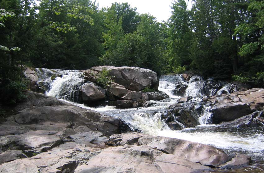
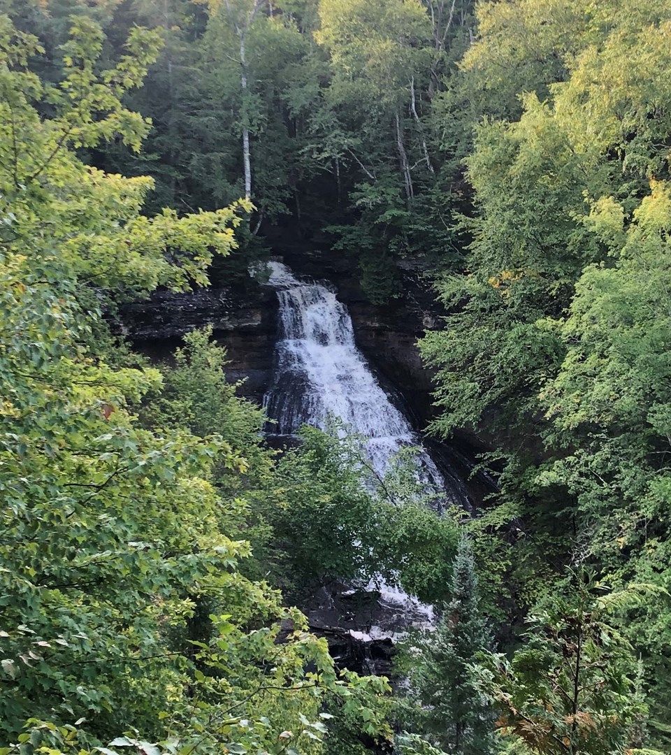
These photographs show the real falls. Open a guide for the full view, the trail in and the details for your visit.
MUNISING & PICTURED ROCKS / FROM FOREST TO SHORE
Three waterfalls, three sides of the north woods.
Start where Wagner Creek tumbles through a cool green hollow. Continue to Miners Falls, where water has carved a narrow passage through sandstone. For your third stop, follow the shore to Elliot Falls or head deeper into the woods for Chapel Falls.
Visiting in winter? Pictured Rocks doesn't plow its park spur roads. From December 1 through March 31, unplowed park roads are closed to ordinary motor vehicles, and snow can change access beyond those dates. NPS winter road policy · Current park alerts.
THE SHORTER WALKING DAY
Waterfall gorge + Lake Superior beach
Choose the shore route for an easy forest cascade, a sandstone gorge, and a final walk to the Lake Superior beach. It works when the Miners Castle and Miners Beach roads are passable.
Wagner FallsDNR signed lot off M-94, about 8–10 cars. Packed-gravel and boardwalk approach, 0.13 mile to the platform; some steps. DNR access source.
Miners FallsOfficial Miners Falls lot off Miners Castle Road; 1.2-mile out-and-back and 64 steps to the lower platform. No vehicles over 32 feet on Miners Falls Road. NPS access source.
Elliot FallsUse the small east-end Miners Beach lot, descend the designated stairs, then follow the sand a couple hundred yards right toward the cliff. Lake conditions matter. NPS access source.
THE LONGER FOREST DAY
Waterfall gorge + Chapel woods
Trade the beach for more time among the trees. Chapel Falls adds a longer walk, reached by rough, five-mile Chapel Road. Check road and trailhead conditions first; pets aren't allowed on Chapel trails.
Miners Falls1.2-mile out-and-back, with lower-platform stairs. Check access and construction alerts before leaving. NPS current conditions.
Chapel FallsFrom the authorized Chapel/Mosquito trailhead at the end of Chapel Road, roughly 2.5 miles round trip. No pets; primitive road, limited lot. NPS trail guidance.
Put the day together
Save these three places to your waterfall day and open a printable trip sheet. Your other saved stops stay put. Use the individual guides for arrival directions and allow time for the drives between falls.
Choose your travel date above so the day planner can flag seasonal road and trail concerns.
PORCUPINE MOUNTAINS · ONE PARK ARRIVAL
Three falls on one wild river.
On the Presque Isle River, dark hemlocks shelter a river that spills, rushes and plunges over ancient bedrock. Manabezho, Manido and Nawadaha are three different falls within one scenic area. Come for a quick overlook or take time to explore the river trails.
Start at the Presque Isle River Scenic Site
Use the Presque Isle River Scenic Site day-use area. DNR says winter access from the west remains available via County Road 519 east of Wakefield, not via closed winter segments of South Boundary Road. Check the park's current road and trail notices before setting out.
Want a taste of the river without the full gorge walk? The park's visitor guide describes the flat gravel path behind the DNR Presque Isle contact booth as the shortest and easiest way to view Nawadaha. Check the viewing area and trail conditions, particularly in winter.
Walk: use the signed gravel viewpoint approach, then return the same way. No independently measured parking-to-platform distance is claimed here.
Follow the West and East River trails to see the river change character from one cascade to the next. Expect wooden stairs, overlooks and a river bridge along a roughly two-mile route described in the park guide. West River Trail repairs were reported in June 2026, so use current DNR signs to decide how far you can go.
Nawadaha · upstream waterfall and shorter viewpoint option
Manido · a narrower cascade with stair and riverbank terrain
Manabezho · broad lower gorge falls and boardwalk views
Along the river: Wet bedrock, spring flooding and winter ice can change this walk dramatically. Treat the three falls as one possible river outing, and turn back where trails are closed.
Choose a shorter viewpoint or a longer river outing, then check the park's latest road and trail updates.
KEWEENAW & BLACK RIVER / TWO VERY DIFFERENT DAYS
From copper country to the Black River gorge.
The Keweenaw's winding roads lead to quiet picnic parks and moss-covered ravines. Farther west, the Black River drops through a series of rocky gorges on its way toward Lake Superior. Both make fine days of exploring, though some Black River trails and overlooks are under repair.
KEWEENAW PENINSULA · PARKS FIRST
The Eagle River-to-Lac La Belle waterfall day
Begin at Eagle River Falls, where the water passes beneath the road bridge, then seek out the quieter setting of Haven Falls. If you have time and find lawful parking, continue toward Copper Harbor for the steep, moss-lined gorge at Manganese Falls.
Eagle River FallsUse Eagle River Bridge Park, 5055 M-26, and the public pedestrian bridge for the waterfall view. Do not park on the highway bridge shoulder. Visit Keweenaw directions.
Optional: Manganese FallsNear Copper Harbor, turn onto Lake Manganese Road; the gorge overlook is roughly 100 feet from the road. There is no independently certified roadside parking point or barrier-protected gorge trail. Use only lawful off-road stopping; skip the stop if no safe space exists. Visit Keweenaw gorge guidance.
Before the drive, check park roads and trail conditions for your travel date.
Enjoy these as separate stops along a scenic drive. Each guide gives the approach for its own park.
BLACK RIVER SCENIC BYWAY · ACTIVE CONSTRUCTION
Five waterfalls along one remarkable river.
North of Bessemer, County Road 513 winds alongside the Black River as it tumbles toward Lake Superior. Five named waterfalls lie along the byway, each with its own signed trail. Repairs to stairs and viewing platforms began May 15, 2026, with no published completion date. Check the Forest Service alert before choosing which overlooks to visit.
Great Conglomerate FallsSeparate signed lot off CR 513; about ¾ mile of trail, with stair and tread caution. Forest Service's posted alert lists it as open, not verified open today.
Potawatomi Falls and Gorge FallsUse their shared signed parking area. Both have partial platform/trail closures in the posted alert; do not assume either full waterfall viewing route is usable.
Rainbow FallsA distinct signed CR 513 lot and a stair-heavy approach; construction and access may change. The east-bank suspension-bridge route is not the same as the west-bank approach.
Sandstone Falls — CLOSEDForest Service construction closure; deliberately excluded from both save options. No bypass or alternate access is suggested.
Winter snow and ongoing repairs can change which trails and platforms you can reach.
Save the four falls to explore, then use the Forest Service updates to choose the viewpoints available for your visit.
A tip for the road: Let the map show you the landscape, then use each waterfall guide to find the trailhead or parking area. The planner notes seasonal concerns, but it doesn't calculate the drive between stops or report live trail conditions.
MORE FALLS IN THE NEIGHBORHOOD
There's another waterfall just up the road. Or is there?
Pick a waterfall and see what else lies nearby. The distances are measured across the landscape, as the crow flies, so two close pins may still be separated by a long drive or a stretch of wild country. Open each guide to find the way in.
Looking for nearby falls with visitor guides…
Only curated destinations with a documented visitor approach are considered; confirmed closures and research-only locations are excluded.
How distance works: These are straight-line miles between falls, not driving distances or linked hiking trails. Each waterfall guide has the road, parking and access information you'll need.
New Marquette field guide
Carp River or Morgan Falls?
Two falls share the same starting area near Marquette, but lead to very different experiences. The newer Carp River Falls Trail reaches a managed overlook; the older gorge paths and a similarly named point near Ishpeming are not interchangeable routes.
The NTN reported a newly linked Carp River Falls Trail overlook in the wider Raging River trail system. We distinguish the supported viewing opportunity from the older rough hiking approach rather than inventing a walking line.
For curious explorers:Search 640 source records across curated guides, Michigan GIS, independent waterfall names and 108 indexed UP Travel pages. Those are not 640 distinct falls. We screened 149 indexed tourism URLs, excluded 41 unrelated results, and preserved only 12 directly observed directory-card road/town labels. None of the 399 name-only or tourism records are geocoded into visitor parking or trailheads. A second review reconciled 13 difficult UP Travel names to existing coverage, documented aliases or unresolved wilderness research, without opening new visitor routes. The Evidence Atlas now includes focused land-manager research on Pinkerton Creek, Bulldog Falls and Isle Royale's Siskiwit Falls, including the November–April island closure, documented trails and portages, and the missing waterfall-viewpoint routes. A November 9 federal USGS and DNR GIS crosswalk confirms Pinkerton and Traders Falls are two distinct named features about 1.97 km apart; the nearest mapped hiking-trail offsets are about 364 m and 70 m, respectively. Those are straight-line source comparisons, not waterfall walking directions, and the separate unnamed Pinkerton Creek cascade is still unidentified.
Important regional waterfalls not cleared for trip planning: Dead River Falls near Marquette has a documented private-property gorge trail but no verified current recreational hiking permission or parking (Dead River access research); Alger Falls near Munising is roadside-visible but local adopted plans identify no safe parking (Alger parking research); and Au Train Falls has unresolved visitor rights after hydropower ownership changes and a 2026 emergency dam-safety order (Au Train source review). These are not approved driving or hiking destinations. The evidence pages explain what remains unknown; they are not visitor routes or live opening reports.
Michigan state GIS contains 197 mapped geographic records. After removing unnamed features, dam entries and obvious rapids, 161 remain as geographically valid research candidates. Some already have verified visitor guides above; the others do not yet have verified public access.
Unverified points hidden by default.
UP Travel location audit: The regional tourism directory publishes names and road/town labels, but a tourism listing is not a legal parking location. Its 2024 Western U.P. guide features Paul's Falls, an older name for Löytilä Falls on the Sante River. The independently documented natural location is near Toivola rather than an approved Copper Harbor-area visitor trailhead. This source-only review has no certified parking or public walking route and is excluded from trip planning.
Known named waterfalls not in the state GIS subset:Upper Eagle River / Ten-Foot Falls is recognized by Visit Keweenaw but remains outside the 78 curated trip stops because its unsigned M-26 turnout and legal riverbank walk are not fully certified. This source review is not an additional map pin or parking recommendation.
Black River waterfall construction, 2026–27: The Forest Service lists Sandstone Falls closed; Potawatomi and Gorge have partial closures, with more trail work affecting Rainbow. Conglomerate requires stair/tread caution. This agency notice began May 15, 2026 and has no listed end date. Check before driving. Read the Forest Service restrictions and timeline.
Your waterfall day
Collect up to six waterfalls for your day. Keep their guides together, compare the walks, and copy the links when you're ready to travel.
Your list is empty. Start with a waterfall that catches your eye.
The best waterfall day leaves room to wander
Find your kind of trail
A short walk: Wagner Falls and the developed viewpoints at Bond Falls or Tahquamenon can make a lovely introduction. More trail time: Miners Falls and Chapel Falls lead you into very different forest settings. A bigger adventure: Reaching a view of Spray Falls calls for a long hike or a boat trip.
Come back in another season
Spring snowmelt brings the roar. Summer fills the woods with green. Autumn lights the hardwood ridges, and winter dresses the cliffs in ice. Every season offers a different view; check conditions and seasonal road access before you go.
The best day begins with knowing where to start. Michigan DNR, the National Park Service and the Forest Service publish trail information and local conditions. Use those guides for the final details before leaving home.