Skip to Michigan first snow adventures
Chris Izworski

Field Guide · Michigan Early Winter & First-Snow Belts · Written by Chris Izworski

Where winter arrives first in Michigan—and what works on early snow.

Weeks before southern Michigan sees a flake that sticks, cold Canadian air pouring across 42°F Lake Superior and Lake Michigan is already piling up early-season snowpack across Upper Peninsula highlands and the 1,350-foot Northern Lower plateau. The secret to getting on snow in November and early December is knowing which inland ridges turn shoreline sleet into powder, and which Nordic trail systems mow smooth grass beds that ski cleanly on the very first four inches. Choose how you want to move below, explore 12 early-snow destinations, and check live ground snow depth before you load the skis.

Written from the trail · 12 high-elevation snowbelt hubs · Connected to live NOHRSC snow depth & lake-effect radar

Snowshoer in deep Lake Superior lake-effect powder on the Munising Snowshoe Trail at Pictured Rocks National Lakeshore
Photo: National Park Service · Pictured Rocks · NPS public domain · Munising Snowshoe Trail
Early winter snow and ice along the Keweenaw Waterway and Portage Lake Lift Bridge near Houghton
Photo: Dcclark · CC BY 2.5 · Keweenaw Waterway in early winter
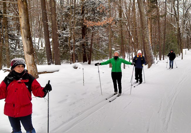
Cross-country skier gliding along a snow-covered corridor at Sleeping Bear Dunes National Lakeshore
Photo: National Park Service · Sleeping Bear · Public domain · Northern Michigan XC ski track
Climb the inland ridges1,350–1,958 ft highlands downwind of Lake Superior and Lake Michigan hold snow when shoreline harbors sit at 35°F
Seek out mowed grass bedsRock-picked Nordic corridors roll skiable decks on 4–6 inches of snow; rocky footpaths need microspikes until deep winter
Verify inches on the groundAlways check our live Michigan Snow Depth & 72-Hour Snow Totals before committing to an early-season drive

Start with how you want to get outside

What do you want to do on Michigan's first snow?

Pick a door below to filter the 12 early-snow destinations—or jump straight into the live tools that show ground snow depth, active lake-effect squalls, and trail grooming.

Cross-country skier gliding along a groomed northern Michigan snow corridor Early Nordic
Photo: National Park Service · Public domain

4–6" early base · Mowed turf corridors

Glide grass-bed Nordic trails

Head for manicured, rock-free grass trail beds in Ironwood, Calumet, Houghton, Marquette, Grayling, and the Vasa Pathway that roll skiable decks on the very first 4–6 inches of snow.

Amber waters of Upper Tahquamenon Falls thundering between snow-covered banks Snowy Gorges
Photo: James Phelps · CC BY 2.0

Nov–Dec high flow · Tahquamenon & Bond Falls

See high-flow snowy waterfalls

Catch Upper and Lower Tahquamenon Falls, Bond Falls, and Wagner Falls when autumn rain volume is still thundering between the season's first deep white snowbanks.

Skiers on snow-covered slopes at the base of Boyne Mountain in Northern Michigan Ski Openers
Photo: Jim.henderson · CC BY-SA 4.0

Thanksgiving–Dec · Fan guns + lake fetch

Catch early snowmaking & ski openers

Head where sub-26°F nights and high-capacity fan guns open the first downhill chairs at Boyne Mountain, The Highlands, Nub's Nob, Caberfae Peaks, Marquette Mountain, and Mont Ripley.

How the doors work: Click any door to filter the 12 snowbelt destinations below and sync the regional map. Click the active door again (or press Reset choices) to see all 12 stops.

Early-Winter Meteorology & Trail Physics

Why snow sticks in these 12 places first—and how I plan around it

Chasing November and early-December snow comes down to understanding how inland elevation, mowed grass trail beds, and public-land seasons work before deep winter locks in.

FIELD LESSON 01 · LAKE SUPERIOR FETCH + 1,400–1,950 FT LIFT

How a 600-foot climb inland turns 35°F shoreline rain into knee-deep powder

If you only check the weather station at a shoreline harbor in November, you will miss half of Michigan’s early ski season. When cold Canadian air pours across 42°F Lake Superior, the shoreline in Marquette or Houghton might sit at 34°F in wet sleet. Drive ten minutes inland up into the Negaunee highlands, Calumet, the Gogebic Range around Ironwood, or the Porcupine Mountains—climbing 600 to 1,200 feet—and adiabatic cooling drops the air temperature 4 to 6°F while squeezing dense lake-effect powder right onto the ridges.

How I use this: Early lake-effect bands are narrow and elevation-driven—always check the inland highland stations on our Michigan Snow Depth Finder before loading the car.

The 12 First-Snow & Early-Winter Destinations

Choose where to find Michigan's first winter snow.

Every stop below explains what works on a thin early base (4–8") versus deep midwinter snow (12"+), plus a real bare-ground backup if a sudden warm front moves through.

12 of 12 Michigan first-snow & early-winter destinations match. Always verify real-time snow depth and seasonal road gates before driving.

Snow-covered banks of the Keweenaw Waterway and Portage Lake Lift Bridge between Houghton and Hancock
Photo: Dcclark · CC BY 2.5 · Keweenaw Waterway in winter

Western U.P. · Houghton, Hancock & Calumet

200–270+ In. SnowbeltEarliest: Late Oct – Nov

Keweenaw Peninsula, Houghton & Calumet: 3-Direction Lake Superior Snowbelt

Surrounded on three sides by deep, open Lake Superior water, the spine of the Keweenaw Peninsula rises more than 1,300 feet from Houghton and Hancock north through Calumet to Delaware. Because it catches lake-effect squalls on west, northwest, and north winds alike, the mowed turf corridors at Swedetown Trails and the Michigan Tech / Maasto Hiihto network regularly roll the very first skiable Nordic snow in Michigan.

How I Play Early (4–8") vs. Deep SnowOn the first 4–8" of dense snow, glide or snowshoe the mowed grass-bed loops at Swedetown Recreation Area in Calumet and the lighted Michigan Tech Trails in Houghton. Once 12"+ stacks up, add Mont Ripley downhill runs and the Dec 1+ Bill Nicholls snowmobile corridor.
If an Early Thaw Moves InWalk the paved Portage Canal waterfront path, spend two hours inside the world-class A.E. Seaman Mineral Museum and Calumet's historic copper boomtown district, and watch Lake Superior rollers along M-26.

Field & road note: State snowmobile trails do not open until December 1, and Brockway Mountain Drive is unplowed for cars in winter; in November, stick to plowed non-motorized Nordic and hiking trailheads.
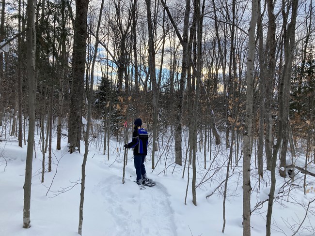
Cross-country skier gliding along a snow-covered northern Michigan forest corridor
Photo: National Park Service · Public domain · Groomed northern Nordic corridor

Western U.P. · Ironwood, Bessemer & Wakefield

1,600-Ft Gogebic RangeEarliest: Mid–Late Nov

Ironwood & Gogebic Range: Early-Season Nordic & Big Snow Country

Just twelve miles inland from Lake Superior along the Wisconsin border, north-northwest winds slam straight into the 1,600-foot Gogebic Range. Because the trail crews at ABR Trails and Wolverine Nordic manicure smooth, rock-free grass corridors every autumn, they can roll a fast, clean ski deck on the first 4 to 6 inches of wet November lake-effect—weeks before rocky forest trails are passable.

How I Play Early (4–6") vs. Deep SnowOn 4–6" of early snow, ski the rolled grass-bed loops at ABR Trails and Wolverine Nordic in Ironwood while snowmaking fires up at Snowriver Mountain Resort and Big Powderhorn. On 12"+, open up the full classic/skate network and dedicated hemlock snowshoe singletrack.
If an Early Thaw Moves InWalk the paved Iron Belle Trail through downtown Ironwood past the 52-foot Hiawatha statue and hike the five waterfall overlooks along the Black River National Forest Scenic Byway out to Lake Superior.

Field & road note: Steep wooden stairs along the Black River Harbor waterfalls glaze over with spray ice in November—pack microspikes in your daypack and check daily Nordic grooming reports before driving.

Bond Falls cascading over dark volcanic rock framed by winter snow and ice in the Western Upper Peninsula
Photo: Stefan.Anderson · CC BY-SA 4.0 · Bond Falls winter cascades

Western U.P. · Porcupine Mountains & Paulding

1,958-Ft Summit PeakEarliest: Nov – Dec

Porcupine Mountains & Bond Falls: High-Country Hemlocks & Early Waterfall Ice

Rising nearly 1,350 feet above Lake Superior to Summit Peak (1,958 ft), the Porcupine Mountains Wilderness State Park turns 35°F shoreline rain into heavy interior snow. I love pairing the eastern M-64 winter entrance near Silver City with Bond Falls Scenic Site off US-45, where the Middle Branch Ontonagon River cascades 50 feet across dark volcanic rock framed by fresh early snow.

How I Play Early (4–8") vs. Deep SnowOn early snow, hike or snowshoe the eastern M-64 Union Bay and Ski Hill approaches with microspikes. Once deep winter snow arrives (Dec–Mar), ski the Porkies Winter Sports Complex natural-snow alpine runs and 25-mile Nordic network.
If an Early Thaw Moves InWalk the sheltered Union Bay shoreline east of the M-107 winter gate, explore Ontonagon's harbor lighthouse viewpoint, or hike the Presque Isle River waterfalls when County Road 519 is still open in late fall.

Field & road note: M-107 west to Lake of the Clouds and South Boundary Road close to wheeled vehicles for the winter snowmobile season; Bond Falls' summer lot is also unplowed once deep snow builds.

Historic Marquette Lower Harbor Ore Dock surrounded by winter snow and Lake Superior ice
Photo: Brett VA · CC BY 2.0 · Marquette Lower Harbor in winter snow

Central U.P. · Marquette, Negaunee & Ishpeming

1,400–1,800 Ft Interior RiseEarliest: Mid–Late Nov

Marquette Highlands & Negaunee: Noquemanon Loops, Ski Hill & Gale Watch

Even when downtown Marquette right on the Lake Superior harbor sits at 34°F, driving ten minutes inland up US-41 toward Negaunee, Ishpeming (home of the U.S. Ski & Snowboard Hall of Fame), or the Forestville / Noquemanon trailheads climbs 800 feet straight into the heavy Lake Superior snowbelt—while Marquette Mountain pairs natural lake-effect with early snowmaking.

How I Play Early (4–8") vs. Deep SnowOn early snow, hit the Forestville / Noquemanon grassy trailhead loops, the packed Iron Ore Heritage Trail, and Marquette Mountain's early snowmaking runs. Once deep snow locks in, ride RAMBA's groomed fat-bike singletrack.
If an Early Thaw Moves InWalk the plowed interior road loop at Presque Isle Park to watch massive Lake Superior rollers and late-season ore freighters, then warm up at the Marquette Regional History Center and Third Street cafes.

Field & road note: Stay well back from wave-swept black rocks and ice shelves at Presque Isle during early-winter gales.

Snowshoer walking through snow-covered hemlocks on the Munising Snowshoe Trail at Pictured Rocks National Lakeshore
Photo: National Park Service · Pictured Rocks · NPS public domain · Munising Snowshoe Trail

Central U.P. · Munising & Pictured Rocks

Northwest Fetch SnowbeltEarliest: Late Nov – Dec

Munising & Pictured Rocks Ridge: Hemlock Snowshoe Woods & Valley Spur

Before Pictured Rocks' famous sandstone seepage ice curtains reach full thickness in January and February, the ridges above Munising catch intense early lake-effect snow off Lake Superior. The NPS-marked 2.65-mile Munising Snowshoe Trail and nearby Valley Spur in Hiawatha National Forest give you wind-sheltered early-winter forest loops right beside Wagner Falls Scenic Site.

How I Play Early (4–8") vs. Deep SnowOn early snow, walk or snowshoe the 2.65-mile Munising Snowshoe Trail and the 0.1-mile Wagner Falls boardwalk off M-94 (pack microspikes). On deeper snow, ski or snowshoe Valley Spur off M-94 and the Sand Point ice curtains.
If an Early Thaw Moves InWalk the plowed Sand Point Beach shoreline for wave-tumbled cobbles and views toward Grand Island East Channel Light, followed by hot pasties and coffee in downtown Munising.

Field & road note: The Munising Falls canyon trail remains closed until further notice following the April 2025 slope washout and 2026–27 repair project; never walk in boots on groomed Munising ski tracks.

Amber waters of Upper Tahquamenon Falls thundering between snow-covered banks
Photo: James Phelps · CC BY 2.0 · Upper Tahquamenon Falls in winter

Eastern U.P. · Paradise & Tahquamenon Falls

Whitefish Bay SnowbeltEarliest: Nov – Dec

Tahquamenon Falls & Paradise: High-Flow Early-Winter Gorge & Packed Loops

Fed by Whitefish Bay lake-effect squalls and high late-autumn river volume, Tahquamenon Falls State Park is the single most reliable November and December outdoor stop in the Upper Peninsula. Even if snow is still too thin for skiing, the packed 0.75-mile walk to the Upper Falls brink rewards you with roaring cedar-amber water framed by white cedar and hemlock snowbanks.

How I Play Early (1–6") vs. Deep SnowOn 1–6" of early snow, walk the packed 0.75-mile Upper Falls brink path with microspikes. On deeper snow, snowshoe the marked 1.0-mile Upper Falls loop or Lower Falls 1.6-mi Green and 2.4-mi Blue snowshoe loops.
If an Early Thaw Moves InDrive 20 minutes north to Whitefish Point on Lake Superior for late-season birding and agate-beach walks, or an hour east to Sault Ste. Marie to watch thousand-footers lock through before the Jan 15 closure.

Field & road note: Per the official DNR winter map, the 1.0-mile Lantern Loop at Upper Falls is cross-country ski only (snowshoes prohibited), and the 4–5 mile River Trail between Upper and Lower Falls is not maintained in winter.

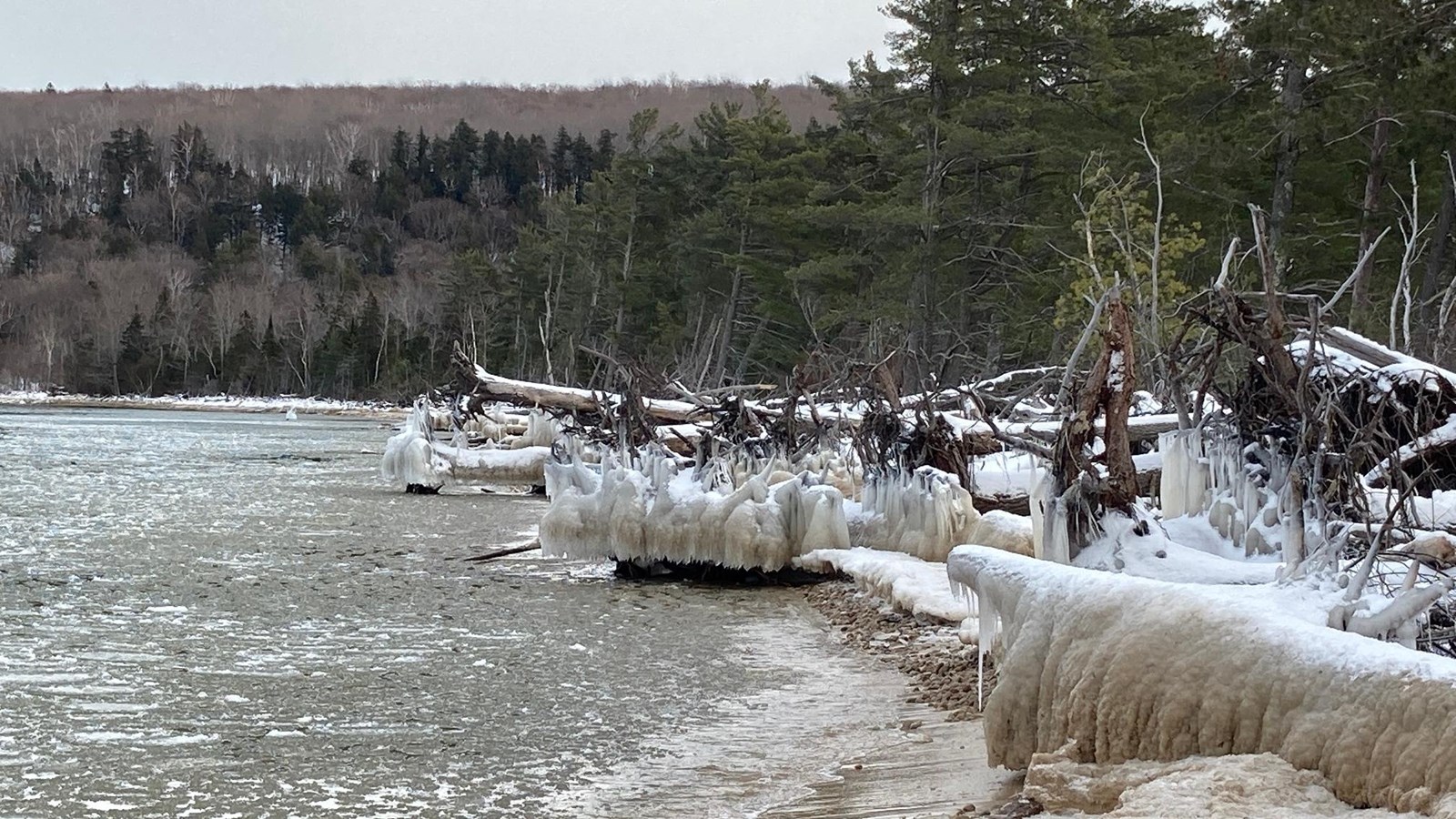
Snow and winter ice along the Lake Superior snowbelt shoreline bordering Hiawatha National Forest and Pictured Rocks
Photo: National Park Service · Public domain · Central U.P. winter snowbelt shore

Central & Eastern U.P. · Hiawatha National Forest

Two-Lake Snow CorridorEarliest: Late Nov – Dec

Hiawatha National Forest: Valley Spur, Bruno's Run & Pine Bowl Ridges

Stretching from the Lake Superior snowbelt south toward Lake Michigan and Lake Huron, Hiawatha National Forest's sandy glacial outwash plains and pine ridges (Valley Spur off M-94, Bruno's Run and McKeever Hills off FH-13, and Pine Bowl / Rapid River) drain autumn rain immediately—so the first November snow freezes onto a clean, mud-free forest floor.

How I Play Early (4–8") vs. Deep SnowOn early snow, hike or snowshoe the sandy pine ridges along Bruno's Run and McKeever Hills off paved FH-13. On deeper snow, ski the groomed loops at Valley Spur (near Munising), Rapid River, or Pine Bowl Pathway (2.0-mi inner loop).
If an Early Thaw Moves InDrive the plowed Whitefish Bay National Forest Scenic Byway (Curley Lewis Highway) along Lake Superior to Point Iroquois Lighthouse or walk Manistique's Lake Michigan boardwalk.

Field & road note: Unpaved Forest Service two-tracks off FH-13 are not plowed once heavy snow accumulates; park only at plowed highway pull-offs and wear blaze orange during November deer seasons.

Winter snow blanketing the high Northern Lower Michigan I-75 corridor near Grayling and Houghton Lake
Photo: Joe Ross · CC BY-SA 2.0 · Northern Lower I-75 winter corridor

Northern Lower I-75 · Gaylord, Grayling & Hartwick Pines

1,350-Ft 45th Parallel PlateauEarliest: Late Nov – Dec

Gaylord, Grayling & Hartwick Pines: 45th Parallel Snowbelt Plateau

When northwest winds sweep off Lake Michigan and climb onto the 1,350-foot Otsego–Crawford plateau along I-75, temperatures sit 4 to 6°F colder than the coast—making Gaylord, Grayling, and Hartwick Pines State Park the first corridor in Lower Michigan to hold snow on the ground, under two hours north of my home base in Bay City.

How I Play Early (3–6") vs. Deep SnowOn 3–6" of early snow, walk or snowshoe the paved 1.25-mile Old Growth Forest Foot Trail at Hartwick Pines and ski the grass-bed/snowmaking loops at Cross Country Ski HQ, Forbush Corner, or Hanson Hills. On deep snow, add Treetops and Otsego downhill slopes.
If an Early Thaw Moves InTour the Hartwick Pines Visitor Center exhibits beneath 300-year-old white pines, check on the herd at Gaylord's City Elk Park off Old 27, and walk the Au Sable River accesses around Grayling.

Field & road note: At Hartwick Pines, an indefinite footbridge closure on the 3.0-mile Au Sable River Foot Trail makes that side trail out-and-back only; stick to the 1.25-mile Old Growth Loop and 2.0-mile Mertz Grade.

Red Charlevoix South Pierhead Lighthouse surrounded by winter snow and Lake Michigan ice
Photo: Charles Dawley · CC BY 2.0 · Little Traverse / Charlevoix winter shore

Northern Lower · Boyne Falls, Petoskey & Harbor Springs

High-Capacity SnowmakingEarliest: Thanksgiving – Dec

Boyne Falls, Petoskey & Harbor Springs: Early Snowmaking & Lake Fetch

When natural late-November snowpack is still building, Boyne Mountain, The Highlands at Harbor Springs, and Nub's Nob fire up massive automated fan-gun snowmaking arrays whenever overnight wet-bulb temperatures dip below 26°F—frequently opening the first downhill chairlifts in Lower Michigan around Thanksgiving weekend or early December.

How I Play Early vs. Deep SnowOn early snow, ski the machine-groomed opening ribbons at Boyne Mountain, The Highlands, and Nub's Nob or walk Petoskey State Park beach. Once lake-effect stacks up, open up the full glade, Nordic, and snowshoe networks around Little Traverse Bay.
If an Early Thaw Moves InWalk the Boyne Mountain SkyBridge, book a heated vineyard igloo at Boyne Valley Vineyards or Walloon Lake Winery, and browse McLean & Eakin Booksellers in Petoskey's Gaslight District.

Field & road note: Check daily open lift and trail counts on our Michigan Ski Hills tool before driving up, and stay off ice-glazed Lake Michigan breakwaters in Petoskey and Charlevoix.

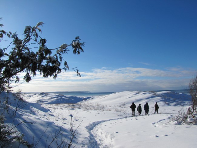
Snow-covered coastal bluff overlooking Lake Michigan at Sleeping Bear Dunes National Lakeshore
Photo: Sleeping Bear Dunes NPS · CC BY 2.0 · Sleeping Bear winter bluff

Northern Lower · Traverse City, Vasa & Empire

Inland Moraine + BluffsEarliest: Late Nov – Dec

Traverse City, Vasa Pathway & Sleeping Bear: Forest Loops & Coastal Bluffs

While Grand Traverse Bay water moderates downtown Traverse City in late November, the inland ridges of Pere Marquette State Forest along the Vasa Pathway (Bartlett Road trailhead) and the high coastal bluffs of Sleeping Bear Dunes catch early northwest lake-effect squalls—giving you morning forest loops just 15 minutes from Old Mission and Leelanau tasting rooms.

How I Play Early (4–6") vs. Deep SnowOn early snow, use the Vasa dedicated snowshoe loops (Orange 1.5 mi, Green/Yellow 0.6 mi) and Empire Bluff Trail (1.5 mi RT). On deeper snow, ski the groomed Vasa 3K/10K/25K courses and the Sleeping Bear Heritage Trail.
If an Early Thaw Moves InHike Empire Bluff or Alligator Hill in winter boots, then spend the afternoon in heated vineyard igloos on Leelanau or Old Mission Peninsula and at The Village at Grand Traverse Commons.

Field & road note: Pierce Stocking Scenic Drive is gated to cars in winter, and boots and dogs are prohibited on groomed Vasa and Sleeping Bear Heritage ski tracks.

Deep early-winter snow blanketing northern Michigan hills and forest
Photo: National Park Service · Public domain · Northwest Michigan winter snowpack

Northwest Lower · Cadillac & Manistee National Forest

1,500+ Ft High PointEarliest: Late Nov – Dec

Cadillac & Caberfae Peaks: 1,500-Foot Manistee National Forest High Country

Surrounding Grove Hill and the Caberfae Peaks area west of Cadillac off M-55, the Manistee National Forest rises above 1,500 feet—the highest general elevation in the Lower Peninsula. Cold west-northwest fetch off Lake Michigan hits this high moraine head-on, feeding Caberfae's early-season snowmaking and the surrounding MacKenzie Cross-Country Ski Trail and Big M trail system.

How I Play Early vs. Deep SnowOn early snow, ski Caberfae Peaks' snowmaking slopes and hike or snowshoe the Big M and Cadillac Pathway forest loops. On deep snow, ski the MacKenzie Trail and groomed Cadillac Pathway classic and fat-bike loops.
If an Early Thaw Moves InWalk the paved 7-mile Keith McKellop Walkway around Lake Cadillac or hike the suspension-bridge loop along the Manistee River Trail.

Field & road note: Check US-131 and M-55 winter driving conditions on MDOT MiDrive during West Michigan lake-effect advisories, and wear blaze orange on national forest trails in November.

West Michigan Lake Michigan coast and red lighthouse surrounded by December winter snow and ice
Photo: Wayne Silver · CC BY 2.0 · West Michigan coast in December snow

West Michigan Coast · Muskegon & Silver Lake

Under 1 Hr from Grand RapidsBest: Dec – Mar (Dec 15 Fat-Bike)

Muskegon State Park & West Coast: Lighted Dune Loops & Dec 15 Fat-Bike Opener

When West Michigan's first December lake-effect bands roll off Lake Michigan, Muskegon State Park's Adventure Sports Park lights up its forested cross-country ski and snowshoe loops while chilling its public natural-ice luge track—and on December 15, nearby Silver Lake State Park opens its vast coastal dunes for winter fat-tire biking.

How I Play Early vs. Deep SnowOn early December snow, ski or snowshoe the lighted dune-forest loops at Muskegon State Park. From December 15 through March 15, air your fat-tire bike down to 4 PSI (3.5" minimum tire width) and ride Silver Lake State Park's open dunes.
If an Early Thaw Moves InHike the 12 miles of sandy dune-forest footpaths up to the timber Blockhouse overlook at Muskegon State Park (sandy trails never turn muddy), and watch Lake Michigan winter surf from the dry beach at Pere Marquette or Grand Haven.

Field & road note: Silver Lake winter fat-tire dune riding opens December 15 (not in November) and parks at the ORV lot at 8962 W. Fox Road, Mears. Never walk onto ice-coated Lake Michigan piers.

Step 4 · Live snow & winter decision tools

Verify real-time snow on the ground before you drive north

Every destination in this guide connects directly to our live NOAA/NOHRSC snowpack, lake-effect, and ski resort engines so you never guess whether early-season snow has stuck.

Real-Time Inches on Ground

Michigan Snow Depth Finder

Check modeled NOHRSC snow depth and station observations across the Upper and Lower Peninsulas with drive-time rings.

Open Snow Depth Finder ↗
Hourly Squall Bands

Lake-Effect Snow Engine

Track active NWS lake-effect warnings, wind fetch directions, and hourly snowfall projections across all Great Lakes snowbelts.

Open Lake-Effect Engine ↗
24h / 48h / 72h Storm Totals

Michigan Snowfall Totals

See where the most recent storm actually dropped measurable accumulation before picking a weekend trailhead.

Open Snowfall Totals ↗
Downhill & Snowmaking

Michigan Ski Hills Finder

Compare 40+ Michigan ski areas by vertical drop, snowmaking capacity, recent snowfall, and drive distance.

Open Ski Hills Tool ↗
Nordic Base & Grooming

XC Ski Conditions Tool

Check cross-country ski snow base, recent snowfall, and temperature windows across Michigan Nordic networks.

Open XC Ski Tool ↗
Snowshoe vs. Microspikes

Snowshoe Conditions Tool

See where snow depth supports full snowshoe floatation versus where thin early cover calls for microspikes.

Open Snowshoe Tool ↗
Gorge Flow & Rim Ice

Waterfall Conditions Tool

Check Upper Peninsula waterfall flow, freeze state, and snowpack around Tahquamenon, Bond Falls, and Munising.

Open Waterfall Tool ↗
15 Systems · 50 Loops

Michigan Winter Trails Guide

Inspect 15 audited DNR and NPS winter trail systems, 50 named loops, and grooming/boot etiquette rules.

Open Winter Trails Guide ↗

Field judgment

The photo inspires. The evidence decides.

Early-winter weather in Michigan changes fast: a sunny 38°F morning in Gaylord or Marquette can turn into a zero-visibility lake-effect squall by 2:00 PM. Always check MDOT MiDrive road conditions, carry traction cleats alongside snowshoes or skis, and wear blaze orange on multi-use public lands during November hunting seasons.

Michigan DNR Winter Guide ↗ · MDOT MiDrive ↗ · Live Michigan Snow Depth ↗